![]()
|
|
![]() back to Stoke-on-Trent districts
back to Stoke-on-Trent districts
Districts
of the Stoke-on-Trent &
Newcastle-under-Lyme Conurbations
Trent Vale, Stoke
![]()
![]()
![]()
next:
Abbey Hulton
previous:
Northwood
Trent Vale
|
"From its boundary with the City General Hospital the geography of Trent Vale is shaped like a triangle with Springfields and Penkhull in the north falling to the Trent Valley through Boothen and Oakhill. It’s a mishmash of old hamlets with a lot of tree-lined streets, some edged with Sutton Trust Houses."
Trent Vale - A History of the County of Stafford Vol 8 |
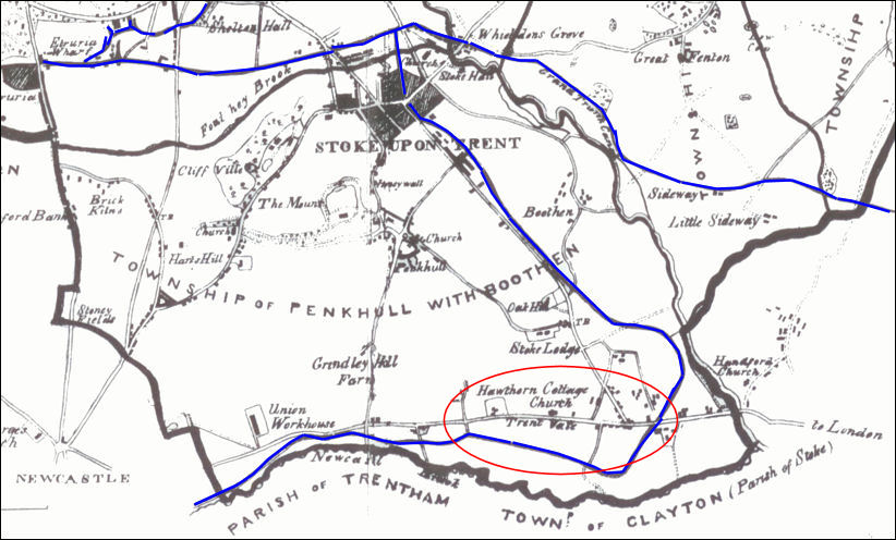
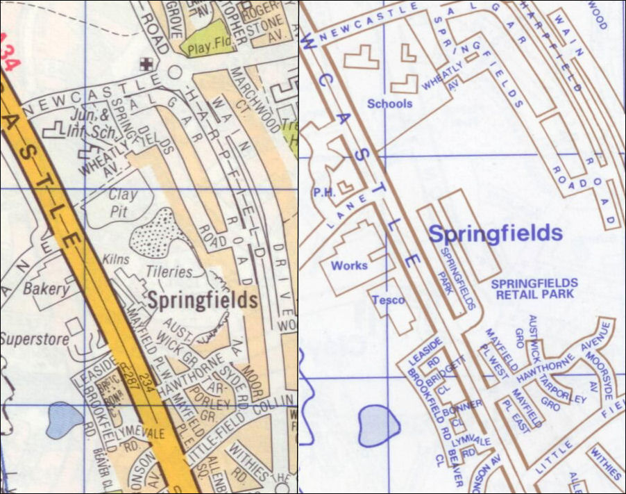
The location of Trent
Vale - Ward's map of 1843
at the top is the Caldon and the Grand Trunk (Trent & Mersey) Canals
running past Trent Vale is the Newcastle-under-Lyme Canal
| The Newcastle-under-Lyme branch canal was built in 1795–6, it ran from the Trent & Mersey canal near Glebe Street along the east side of London Road to Trent Vale where it passed under the main Newcastle road at the west end of Rookery Lane; it then ran north through the meadows by the Lyme Brook to Brook Lane in Newcastle. |
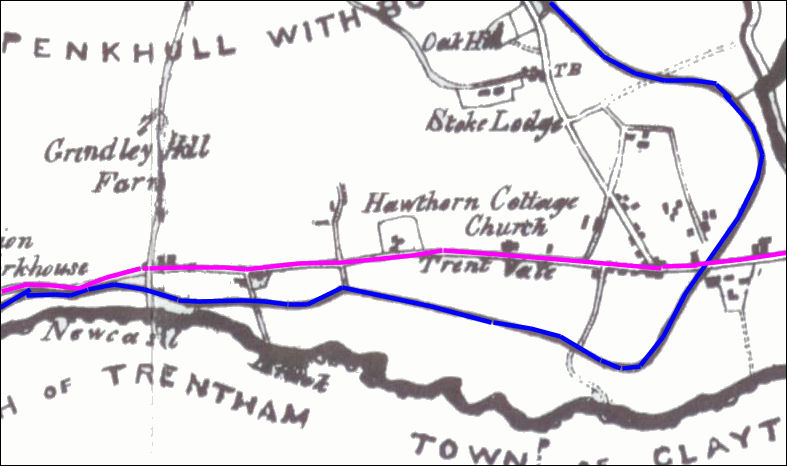
Trent Vale - Ward's map
of 1843
a few scattered houses existed at this time
the turnpike road - now the A34 - is shown in
pink
|
"The first turnpike road in North Staffordshire was, 'the eight computed miles from Tittensor to Talk o' the Hill, in the post road from London to some of the northern parts of the Kingdom.' The date, 1714. The road passed through Trentham, Hanford, Trent Vale, Newcastle, Chesterton and Talk." A Sociological History of Stoke-on-Trent - E.J.D. Warrillow |
![]()
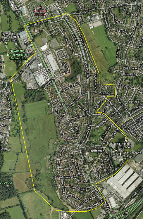
extent of Trent Vale,
Stoke-on-Trent - the Lyme Brook on the left
Google
maps
|
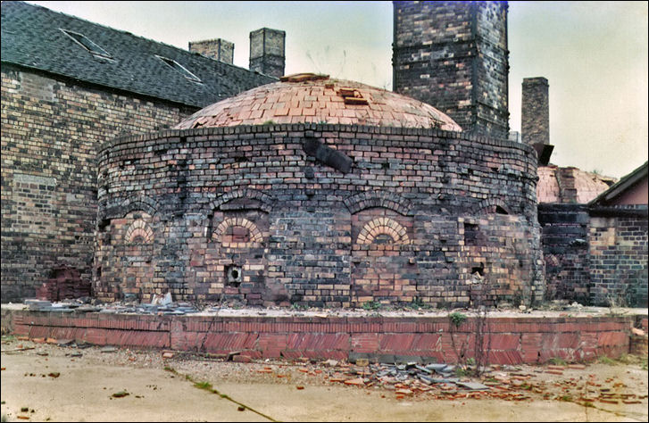
![]()
A Roman military depot & pottery kiln in Trent Vale..
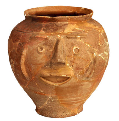
an exceptional face pot
from the Trent Vale kiln
– a red unglazed vessel with features picked out in relief
photo: Potteries Museum
| In the first and second centuries
A.D. there was a Roman potworks on the ground above the River Trent near the
former Trent Vale Brick Works. This was found and excavated
in the 1950's.
The invasion of Britain under Claudius in 43 A.D. is dated fairly accurately, but the interesting fact is the site at Trent Vale can be positively dated just a few years later. Trent Vale must have been an important staging post where soldiers garrisoned. It is more than likely that this site was a military depot. The Fort and Pottery Kiln at Trent Vale Roman
Britain
|
![]()
Newcastle-under-Lyme canal through Trent Vale...
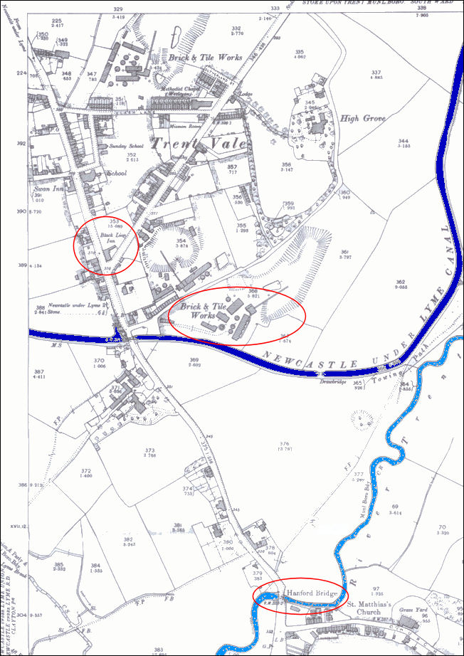
1898 map of Trent Vale - the
River Trent and the Newcastle-under-Lyme Canal are marked
Hanford Bridge, The Black Lion Inn and the Trent Vale Brick & Tile
Works are highlighted
|
![]()
Knappers Gate..
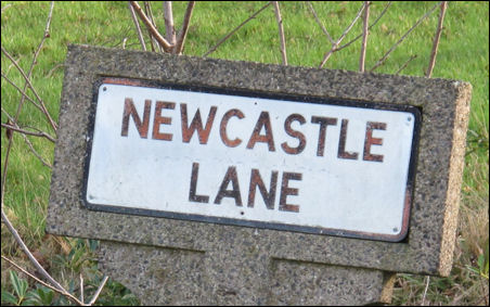
Newcastle Lane
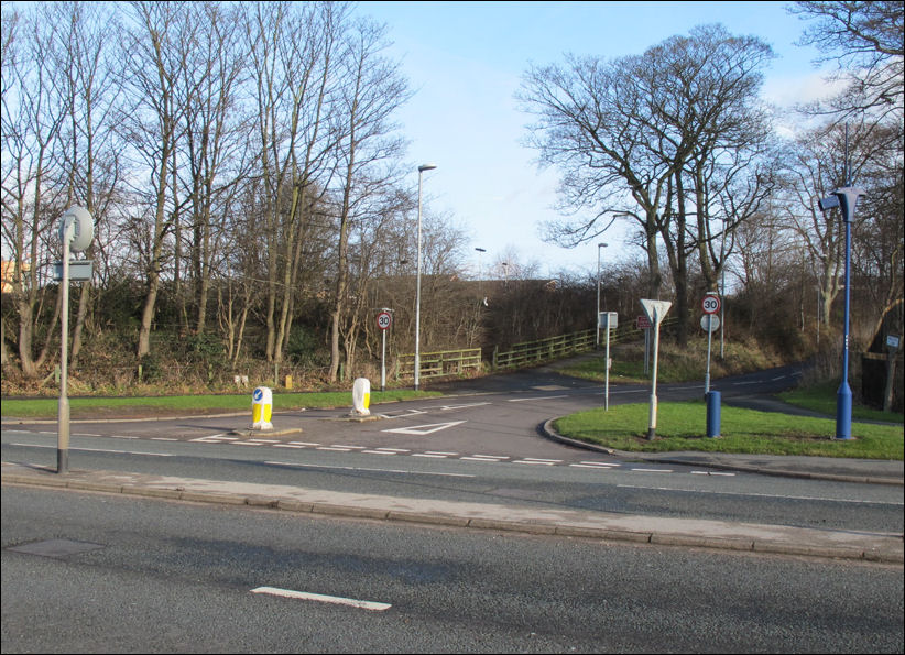
Newcastle Lane on the A34 at
the North End of Trent Vale
| By 1791 there was a tollgate, known as Knappers Gate, at Spittles where a road from Penkhull, the present Newcastle Lane, joined the main road. This still stood in 1878. |
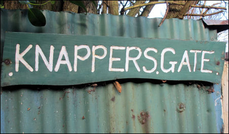
Knappers Gate where there
was once a toll-gate
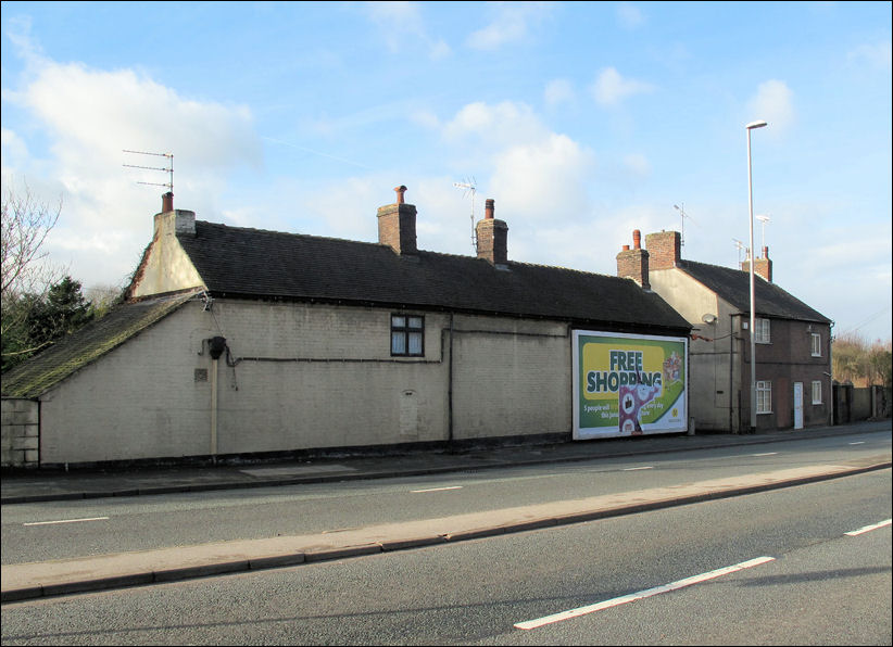
the rear of the Knappers Gate
cottages from the A34
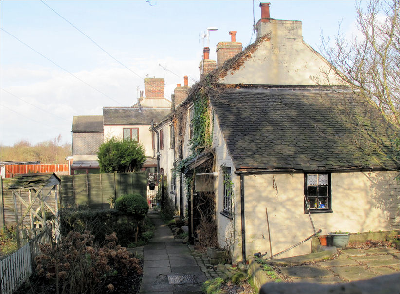
the front of the Knappers
Gate cottages
![]()
Wheatley's Springfield Tileries..
an intermittent down draught
kiln at Wheatly & Co Ltd., Springfield Tileries, Trent Vale.
photo: 'Tarboat -Flickr'
| Wheatly's was established before 1819 and was famous for its 'Triton' brand roofing tiles. In 1978 the company was taken over by Daniel Platt Ltd of Brownhills Tileries in Stoke, then in 1982 works was closed and demolished soon afterwards. |
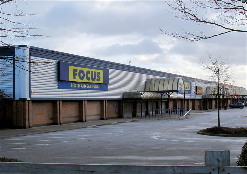
Springfields Retail Park on
the site of the former Springfields Tile Works
Springfields - on the left
about 1980 and on the right about 2000
the tile works has been replaced with
a retail park
![]()
Examples of earlier housing...
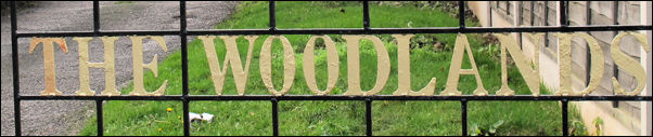
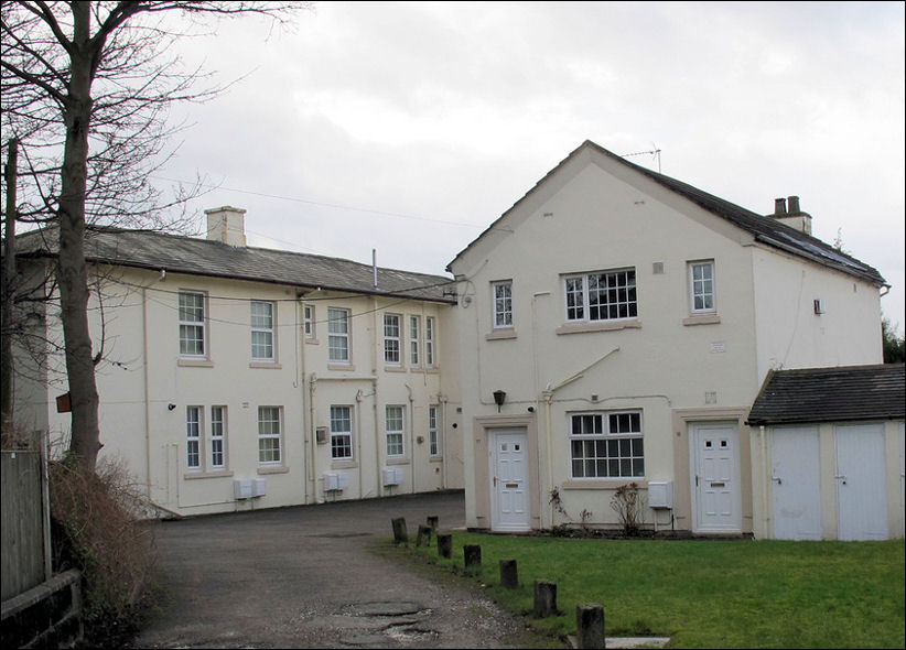
The Woodlands
a five-bay Georgian house with a
one-bay pediment.
It stands behind Nos. 149-163 Newcastle Road - adjacent to the Jubilee Club
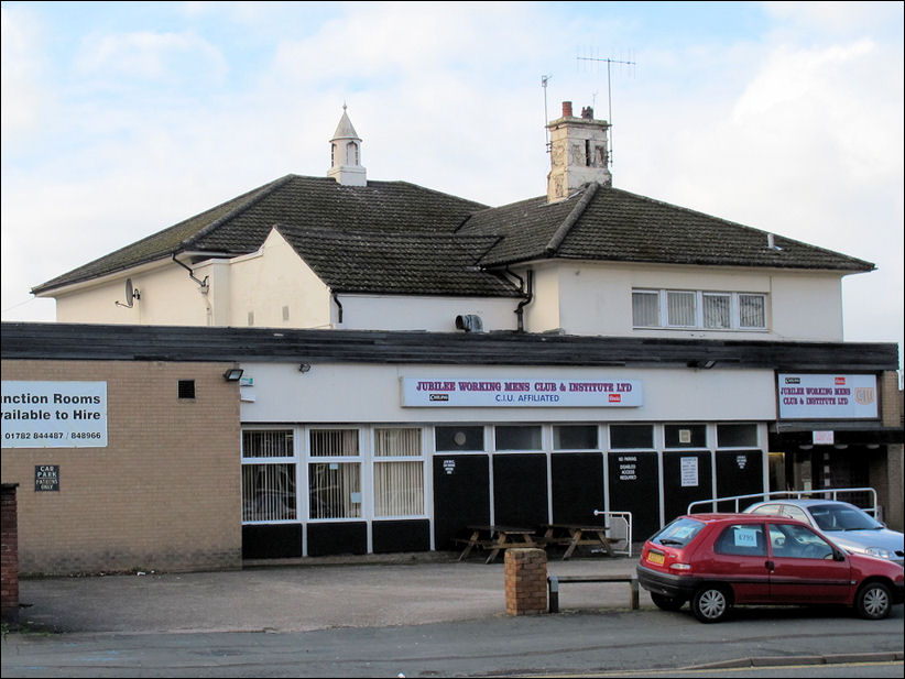
Jubilee Working Mens Club
& Institute Ltd
the former house can be seen behind
the added frontage
| In the earlier 19th century Trent Vale and Oak Hill districts to the south of Penkhull were a favourite residential area - some larger detached houses of this date survive, including the present Jubilee Working Men's Club and the adjacent Woodlands house both on Newcastle Road |
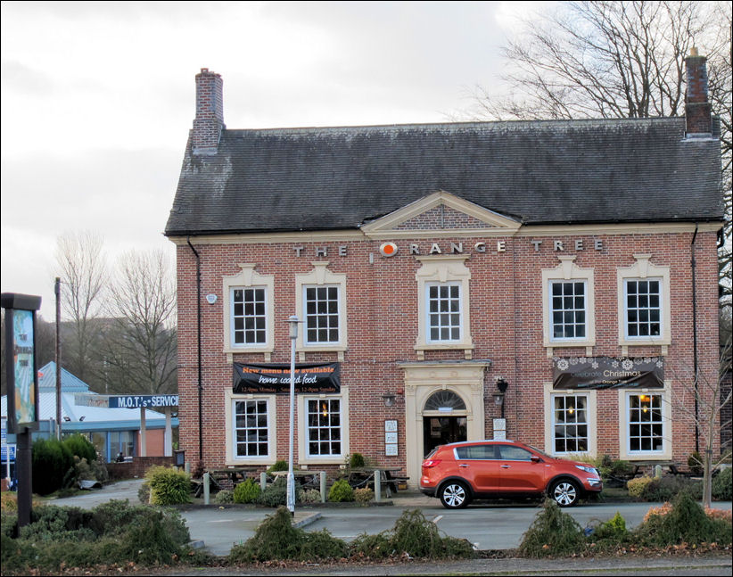
The Orange Tree -
formerly the Springfields Hotel
| Originally Springfields
House, built in the mid C18 - it is now a listed building it
stands west of Newcastle Road at its junction with Clayton Lane.
A square brick building with stone dressings and a central pediment, the symmetrical two-storied front is of five bays, the windows having stone lintels with raised keystones. The central first-floor window is emphasized by a stone architrave, the doorway below it being flanked by Corinthian pilasters and surmounted by a semicircular fanlight and an enriched frieze. |
![]()
St. John's Church..
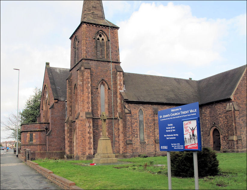
St. John's Church, Trent Vale
| A local timber merchant,
John Kirkham family played a key role in the construction of the new Anglican Church at Trent Vale.
The church of St. John the Evangelist on Newcastle Road, Trent Vale, was built to the design of George Gilbert Scott between 1843–4 at a cost of £1,260, of which £250 was given by the Kirkham family, £255 was given by the Diocesan Church Extension Society and the rest raised by subscription. It was made a parish church in 1844 shortly after its consecration. It was described in White's Directory of Staffordshire, 1851, as "a neat plain structure, which was erected by subscription in 1843, at the cost of £1260 and has about 400 sittings, two thirds of which are free." |
![]()
Stoke Lodge housing estate....
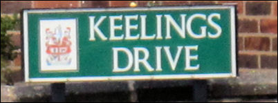
"Keelings Drive", named after the original
landowners
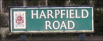
"Harpfield Road" - the principal estate
road
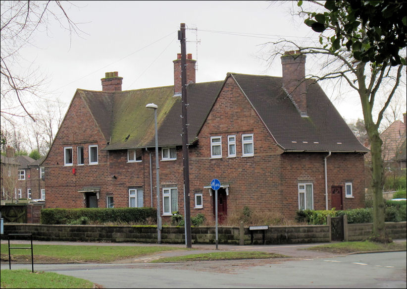
Semi-detached house on the
Stoke Lodge Estate, Trent Vale - built by Stoke-on-Trent Council
|
During the First World War house building came to a standstill in England, with the result that there was a serious housing shortage by 1918 - especially in Stoke-on-Trent which had a serious overcrowding proble. The Housing Act in 1919 offered a generous subsidy for the building of council houses and Stoke-on-Trent set up a Housing Committee to tackle the twin problems of slum clearance and rehousing. The committee agreed to purchase 30 acres on the Stoke Lodge Estate for £4,400. The principal estate road, "Harpfield Road", ran from the junction of Flash Lane and Newcastle Road to a central circular feature called "The Crescent" where it met the other main estate road, "Keelings Drive", named after the original landowners. Andrew Dobraszczyc notes |
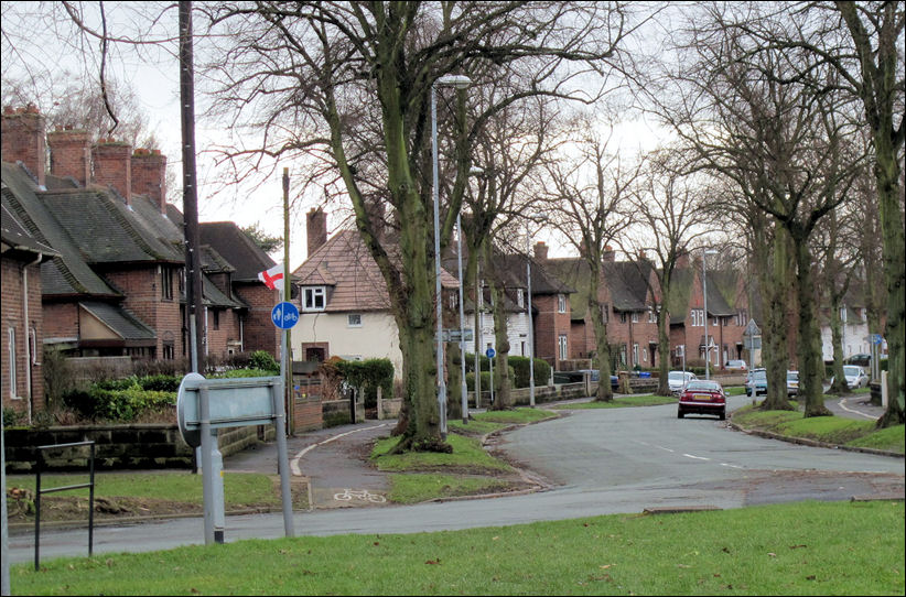
Harpfield Road from The Crescent - the Stoke Lodge Estate was completed by 1924
![]()
The Sutton housing estate....
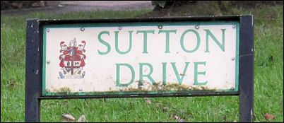
Sutton Drive
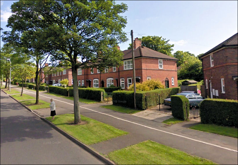
Houses on Harpfield Drive
built by the Sutton Model Dwellings Trust
Google Street View
|
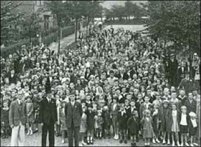
Sutton outing, Trent Vale estate, Stoke-on-Trent The Sutton Trust engendered a real sense of community in its estates. Each estate had a Sutton Fund, which residents would pay into. The fund was often used for trips to bingo evenings, evening dances, tennis and cricket tournaments, and often annual trips to the seaside for children. |
![]()
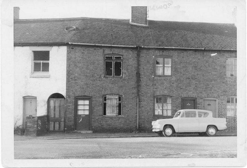
numbers 2, 3, 4 and 5 Rookery
Lane - just before the houses were demolished
![]()
![]()
![]()
![]()
next:
Abbey Hulton
previous:
Northwood