|
Meir and the monks of Hulton Abbey
|
3 .... in 1223 Henry de Audley granted land to the monks
of Hulton Abbey, this included land
in Normancote (became Normacot Grange) and monks passed
through the village of Meir on their way to the Grange at Normacot.
|
Charter of the Abbey of Hulton
The Foundation Charter of the Abbey
of Hulton, dated 1223, contains a description of the possessions,
granted by Henry de Audley, to the Abbots and Monks; which includes
lands in Normancote (became Normicot Grange, now Normacot),
adjoining to Longton and Lane End.
This estate is said to
be bounded by the old course of the river Blithe (now river Blythe), as
far as a place called Wetmeresbrook, (or Wetmotesbrook), which must be
near Bthythe Bridge, and from there to run up Rykeneld Street and
through the village of Mere as far as the spring which flows from the
intakes of Mere.
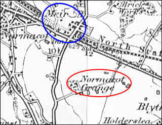
1898 OS map showing the relationship of
Meir and Normacot Grange
The monks of Hulton Abbey and Normacot Grange
Henry de
Audley - vill of Hulton, the vill of Rushton to the south of Burslem
with a wood at Sneyd 'with the enclosed hay' at Carmount near Hulton,
all his land at Bucknall and Normacot.
Further land at Normacot was given by Simon de Verney
By 1291 the abbey had acquired tithes at Biddulph and had mills at
Normacot and Mixon.
About 1300 Sir William de Mere had given the monks land at Meir near
Normacot.
Other grants included land of Normacot Heath from Robert de Caldwal.
The
monks income: By 1242 there is mention of the abbey's sheepfold at
Normacot.
They were running an iron smithy at Horton in 1528 and owned coal mines
at Hulton and Hanley by the 16th century.
Although in 1535, as in 1291, much of the abbey's income was derived
from rents, there was extensive farming at Hulton, Normacot, Bradnop,
and Cammeringham
Normacot Grange: The grange was established on the site by 1242,
built upon lands which were included in Henry de Audley’s grant to the
Cistercian monastery at Hulton
By the 15th century Normacot Grange, including all the buildings and
lands, was leased out.
In1540, following Henry VIII’s dissolution of the monasteries, the
grange was sold to Sir John Gifford of Chillington, remaining in his
family for several generations.
The property continued to operate as a farm and the grange farmhouse,
with its reputedly medieval cellars, was only demolished in 1984.
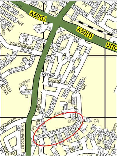
Modern day map showing Normacot Grange
Street near the location
of the Grange lands made over by Sir William de Mere and
Henry de Audley to the monks of Hulton Abbey
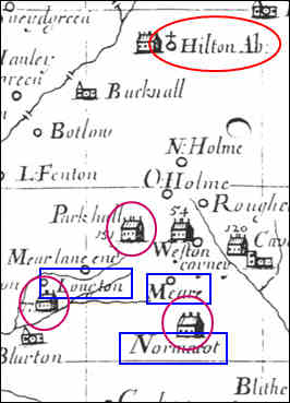
1686 map showing the location of the
abbey, Meare village
and the Grange at Normacot

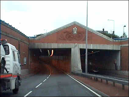
Meir - modern day entry to
the city
|
4 .... today the A50 major trunk road enters the city at
Meir. |
|