|
|
| Stoke-on-Trent Districts: Normacot |
![]()
![]()
next: Normacot and the Iron Furnace
previous: Normacot 4000 years of history
|
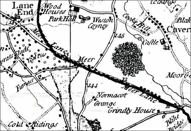
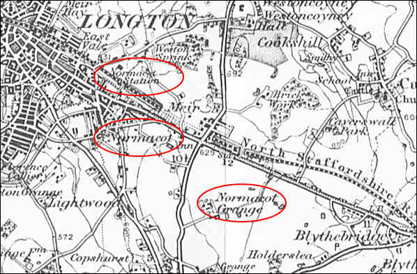
Normacot on the maps: Yates map of 1775 tells us a great deal about the area of Normacot........
|
Normacot in the gazetteers:
| "A charter of
Incorporation [for Longton] was obtained April 3rd, 1865,
and during the year 1883 and 1884, the Corporation obtained
Acts of Parliament, extending the Municipal area so as to
include the outlying districts of Dresden, East Vale,
Florence and Normacott." From 1893 advertising and trade journal - "A descriptive account of The Potteries"
"There are
seven ecclesiastical parishes in the town. The Parish
Church, dedicated to St. James, was erected in 1833. Among
the Rectors was the late Dr. Benjamin Vale, whose residence
was sacked at the time of the Pottery riots. St. John's
Church, built in 1792-5, is still called in ecclesiastical
deeds the church of Lane End. There are other Anglican
churches at Edensor, Dresden, Normacot, and Sandford
Hill.... From 1907 Staffordshire Sentinel 'Business Reference Guide to The Potteries, Newcastle & District' |
![]()
![]()
next: Normacot and the Iron Furnace
previous: Normacot 4000 years of history