|
|
|
Fenton Park |
|
|
|
|
|
Fenton Park |
|
|
![]()
![]()
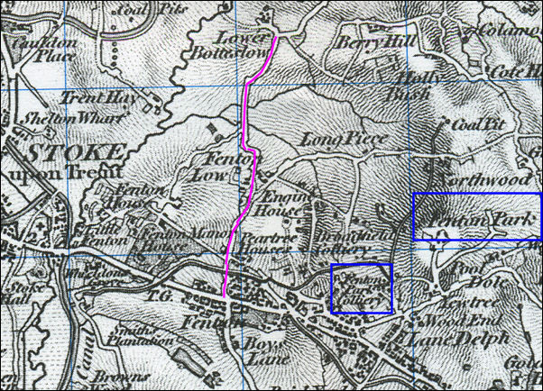
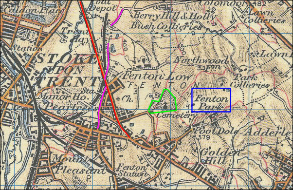
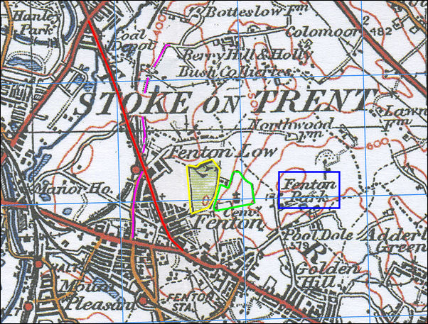
The development of Fenton Low
Shown in pink is the road from Fenton (along what is now Manor Street), through Fenton Low to Botteslow and the Berry Hill Brickworks - it lost what importance it had with the opening of Victoria Road from Fenton through the western end of Botteslow to Joiner's Square and Hanley in the early 1840's. Shown in blue is the area known as Fenton Park (not the municipal recreational park) and Fenton Park Colliery. Just above Fenton Park Colliery was Broadfield Colliery - this is the area where the park was built 1924
|
next: the other side of Fenton Park
previous: Bakers water fountain