Streets of Stoke-on-Trent | Shirley Street |
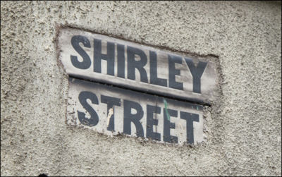
Shirley Street, Longport,
Stoke-on-Trent
![]()
Streets of Stoke-on-Trent | Shirley
Street |
![]()
![]()
| Index of all Longport Streets |
Shirley Street, Longport, Stoke-on-Trent
| This was the location of
Longport Hall, built in the mid 1770's - the hall was demolished in the
1880's and the estate was bought by a builder who demolished the Hall
and built 125 terrace houses fronting Newcastle Street and 3 new streets
behind: Bridgewater Street, Trubshawe Street, and Shirley Street.
In 2010/11 the houses in this area of Middleport and Longport were demolished as part of a Stoke-on-Trent City Council clearance programme. |
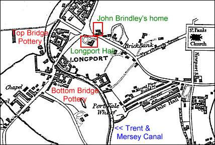
1832 map showing the location of Longport Hall
- click for more information on Longport Hall -
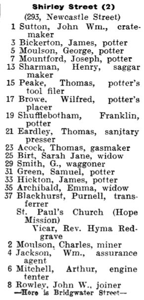
from..... 1907 Staffordshire Sentinel 'Business Reference Guide to The Potteries, Newcastle & District'
|
Shirley Street (293, Newcastle Street) 1 Sutton, John Wm., cratemaker 3 Bickerton, James, potter 5 Moulson, George, potter 7 Mountford, Joseph, potter 13 Sharman, Henry, saggar maker 15 Peake, Thomas, potter's tool filer 17 Browe, Wilfred, potter's placer 19 Shufflebotham, Franklin, potter 21 Eardley, Thomas, sanitary presser 23 Acock, Thomas, gasmaker 25 Birt, Sarah Jane, widow 29 Smith, G.,waggoner 31 Green, Samuel, potter 33 Hickton, James, potter 35 Archibald, Emma, widow 37 Blackhurst, Purnell, transferrer St. Paul's Church (Hope Mission) Vicar, Rev. Hyma Redgrave 2 Moulson, Charles, miner 4 Jackson, Wm ., assurance agent 6 Mitchell, Arthur, engine tenter 8 Rowley, John W., joiner
—Here is Bridgewater Street—
|
|
![]()
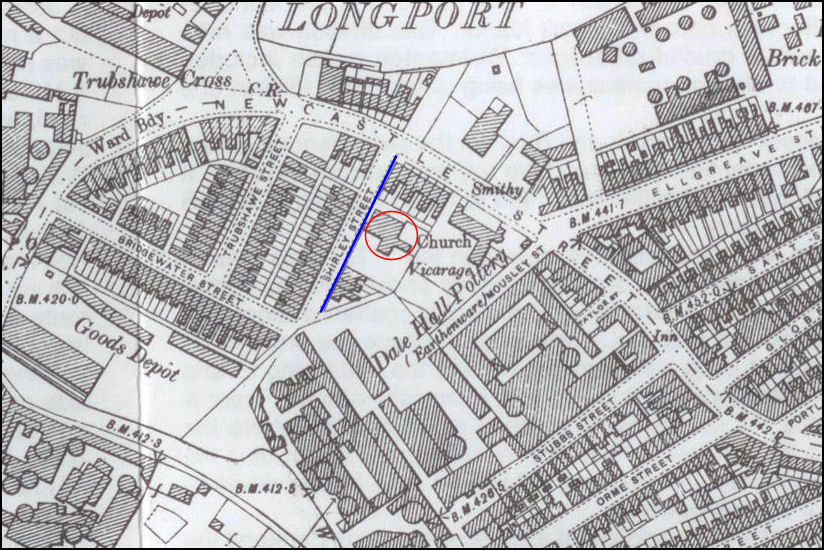
Shirley Street on a 1898 map
the 'Hope Mission' associated to St. Paul's church is shown in red
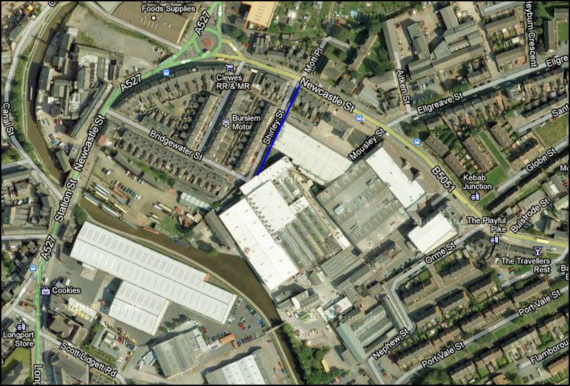
Shirley Street - Google maps
the Trent and Mersey Canal runs to the left of the map
and in the top left corner the Top Bridge Pottery Works
The mission church was built
over by the works of Steelite pottery works
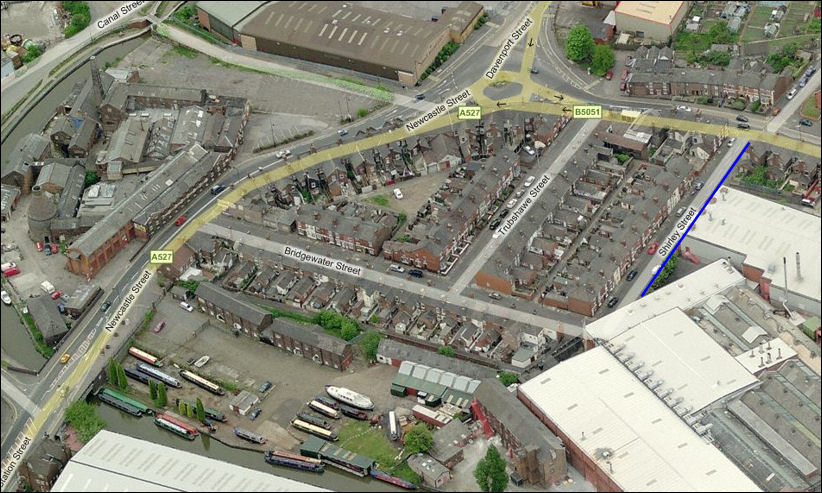
Shirley Street - Bing maps
in the foreground is Longport Boat Wharf - to the right is Steelite pottery
works
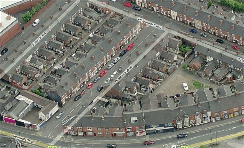
a closer view of Trubshawe,
Shirley & Bridgewater Streets from the Newcastle Street end
Bing maps
![]()
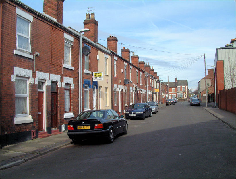
Shirley Street - looking
towards Newcastle Street
photo: Feb 2008
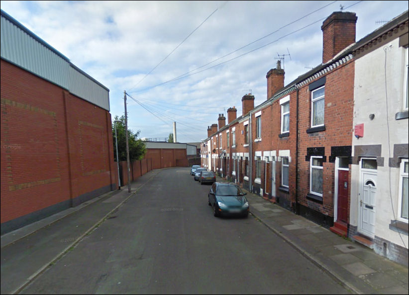
Shirley Street - looking
towards Bridgwater Street - Google Maps
on the left is the Steelite pottery factory
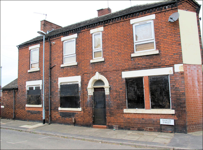
preparing for the demolition of
the last properties in Shirley Street, Middleport
this is No. 1 Shirley Street
Photos: August 2011
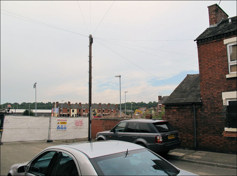
most of Shirley Street has been
demolished - a few properties in Bridgwater Street are still standing in the
distance
related pages....
+ Sentinel Newspaper article on this clearance area +
Longport Hall - home of the Davenport family.
Longport:
John Davenport & Longport.
The creation of Longport (by the Trent & Mersey canal)
between 1760-mid 19thC.
![]()
![]()
Did you live in this street or
area?
questions/comments/contributions?
email: Steve Birks