Grove Road, Heron Cross,
Great Fenton
Grove Road is situated in Great Fenton -
the town of Fenton lies in the south of the
Potteries, historically it consisted of the two townships of Fenton
Culvert or Great Fenton and Fenton Vivian or Little Fenton.
The two Fentons are
mainly an area of low lying land. In the northern part of the area there
remains much open country which rises to over 600 ft. in the north-east
and drops steeply in the northwest from about 450 ft. to the River Trent.
In the south, below Grove Road, the land rises to 500 ft.
Grove
Road and the roads centring on Heron Cross crossroads are ancient
pathways, on the 1775 Yates map below they can be clearly traced - they
are shown as dotted lines which means that they were track-ways and not
roads.
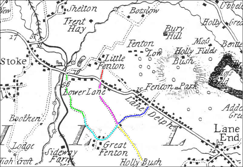
1775 Yates map showing
Grove Road and Great Fenton
Blue = Duke Street leading to King Street
(the main road marked Lane Delph)
Light Blue = Grove Road
Green = Whieldon Road
Red = Manor Street
Pink = Christchurch Street, Heron Street
Yellow = Blurton Road
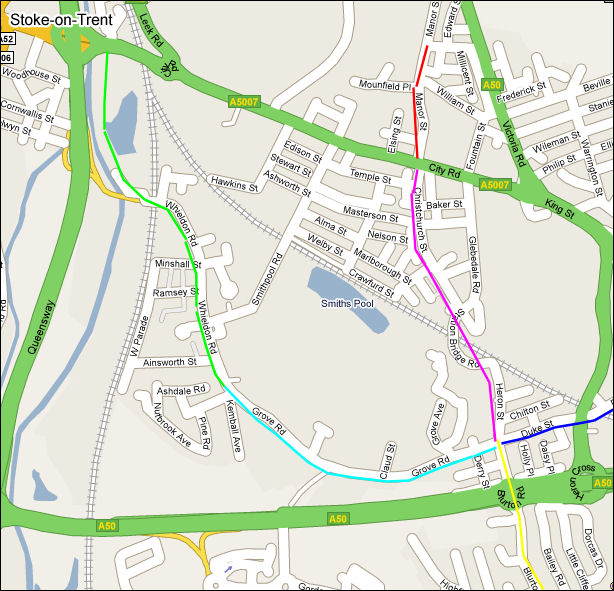
2008 Google map of the
same area
 
next: Development of
the housing
previous:
Early potters walked the track from Lower Lane to Lane Delph
|