![]()
Master Potters in
Georgian Burslem![]()
![]() (1714-1837)
(1714-1837)

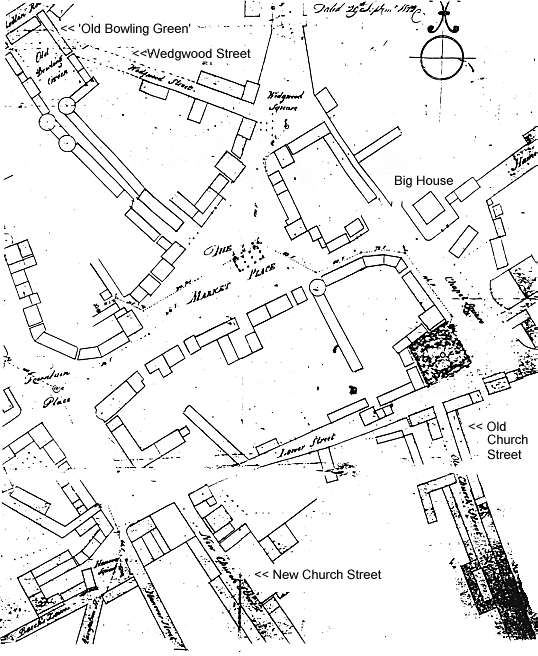
It is the earliest
detailed surviving map of the centre of Burslem though One of the new
developments was 'Wedgwood Street' (now New Street)
NOTE: The Old Bowling Green - top left of map. The Big House - with garden wall & rear entrance. New Church Street was built to provide a direct route to St. John's Church. New Church Street became just 'Church Street' and then William Clowes Street. Old Church Street became Bournes Bank Lower Street became Queen Street.
|