![]()
Longport: The 'Kingdom' of
Davenport![]()
![]() (1760's - mid 19th C))
(1760's - mid 19th C))
The maps are 80-130k in size and so will take
few minutes to download, but they are worth the
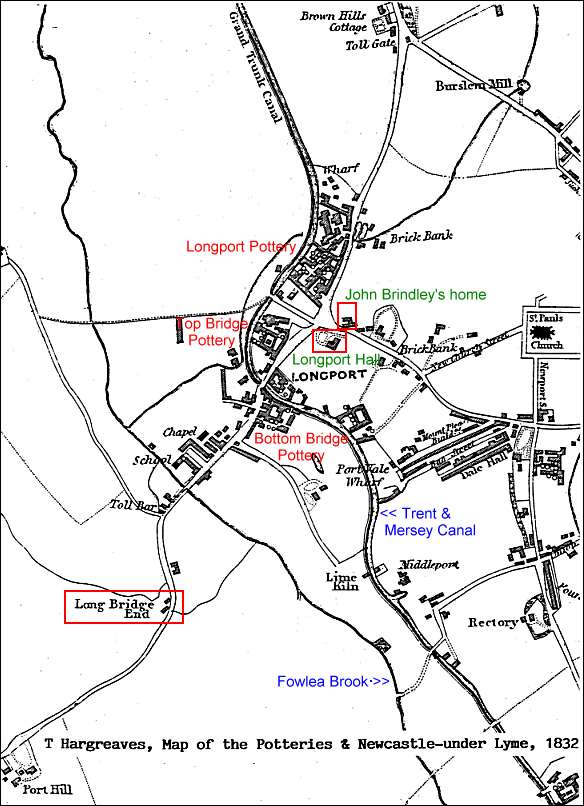
wait if you are interested the history of Longport.T Hargreaves, 1832 Map of the Potteries & Newcastle-under-Lyme - Longport Area
Originally the Longport area did not exist - see 1775 map - it
was known as 'Long Bridge'.There was a bridge which ran about 100 yards parallel to the
Fowlea Brook. The bridge was required because the area
was very marshy & waterlogged.The length of the bridge can be judged from the map, it
ran from Longport to 'Long Bridge End'.
The bridge was removed when the Trent & Mersey
canal was opened in 1777 and then 'Long Bridge'
was renamed 'Longport' - there was then a rapid
increase in buildings, potworks and houses.
![]()
questions/comments/contributions? email: Steve Birks