|
Brownhills:
The
packhorse lanes through Brownhills:
"One of the main pack-horse roads, which left Hanley by Woodisun
(Marsh Street), Brook Street (off Marsh Street North), connected
with the lane from Newcastle and wound through Cobridge and the
lower end of Hot Lane, Burslem, where it branched; one route going
approximately via the present Nile Street, Burslem, and the other, a
narrow lane behind, and to the west of what is now Waterloo Road,
but which was then a portion of the adjacent fields.
Passing Cross Hill and in front of the church yard, it ran by
Bournes Bank, a steep incline, to Swan Square. From here the road
probably traversed the slope by way of St. John's Square, or
through the Market Square, on to Hill Top. From thence it went
down the narrow steep passage of the Back Sytch, past the Sytch
Water Mill on the Brownhills Hall estate and past the hall, where
it would join the road from Newcastle and Longport, into Tunstall
and the north.
From Burslem, the Mother Town of the Potteries, an important
pack-horse road ran from the Market Square, as already mentioned,
via Pack-Horse Lane, winding by St. Paul's Church, Dalehall, via
Trubshaw Cross, fording the stream at Longbridge (Longport), by the
present road past a group of houses called Longbridge Hayes. From
thence it went round the Bradwell side of what is now Longport
Station and up the hill, now traversed by the road (made about 1875)
and so on to Wolstanton and Newcastle."
A Sociological History of Stoke-on-Trent, E
J D Warrillow
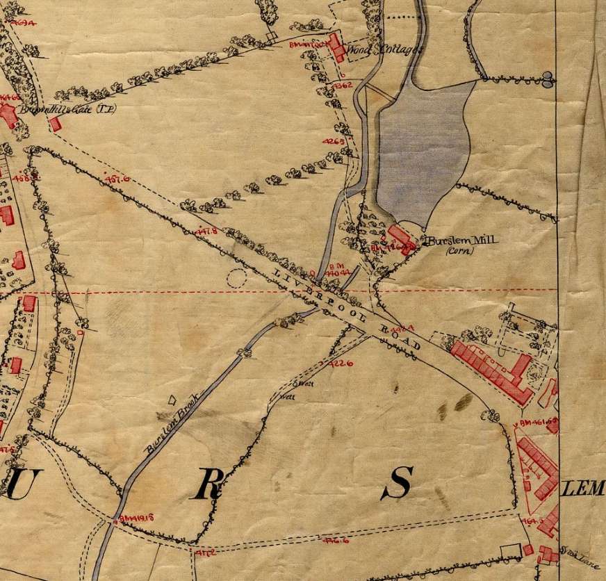
1851 map showing
Liverpool Road (now
Westport Road)
running from the Sytch, Burslem and joining Davenport
Road/Brownhills Road
at Brownhills gate (top left)
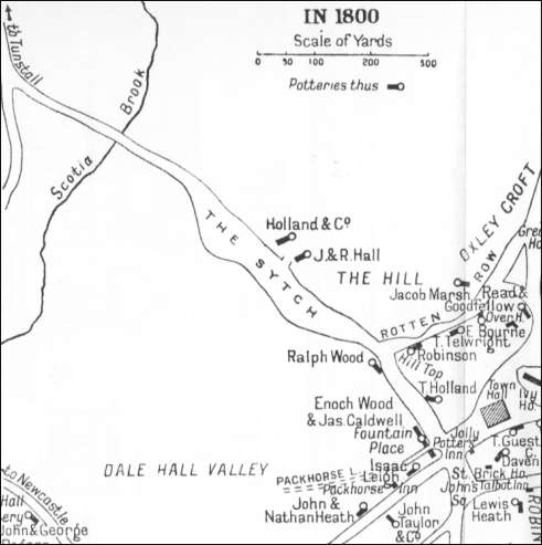
1800
map - top left is Brownhills gate
Since the potteries around
Stoke-on-Trent were in desperate need of something better than
the pack-horse to carry their fragile wares, they wholeheartedly
supported the connection of Staffordshire to the Trent and to the
Mersey canal.
The first sod was cut near
Brownhills by Josiah Wedgwood in 1766 and Brindley carried it away
in a barrow.
"The first clod of the grand trunk canal
was dug the 26th July, 1766, on the declivity of Brownhills, in a
piece of land, now belonging to Mr. Wood, within a few yards of
the bridge which crosses the canal, by Mr. Josiah Wedgwood, then
of Burslem, (the gentleman who afterwards rose to such eminence as
a Potter), in the presence of Brindley, the Engineer, and many
respectable persons of the neighbourhood, who each cut a sod to
felicitate the work.
Perhaps the only survivor who assisted at
the ceremonial, is Enoch Wood, Esq., of Burslem, who communicated
this information ; and also, that a sheep was roasted whole, in
Burslem market-place ; a feu dejoie fired in front of Mr.
Wedgwood's house ; and other demonstrations of festivity displayed
on the auspicious occasion."
Ward - The Borough of Stoke-upon-Trent, 1843
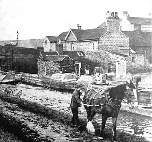
The Trent and Mersey canal at
Brownhills, c.1930

|