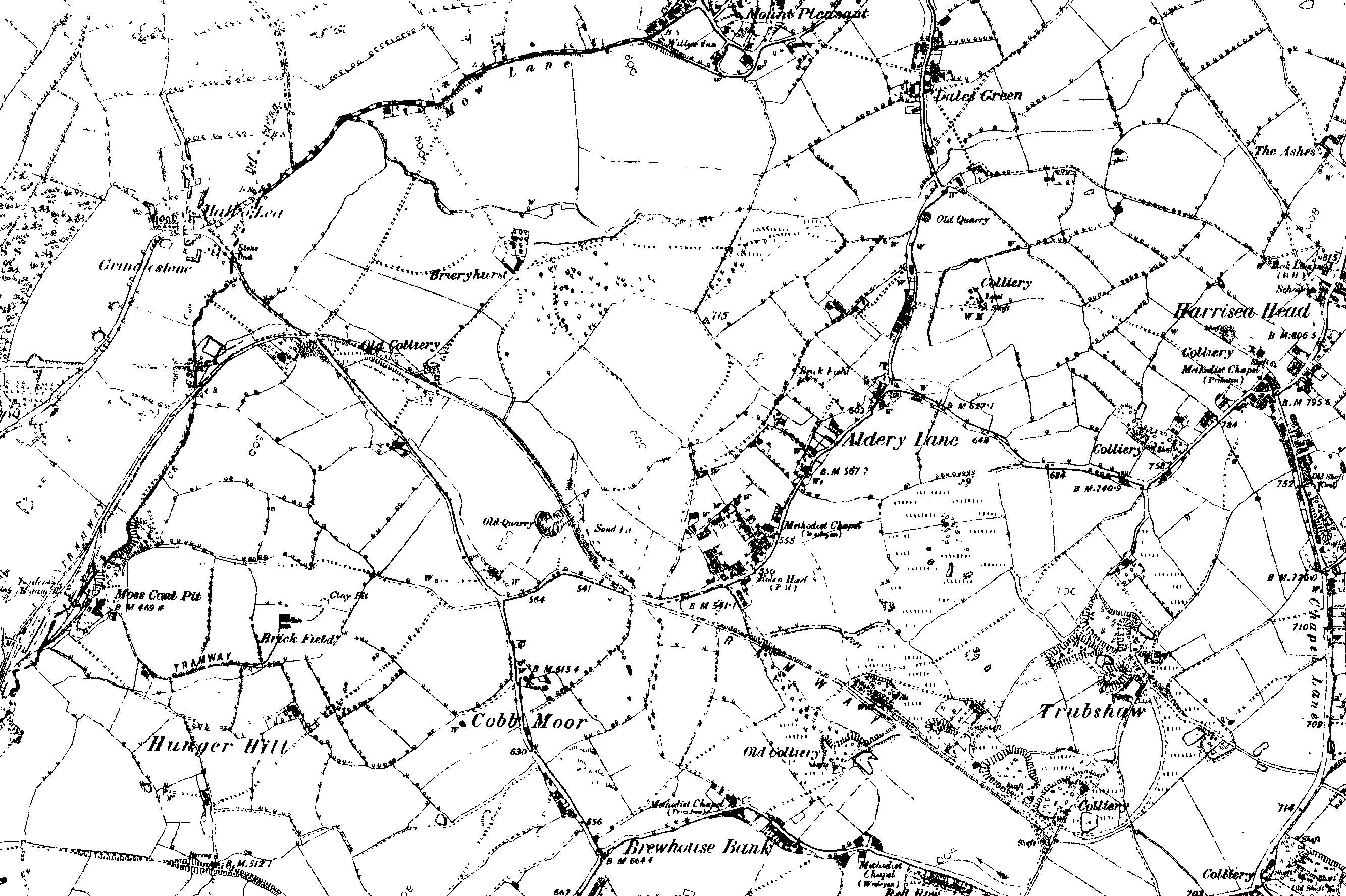
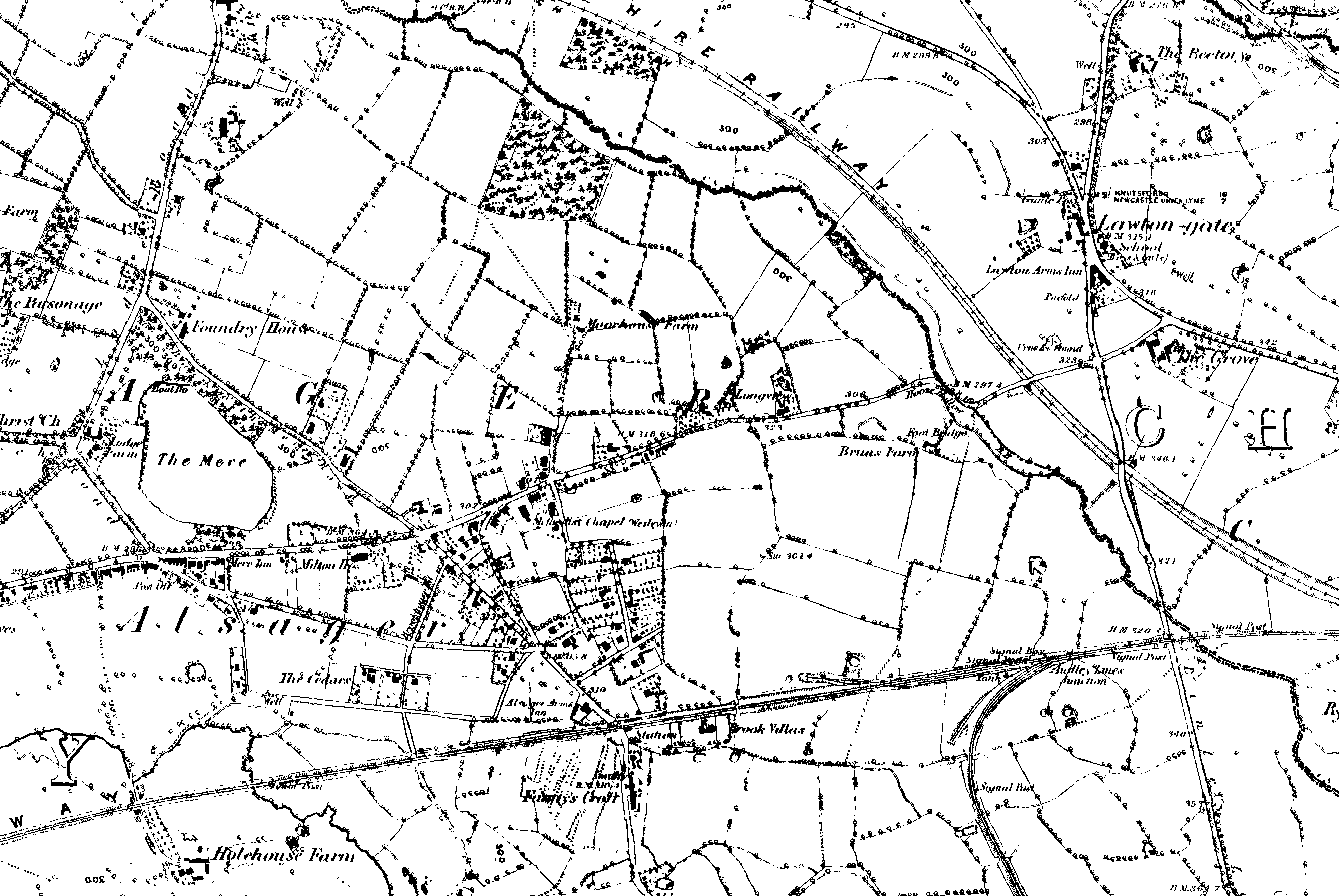
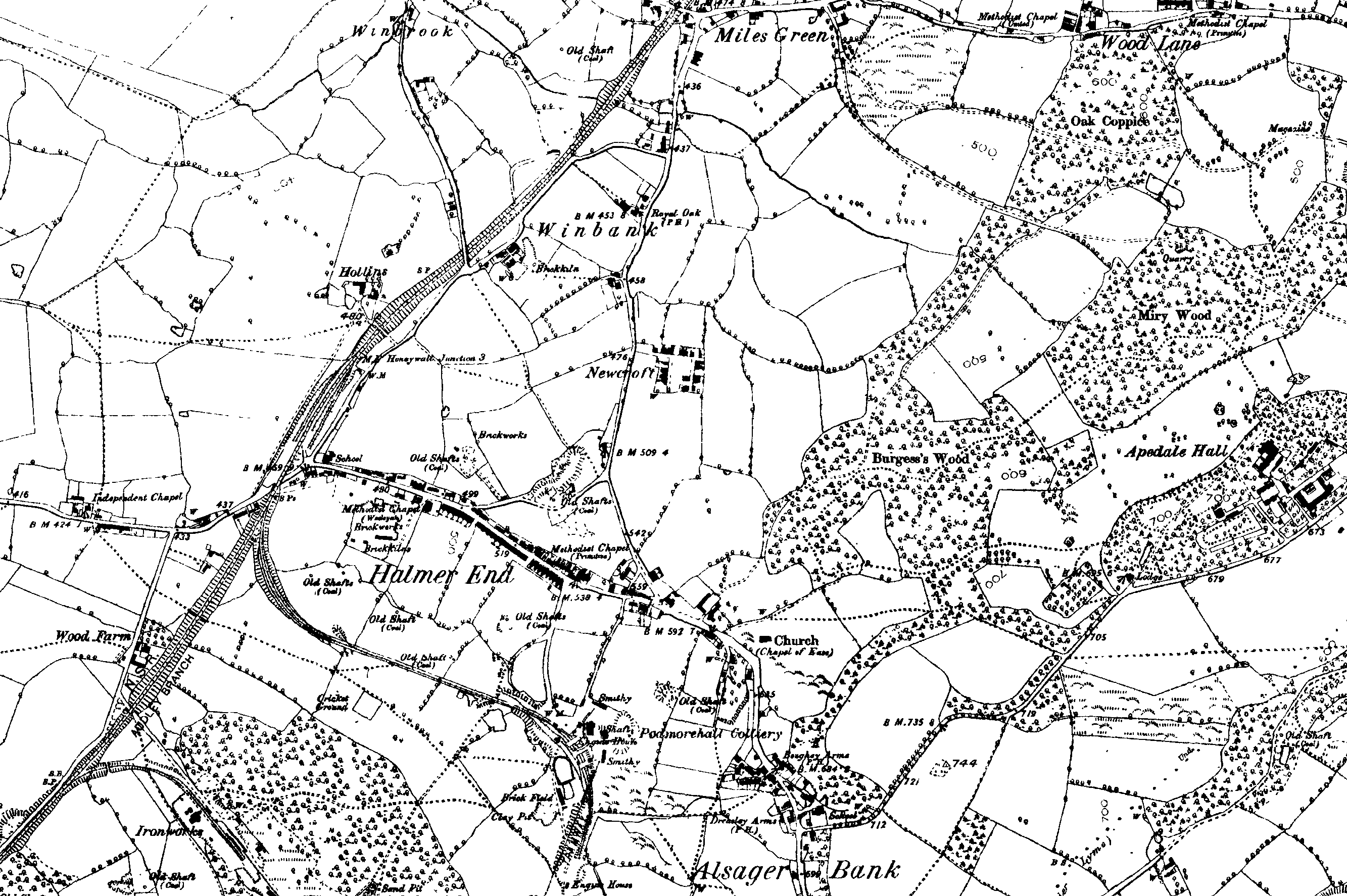
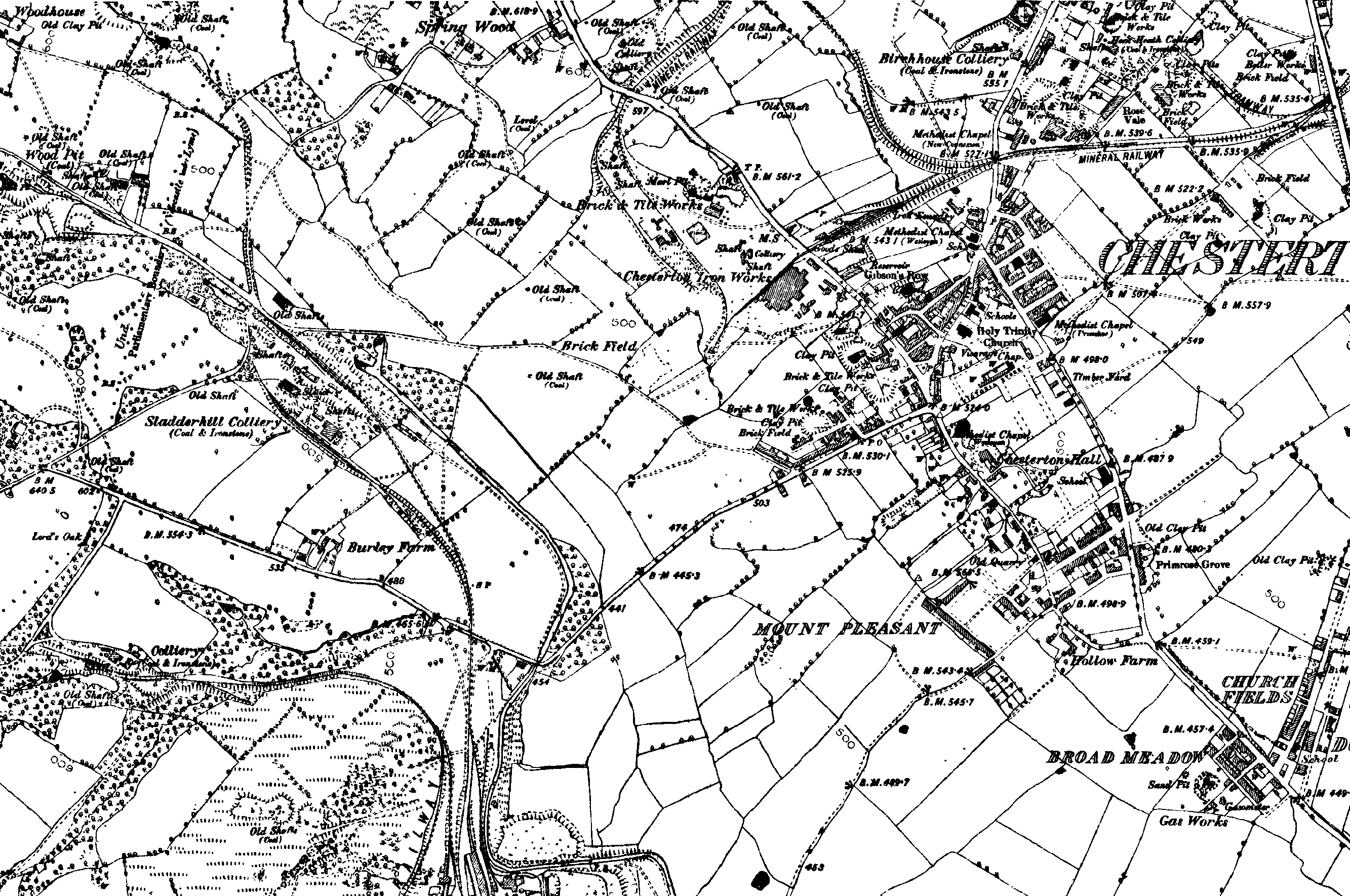
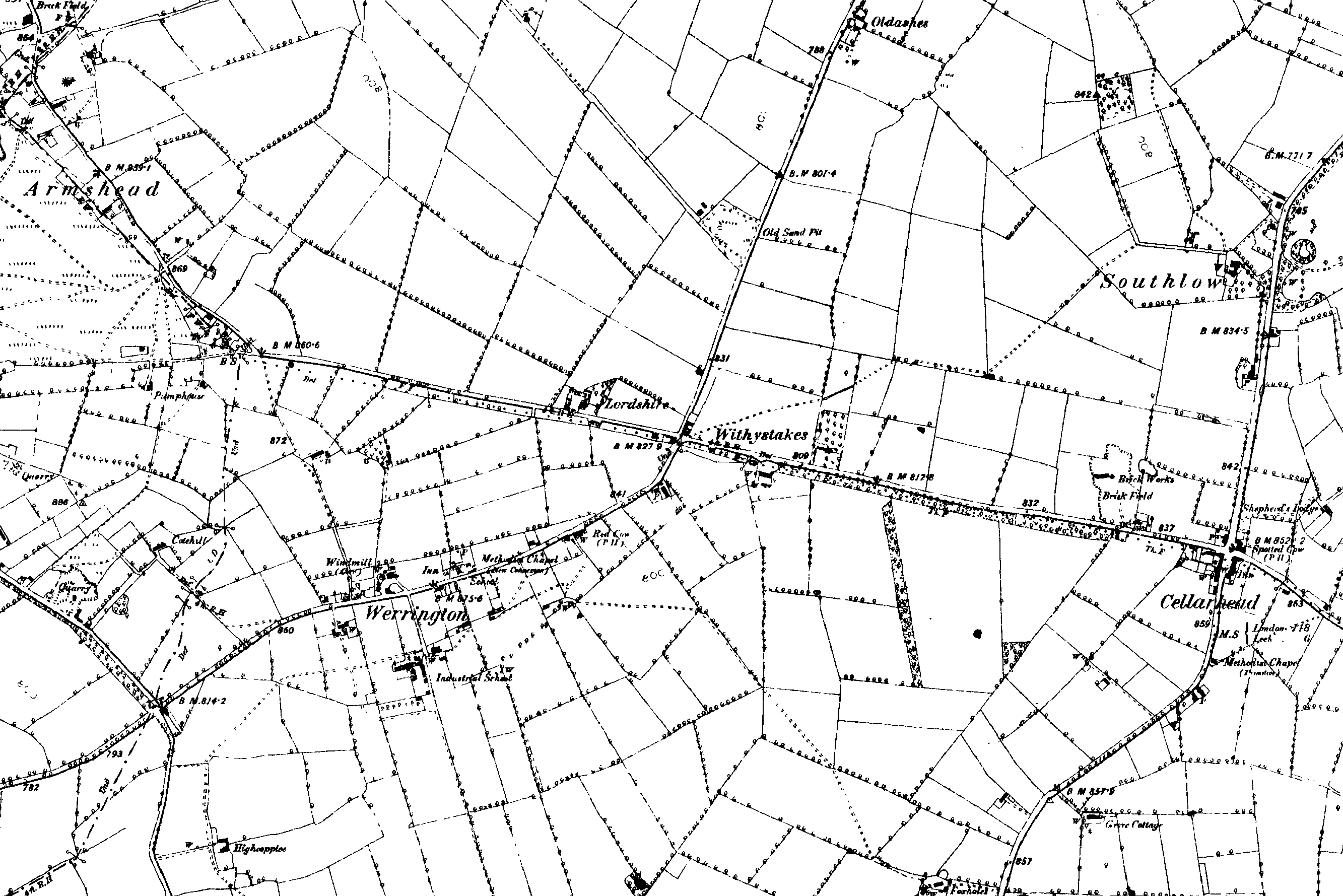
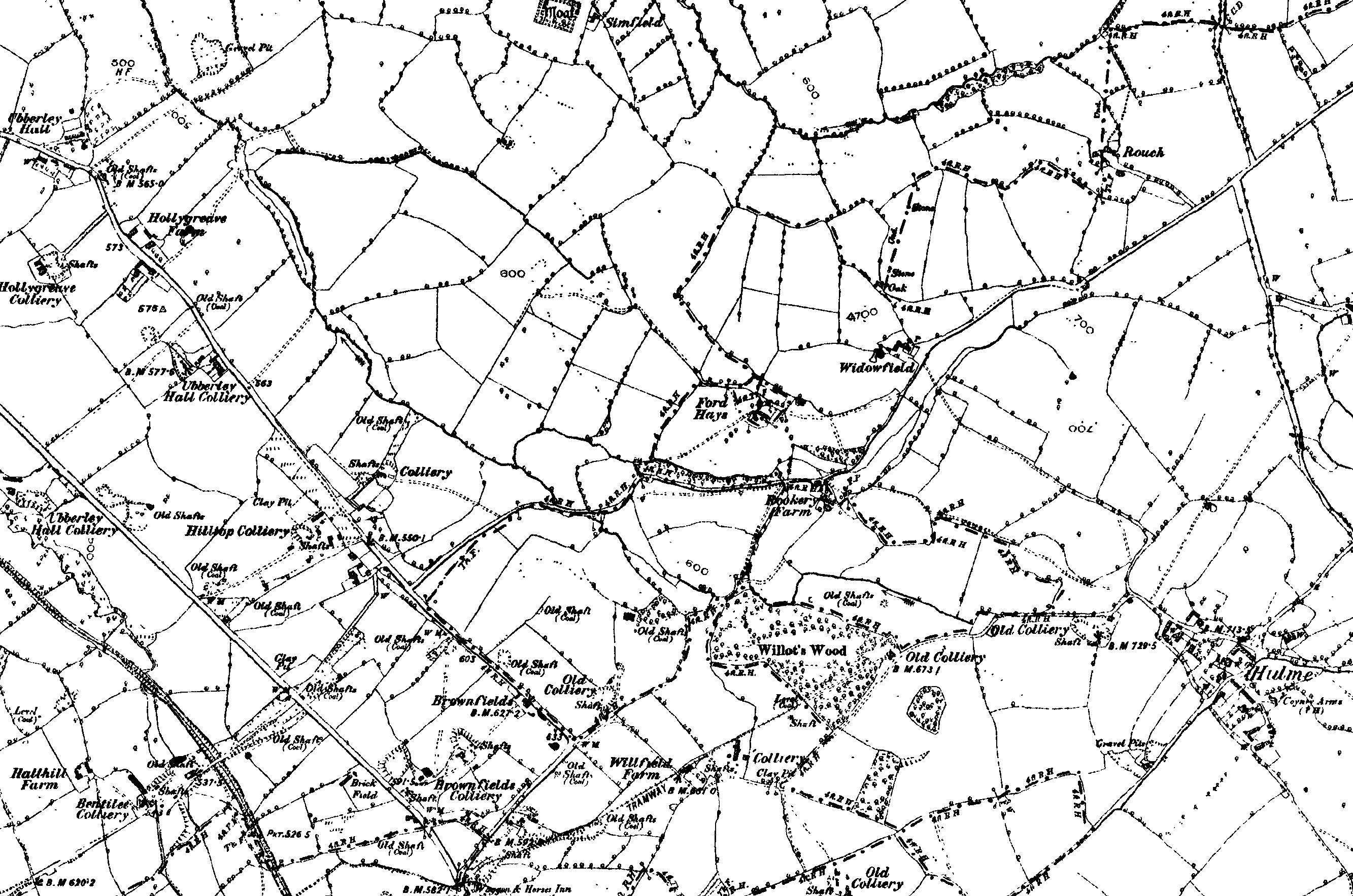
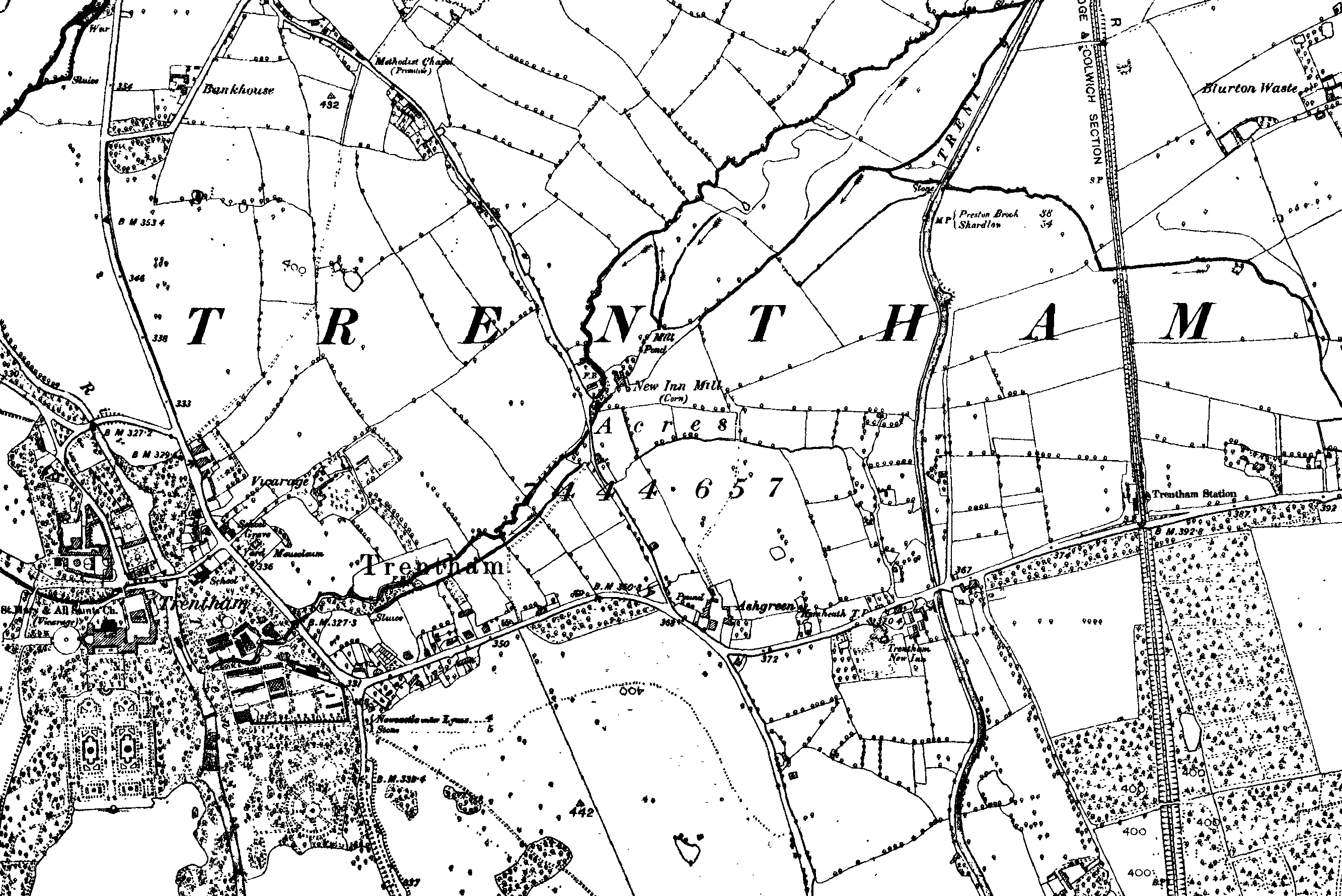
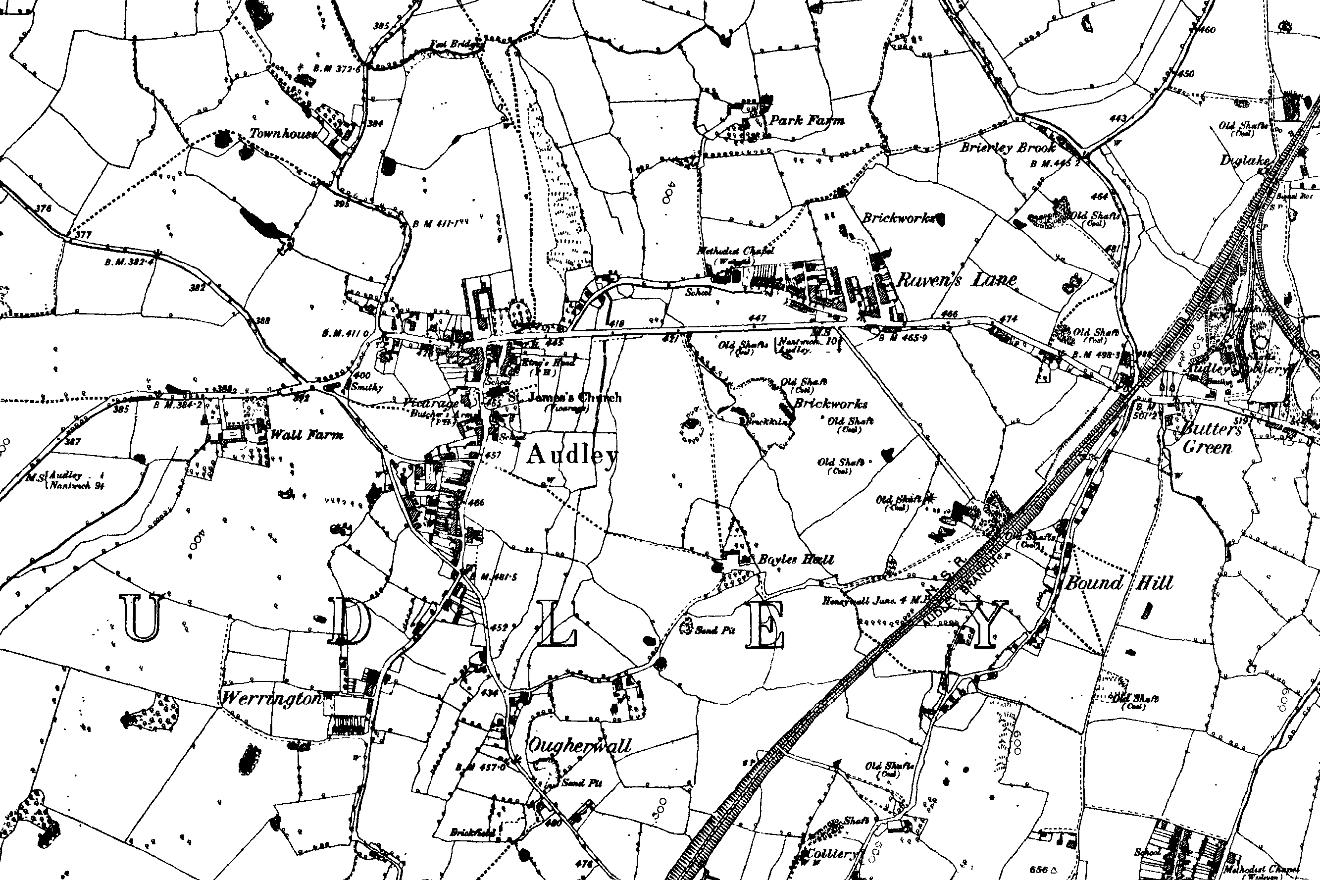
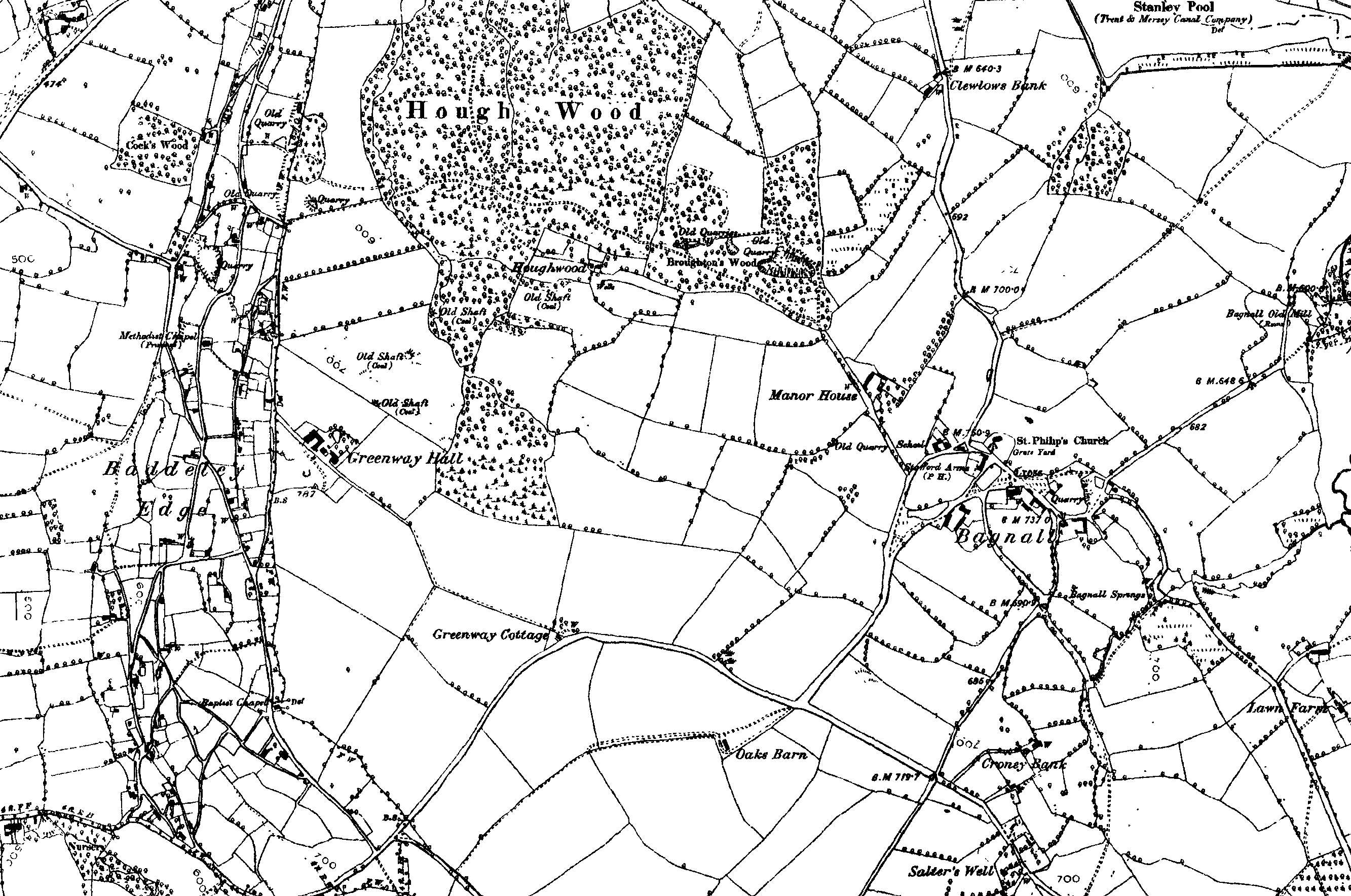
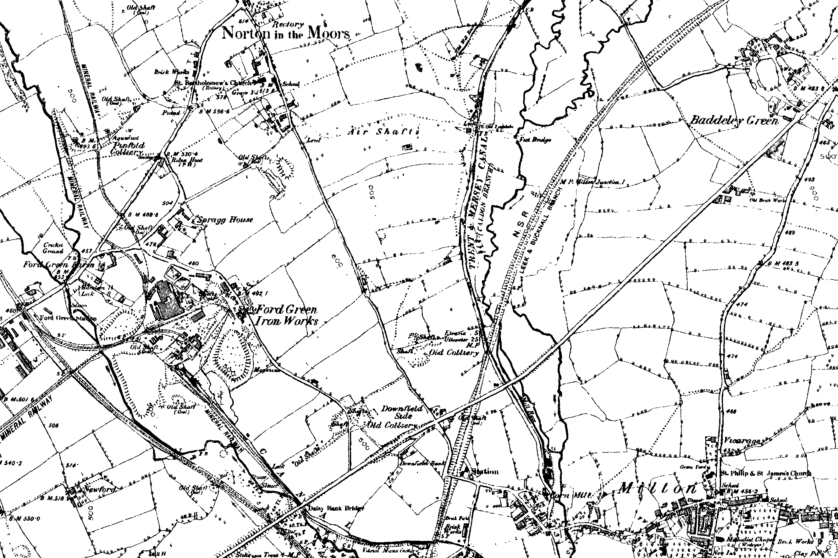
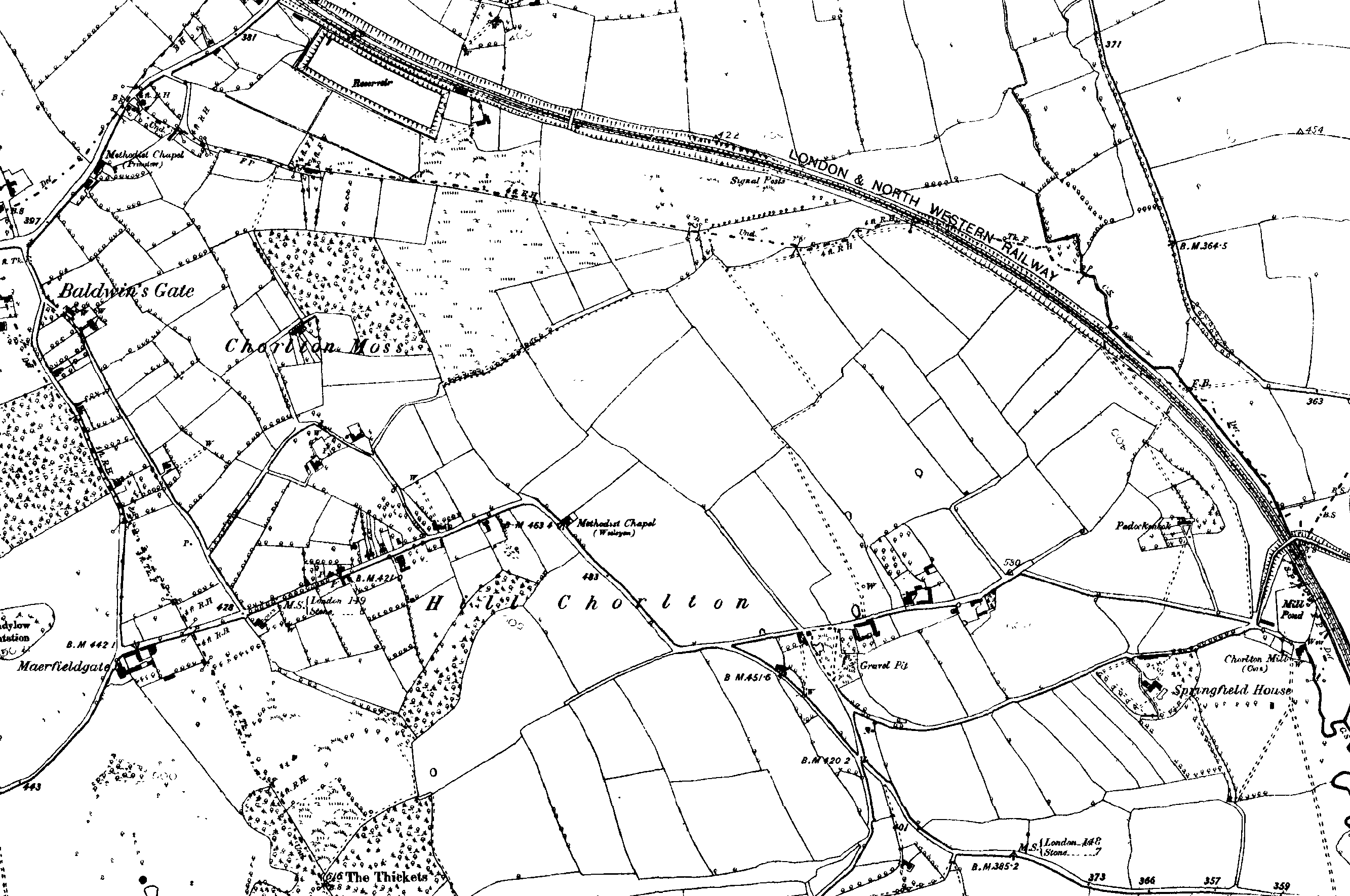
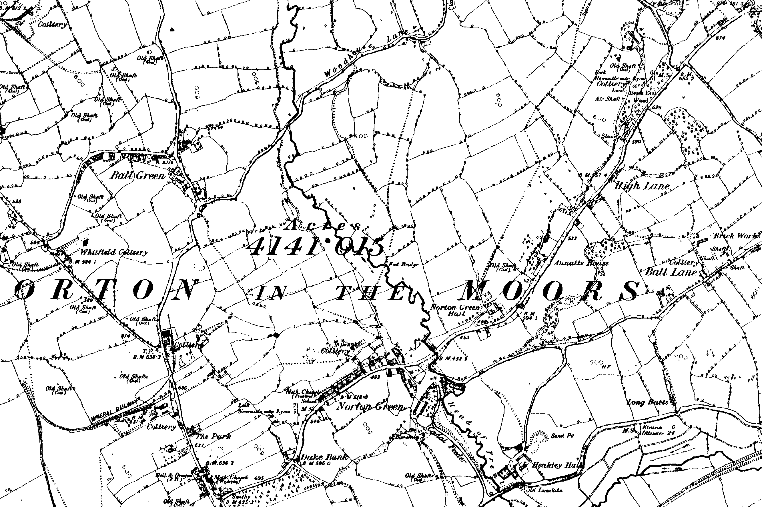
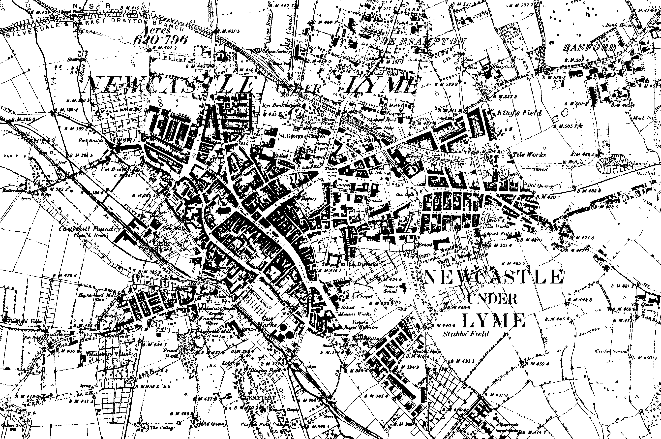
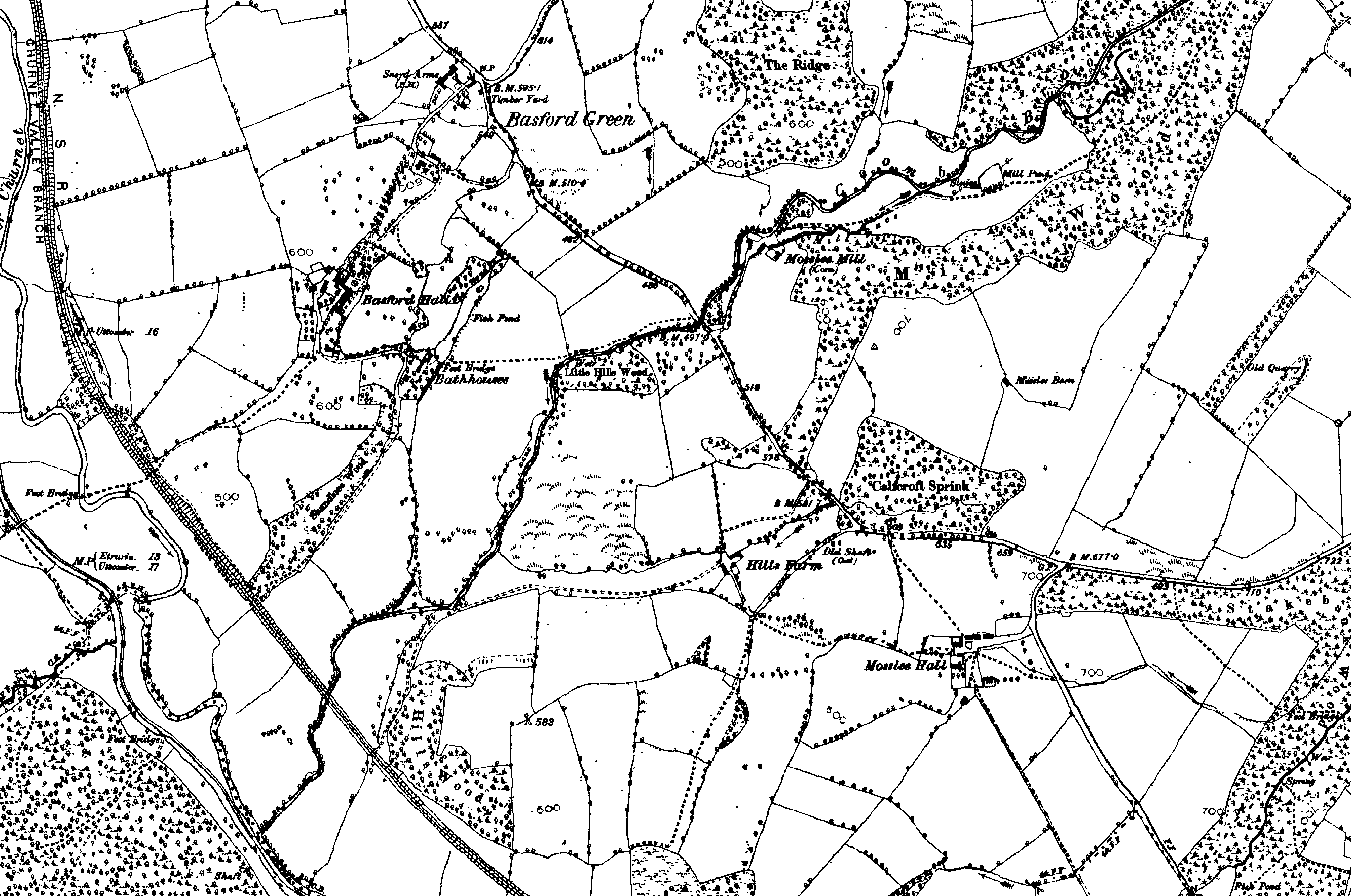
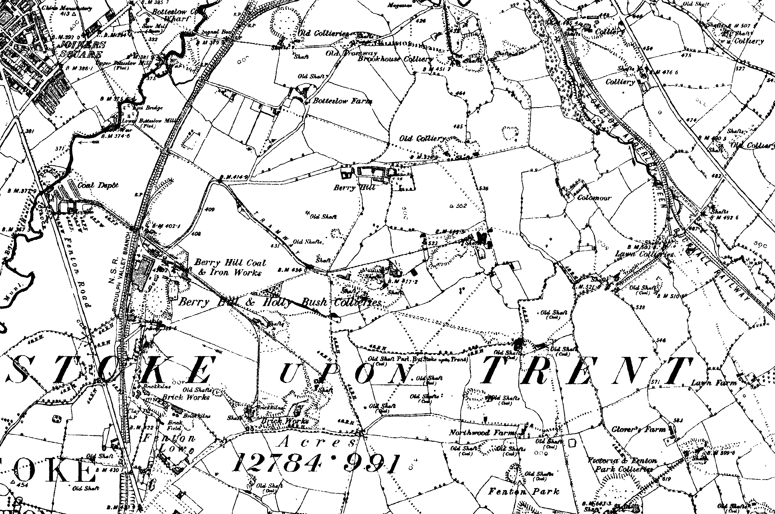
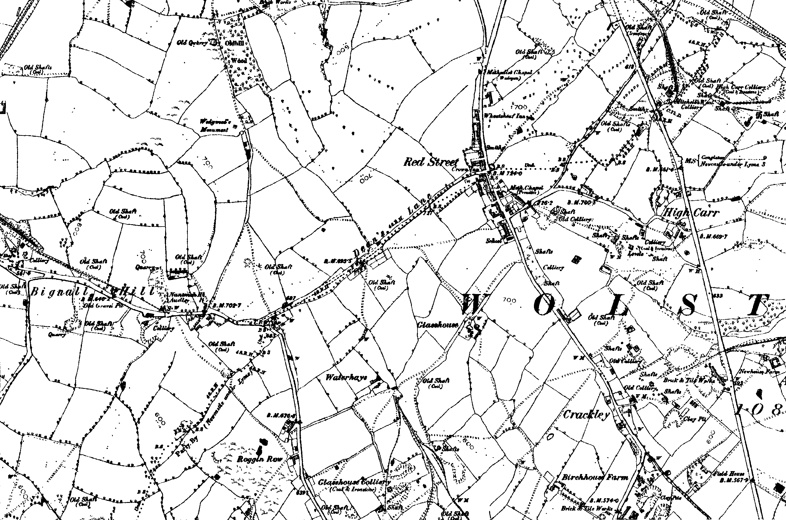
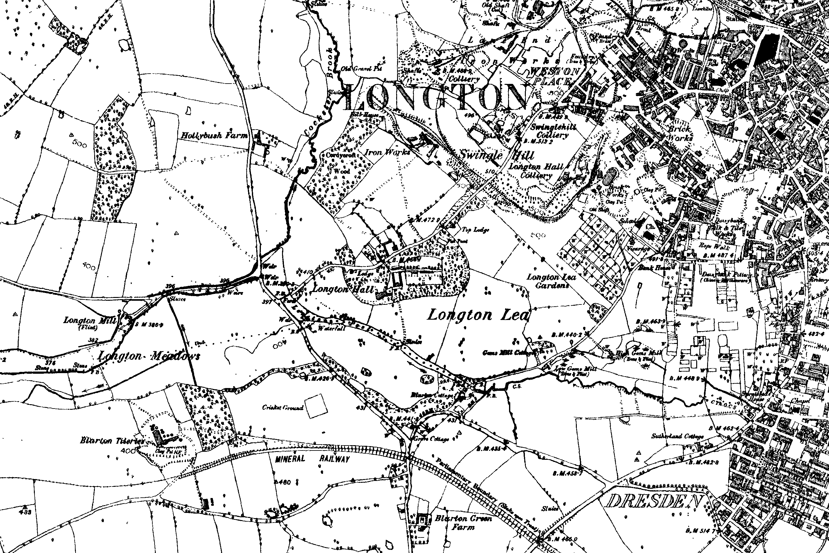
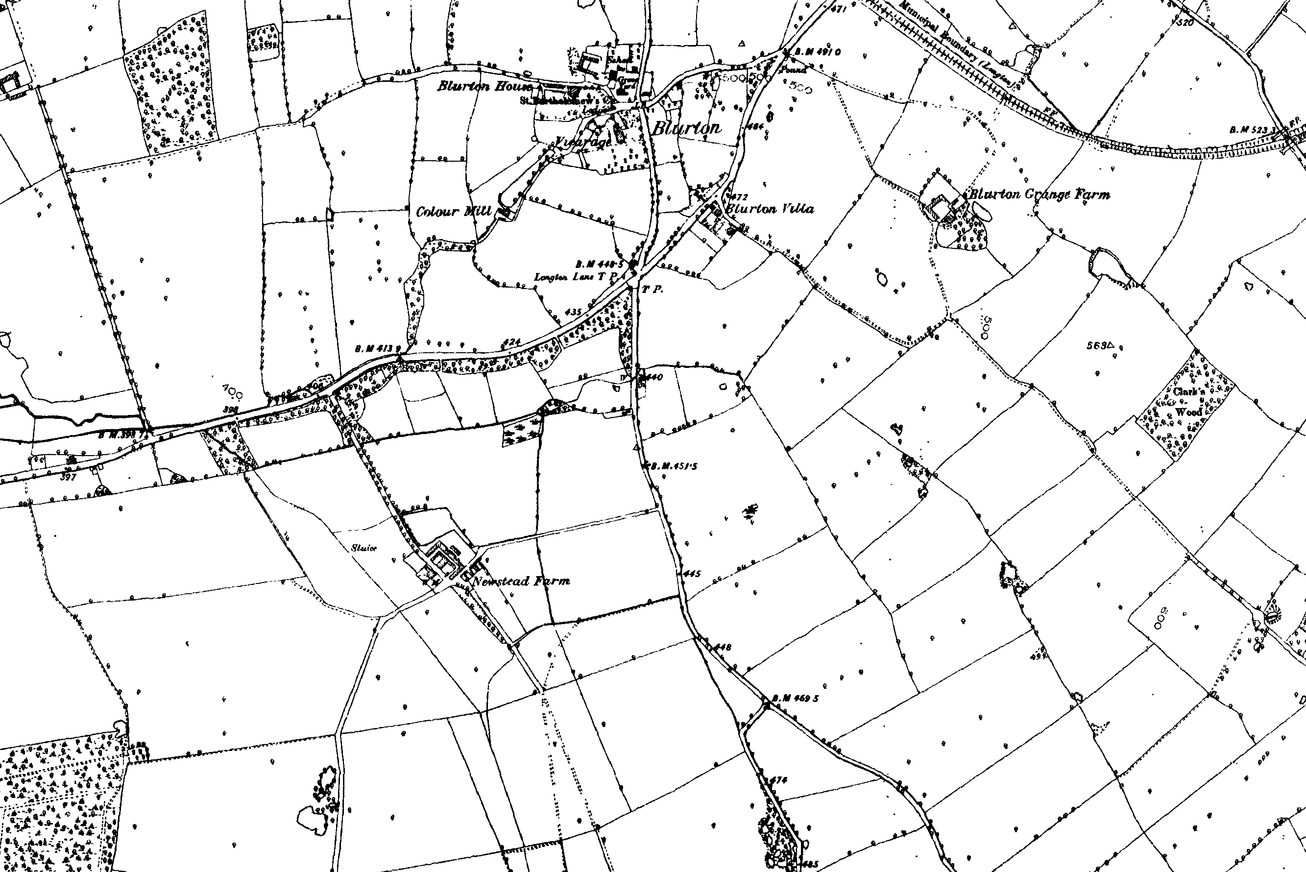
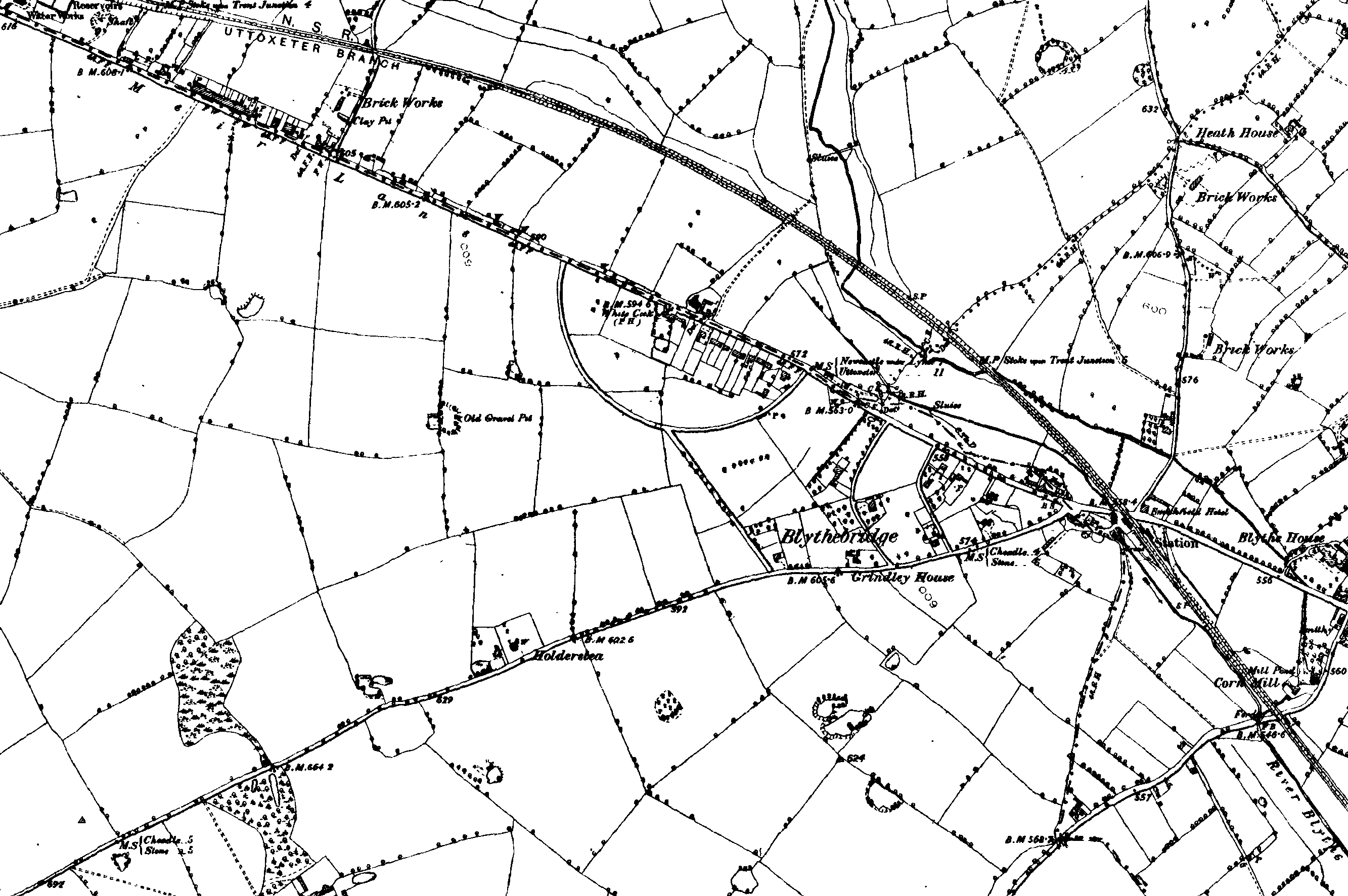
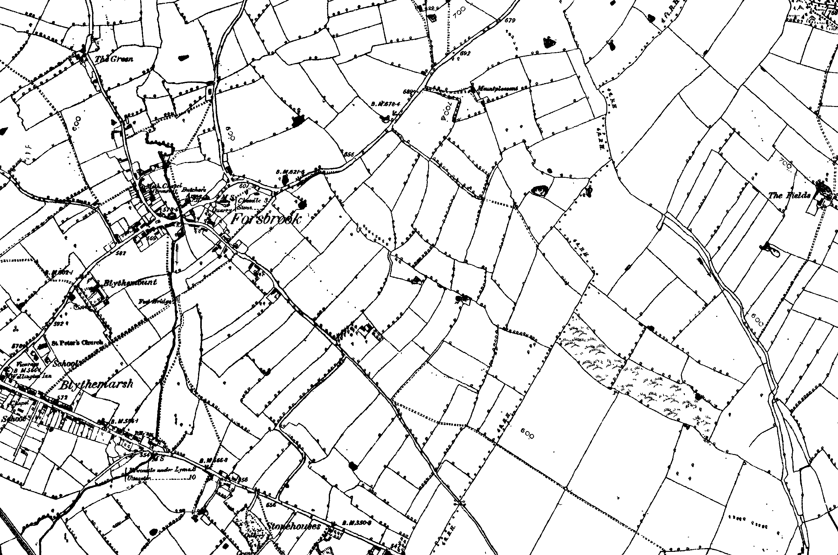
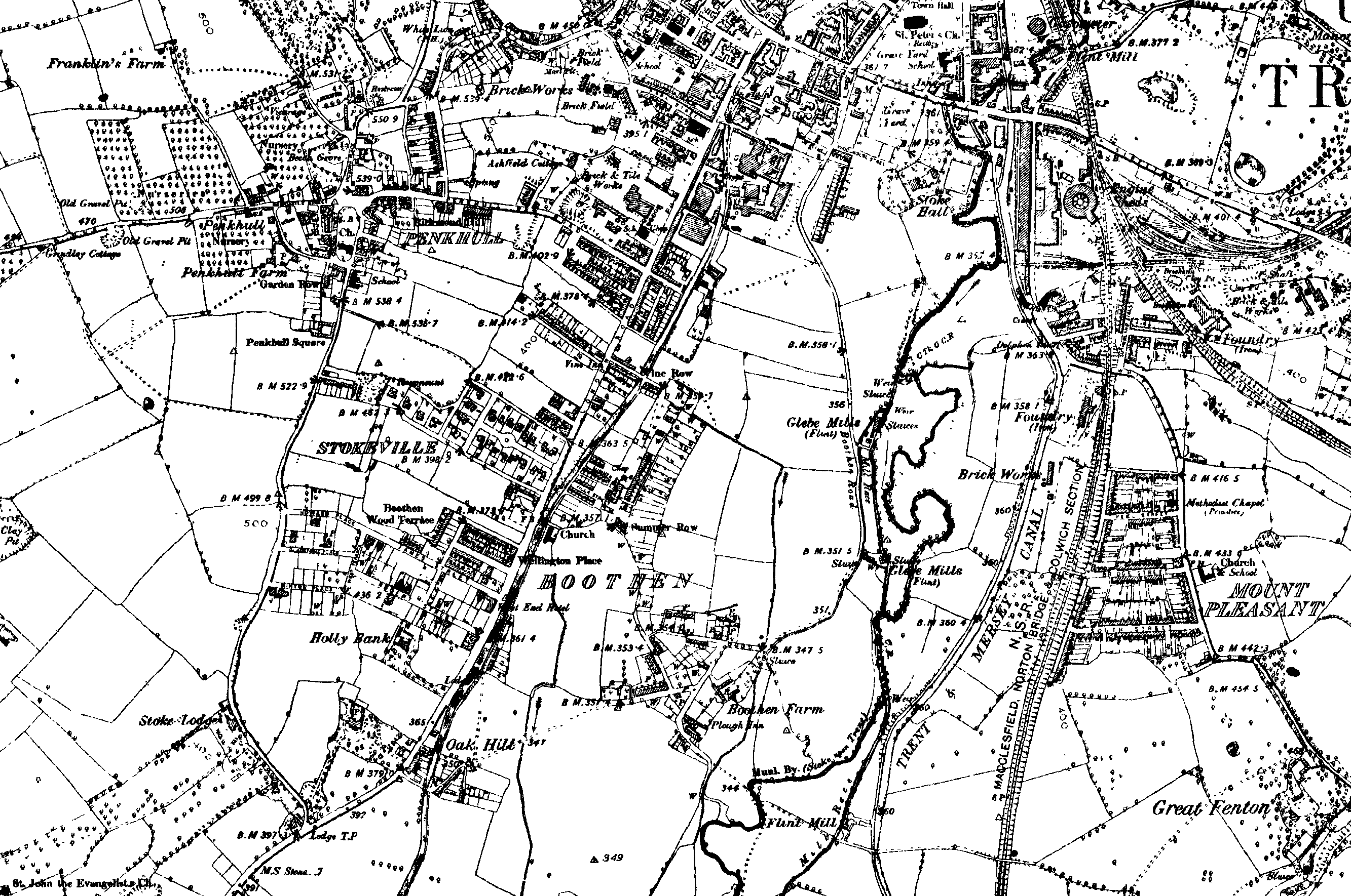
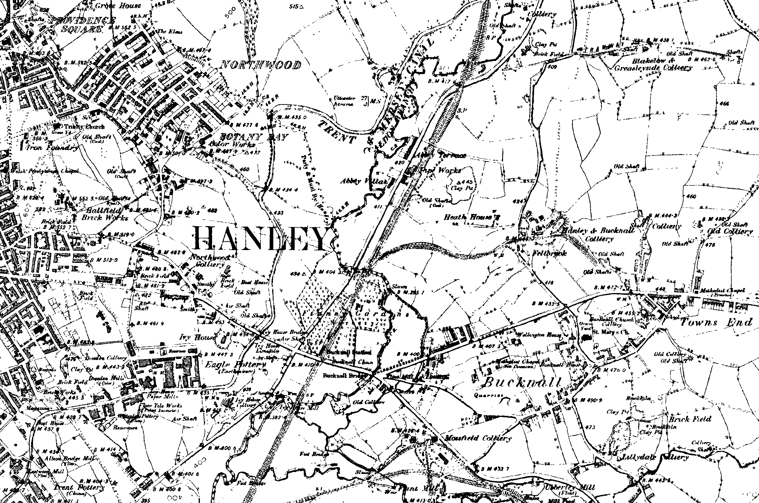
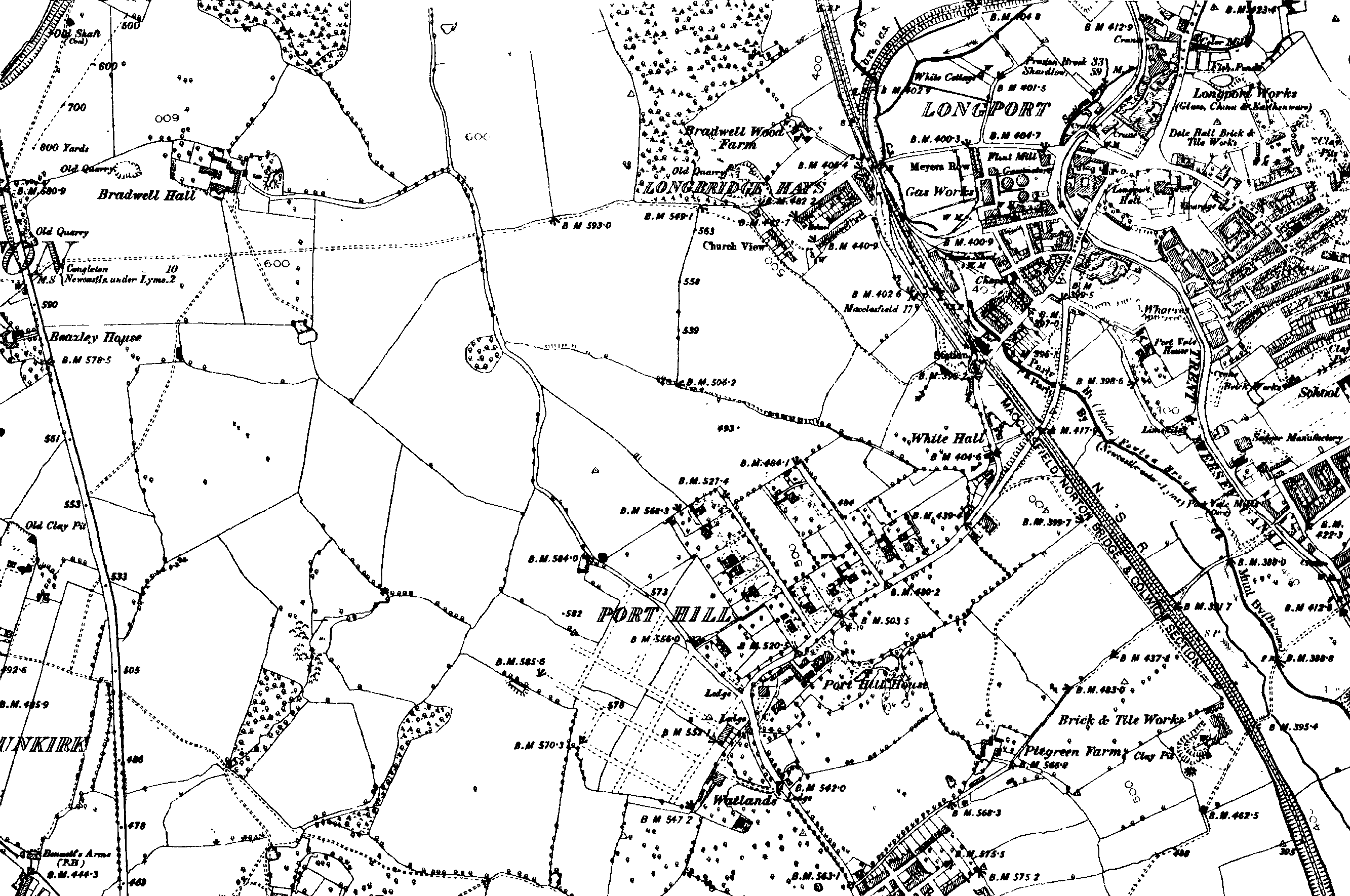
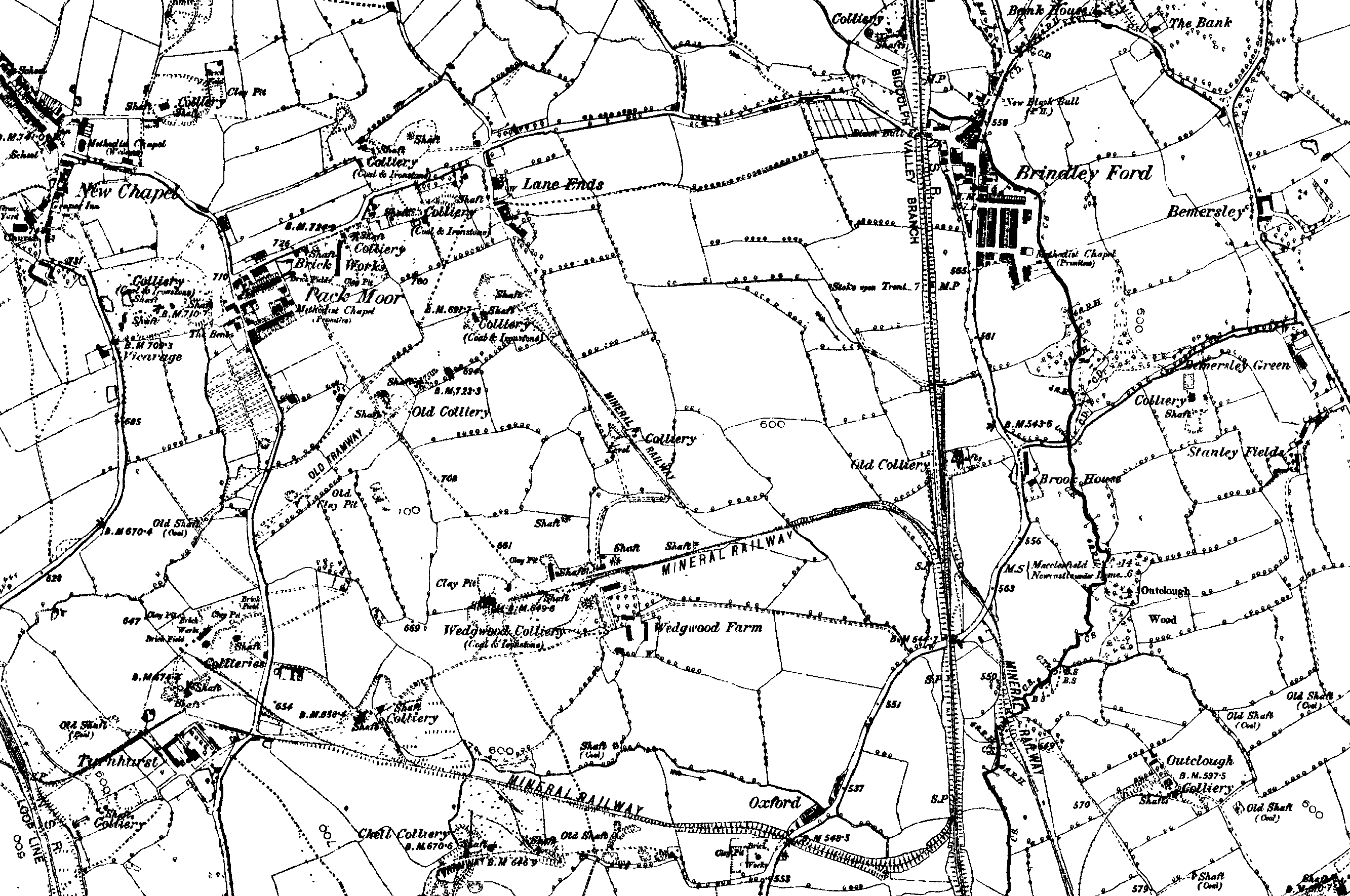
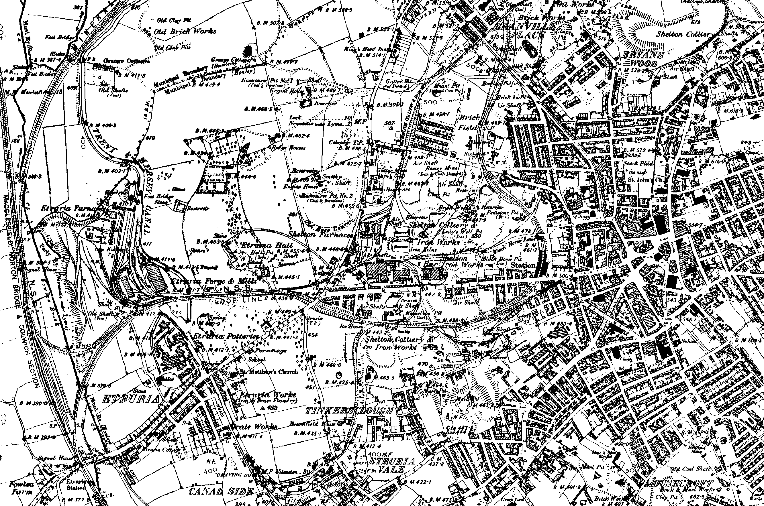
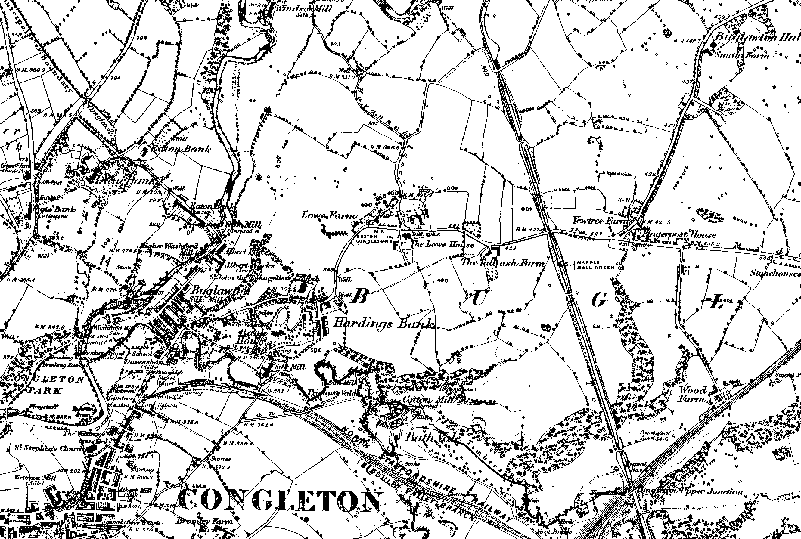
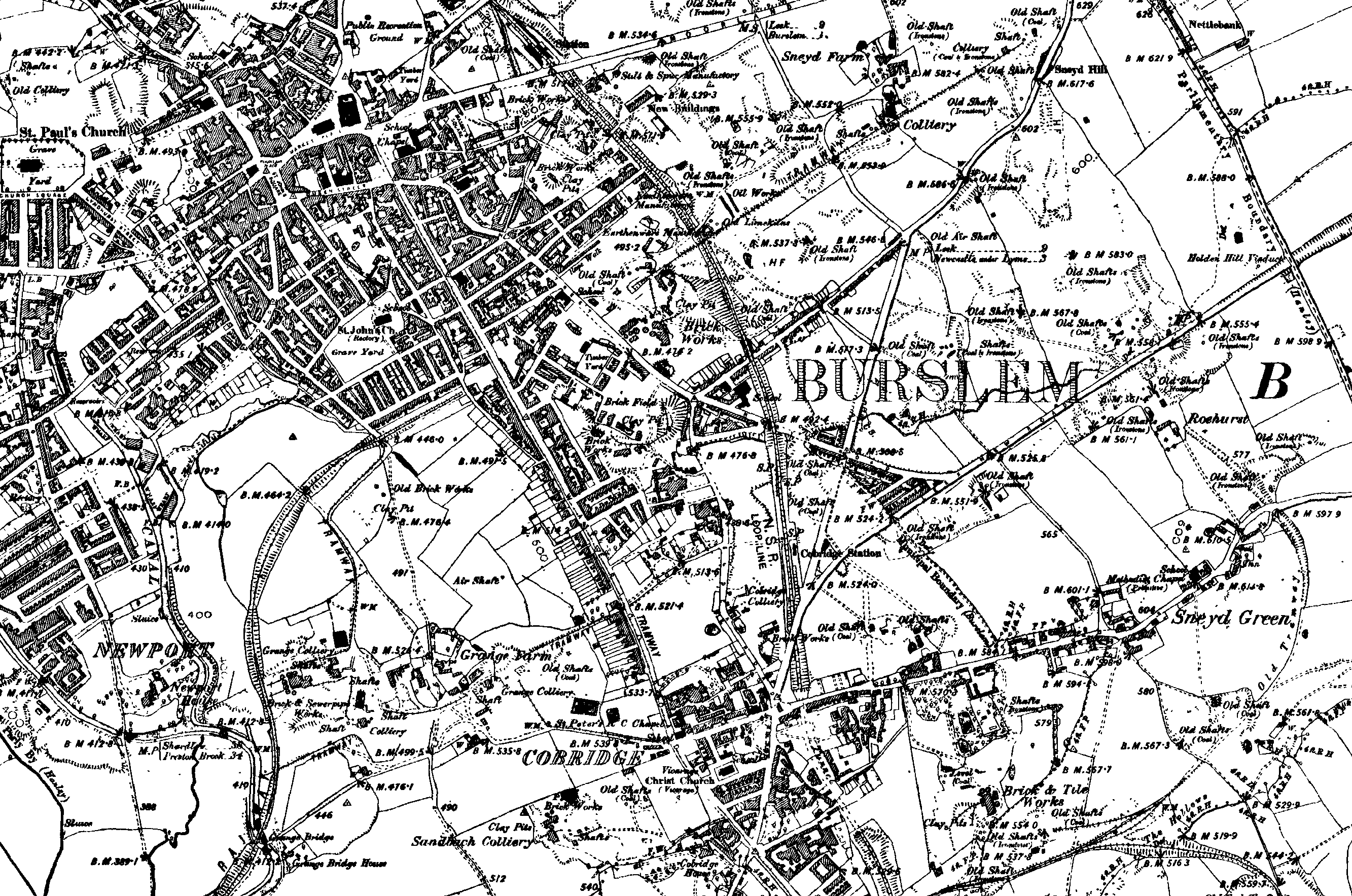
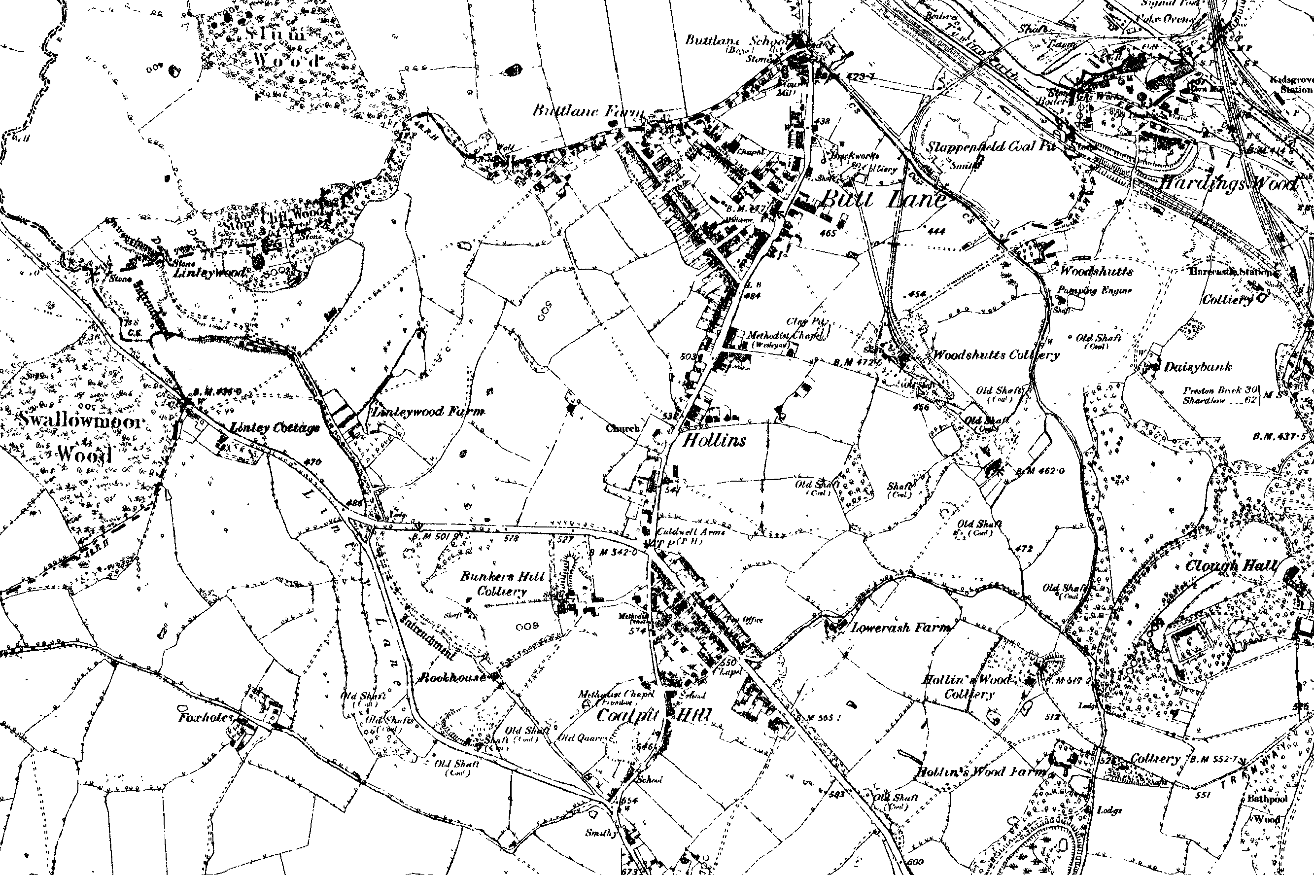
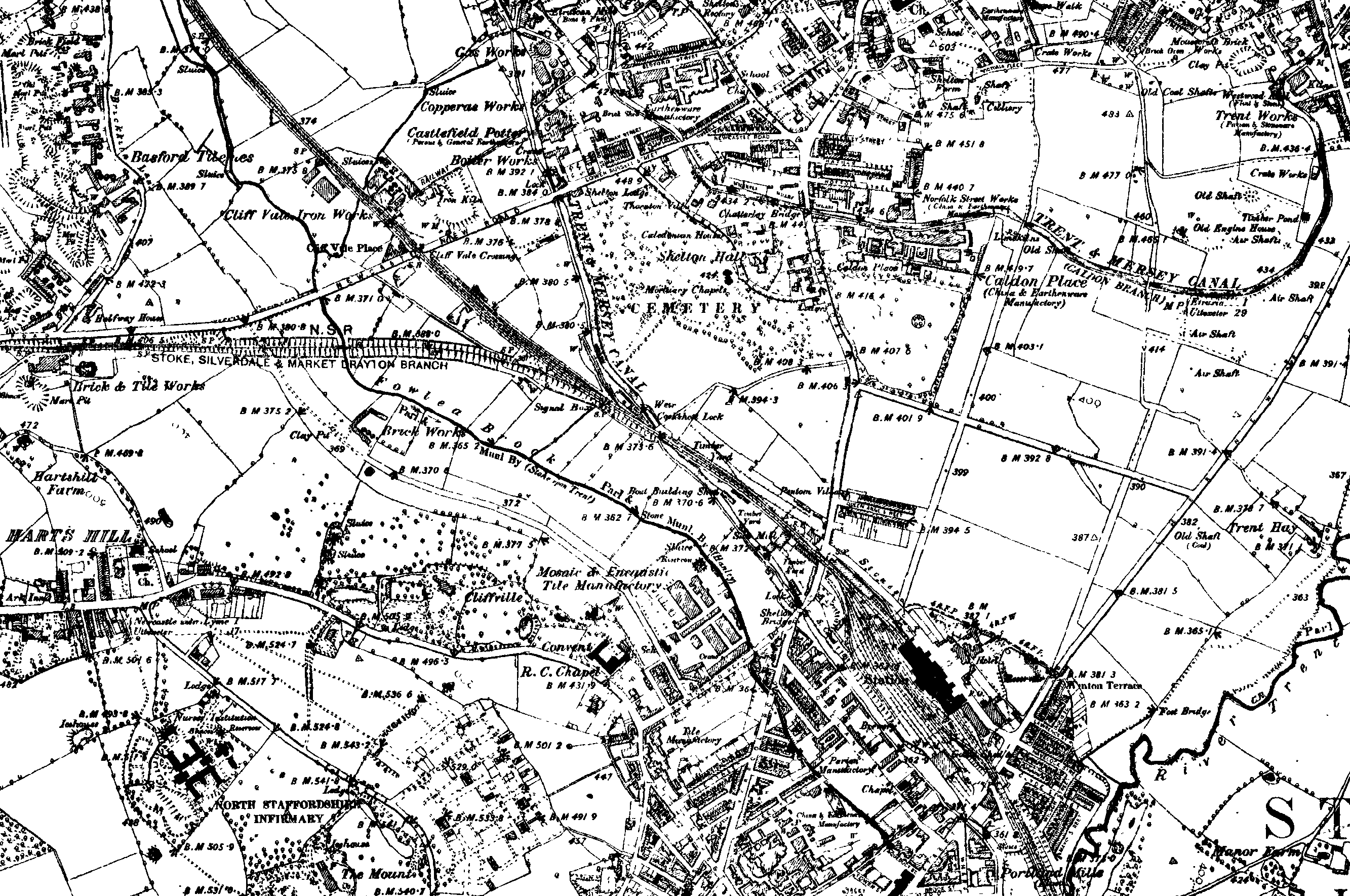
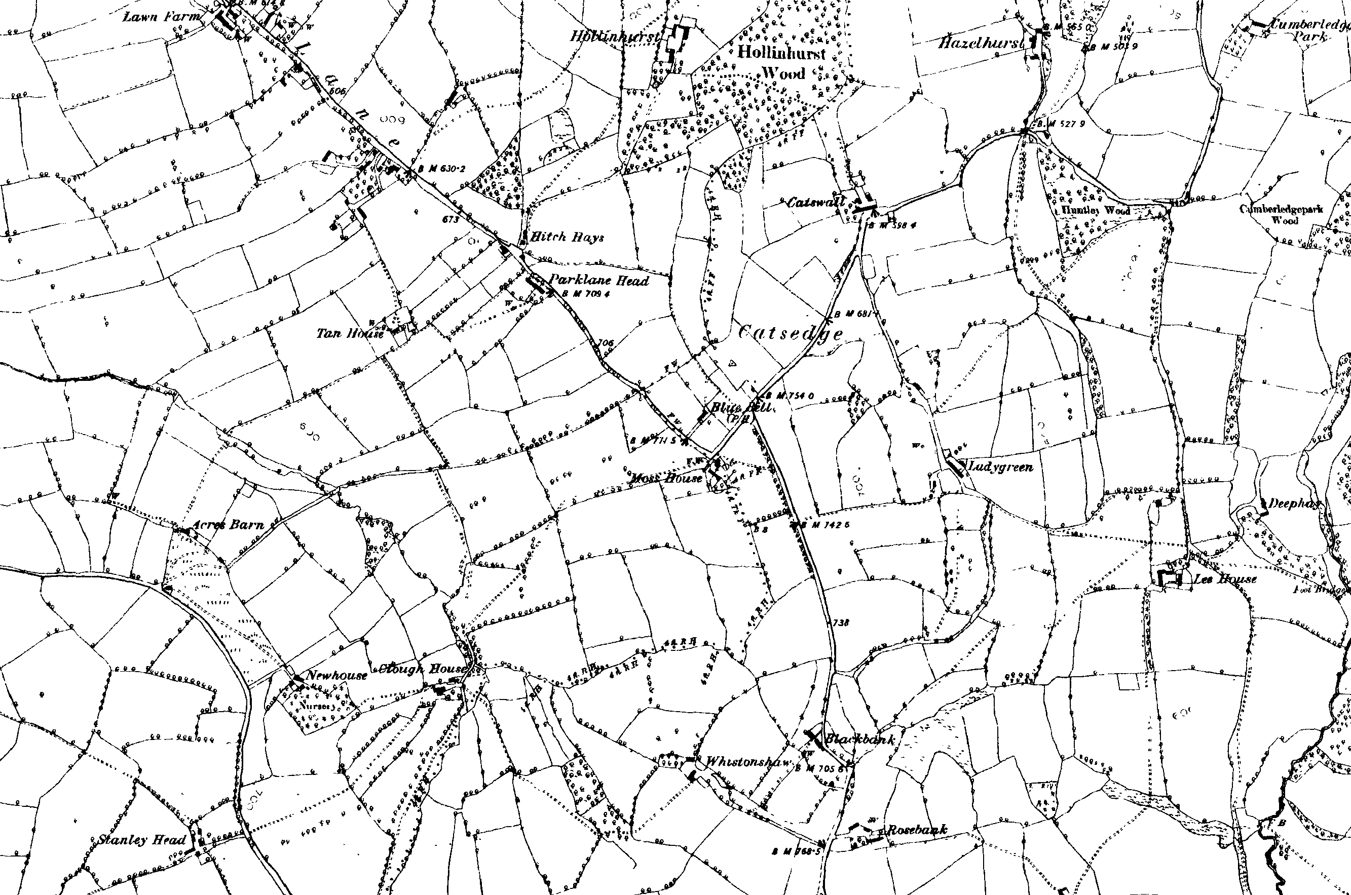
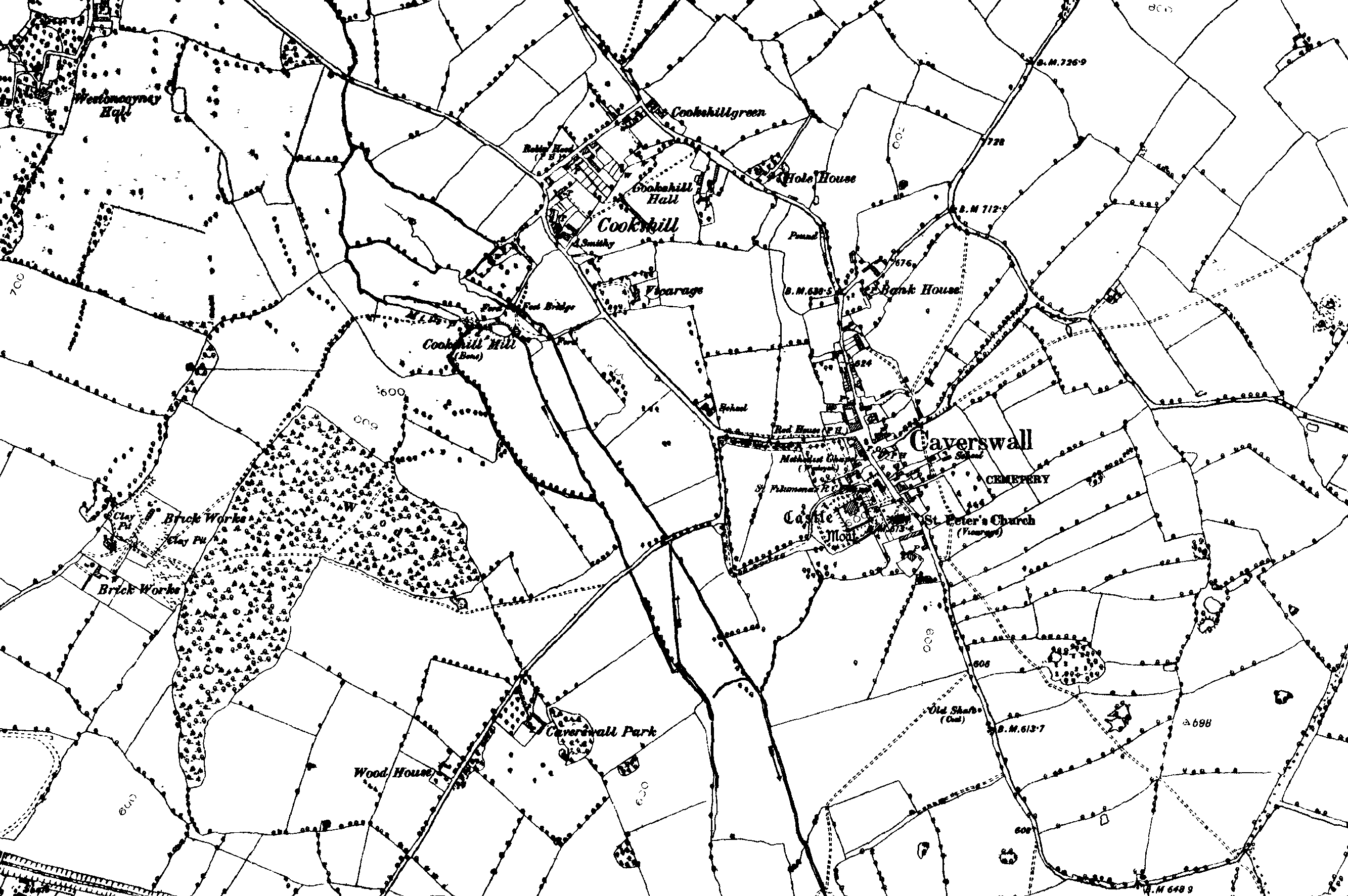
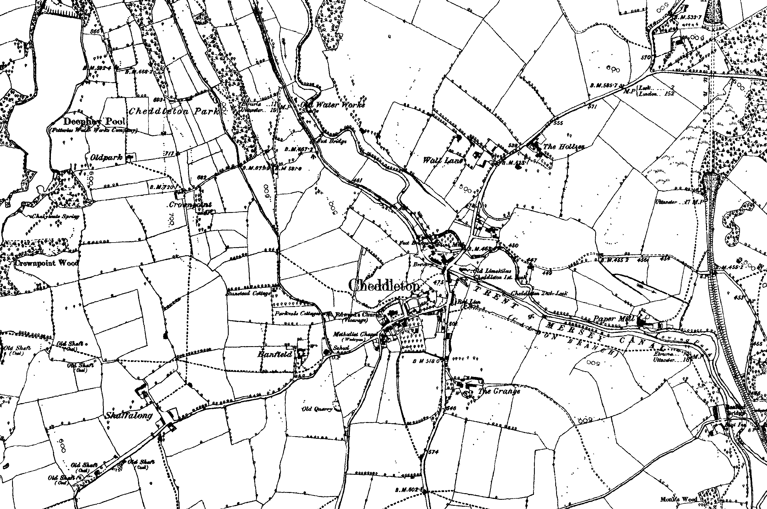
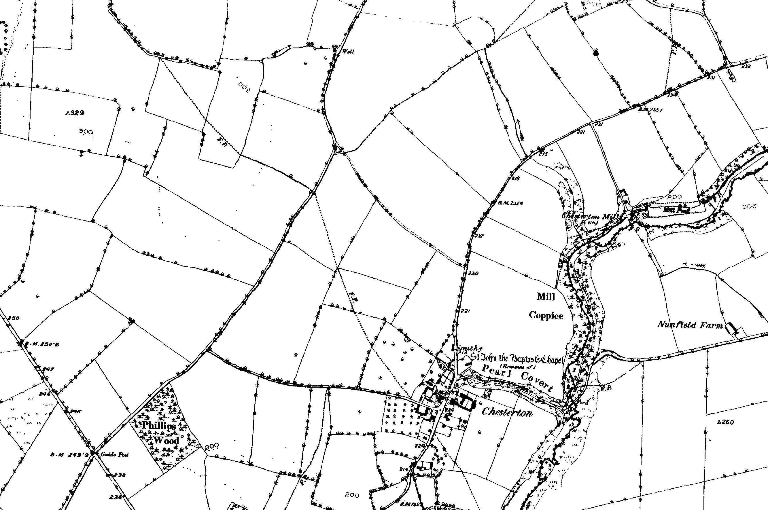
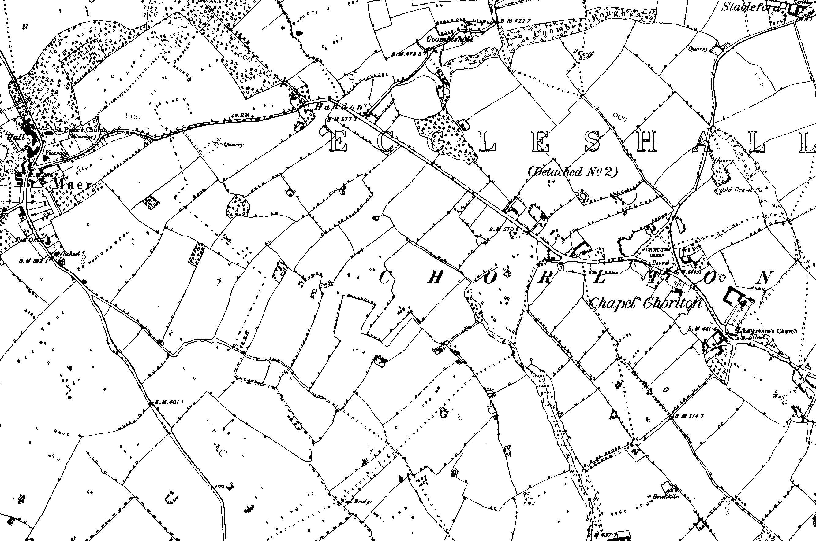
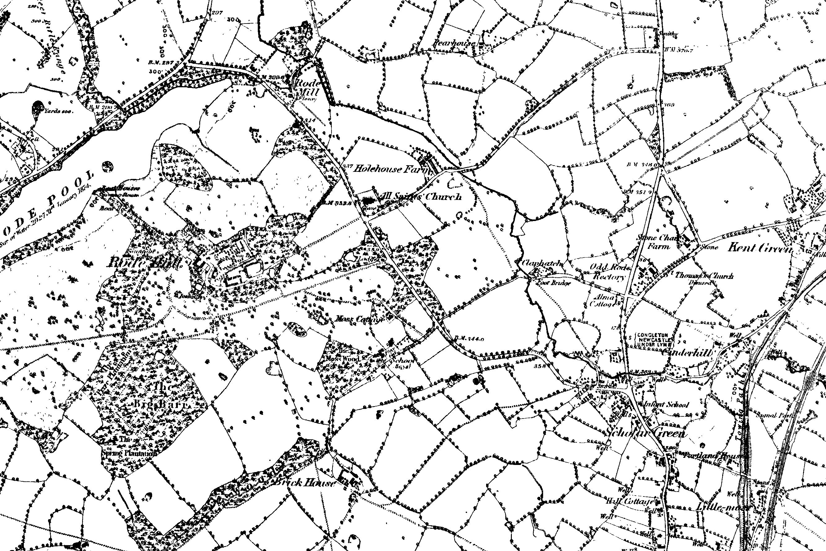
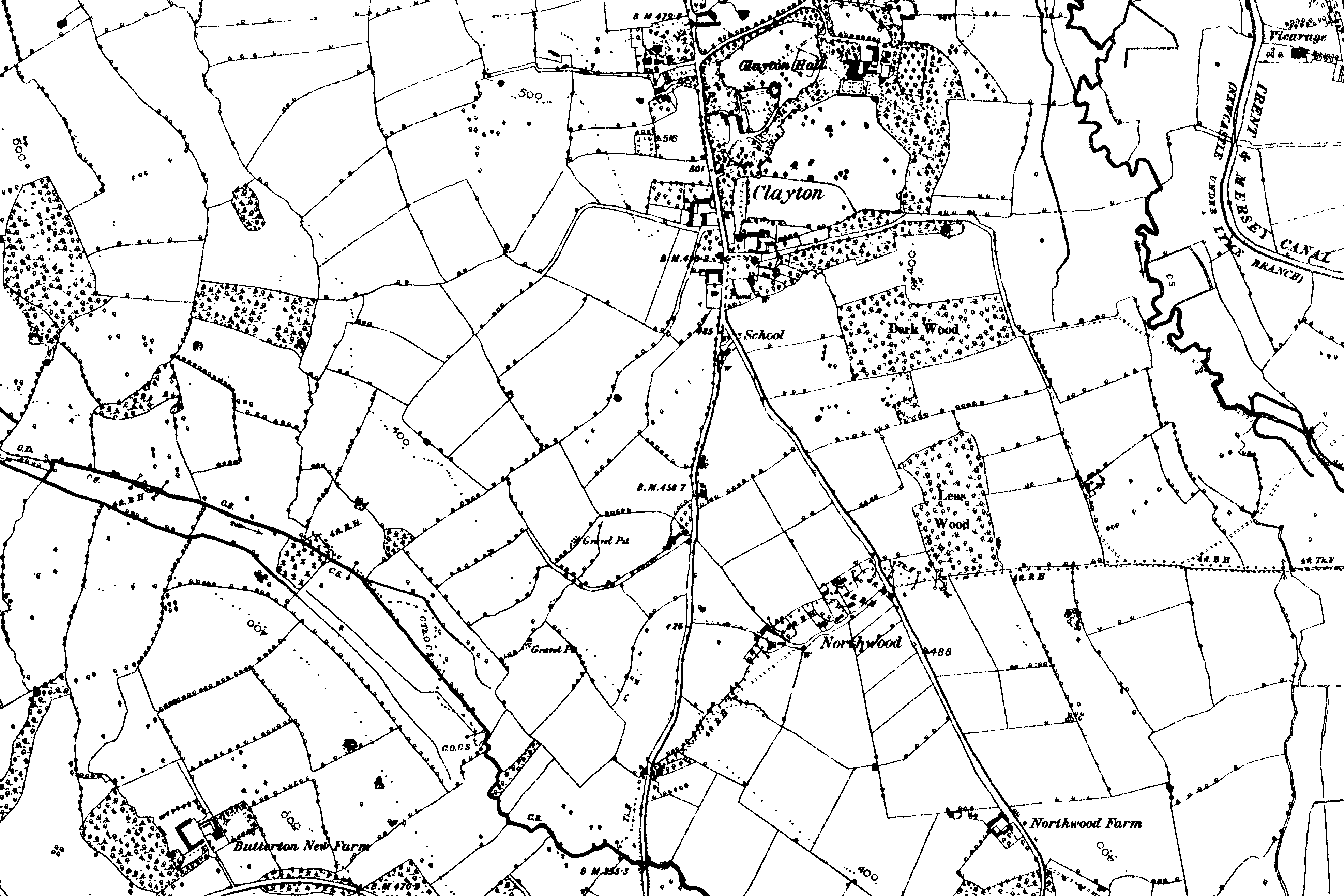
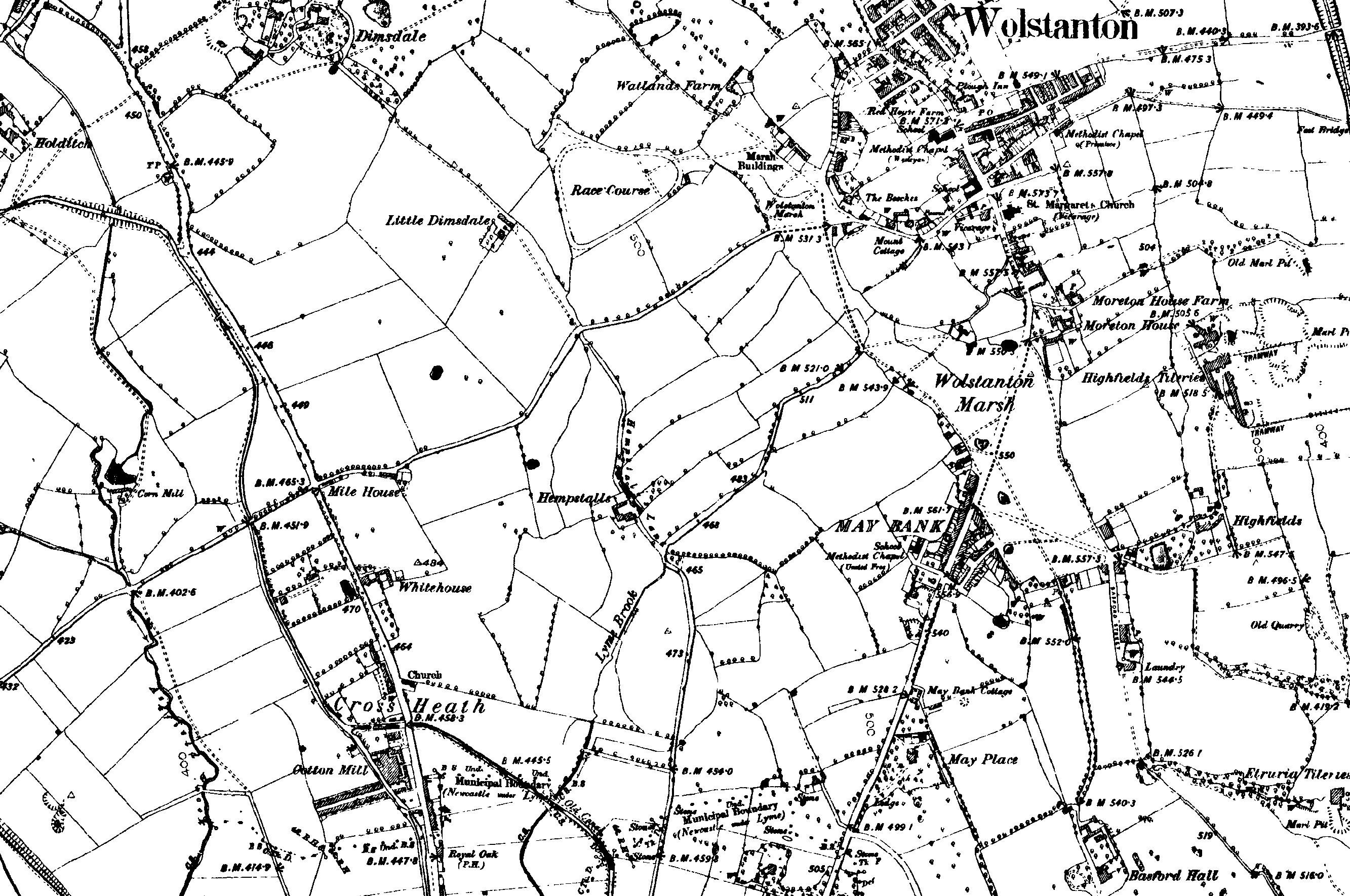
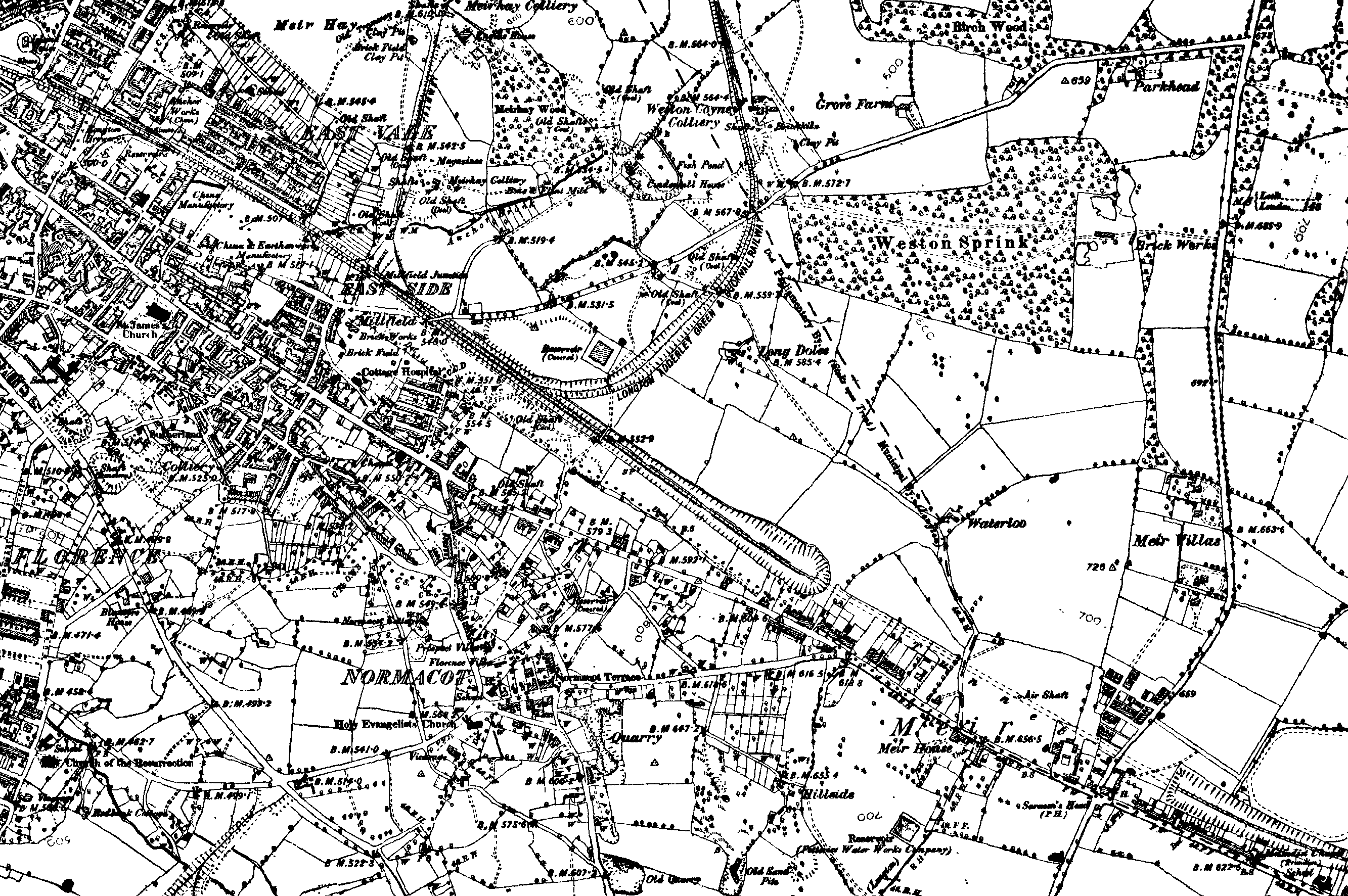
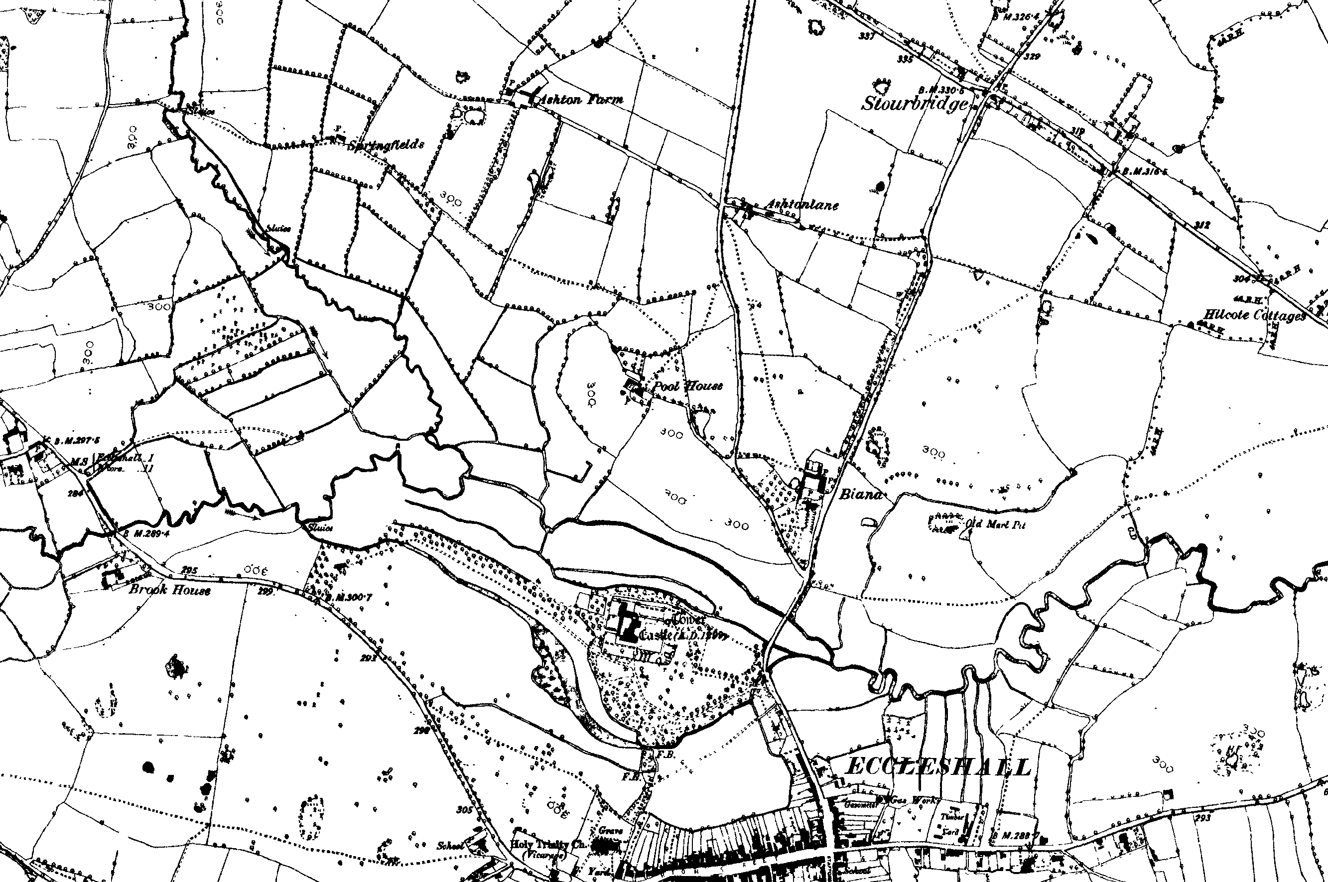
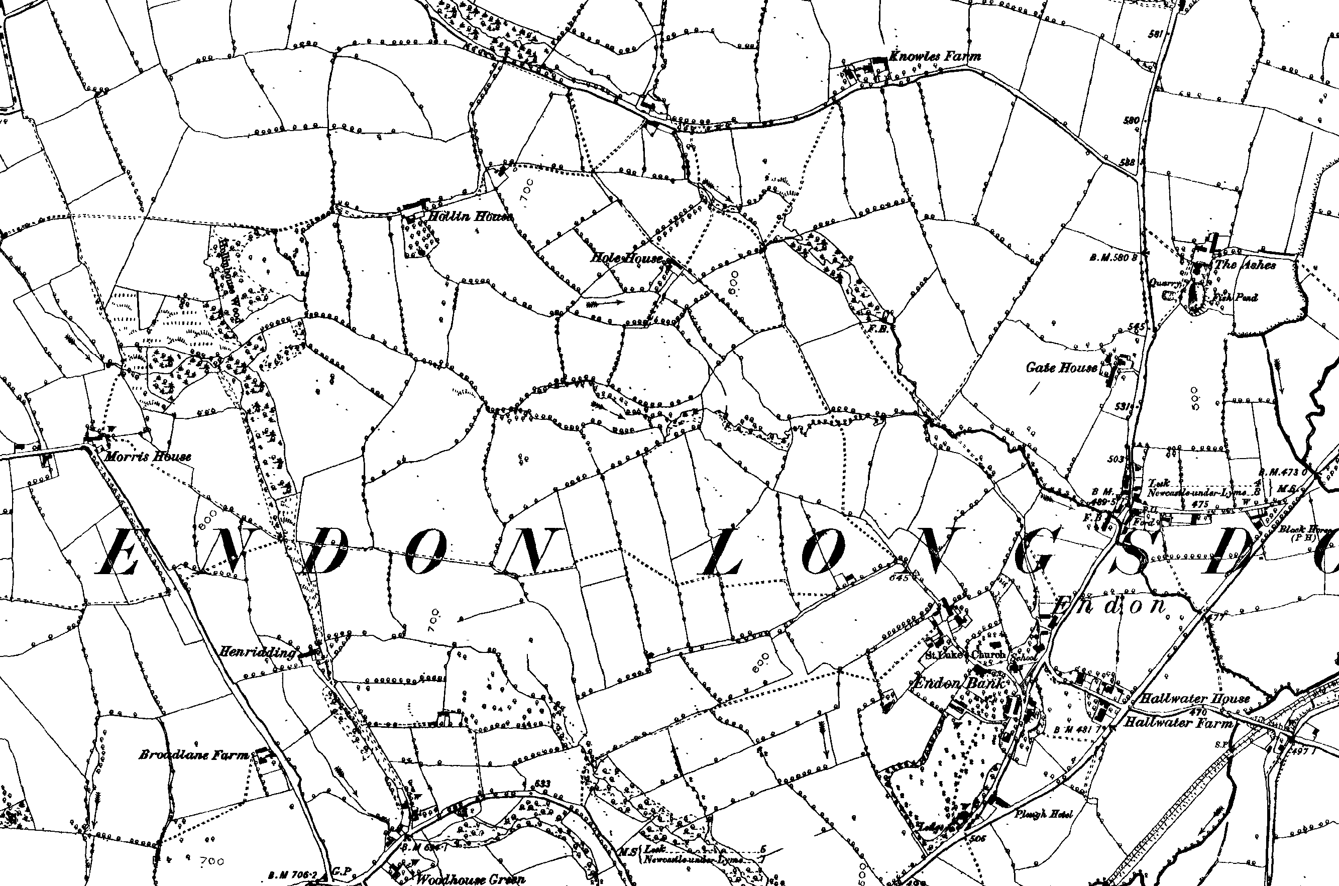
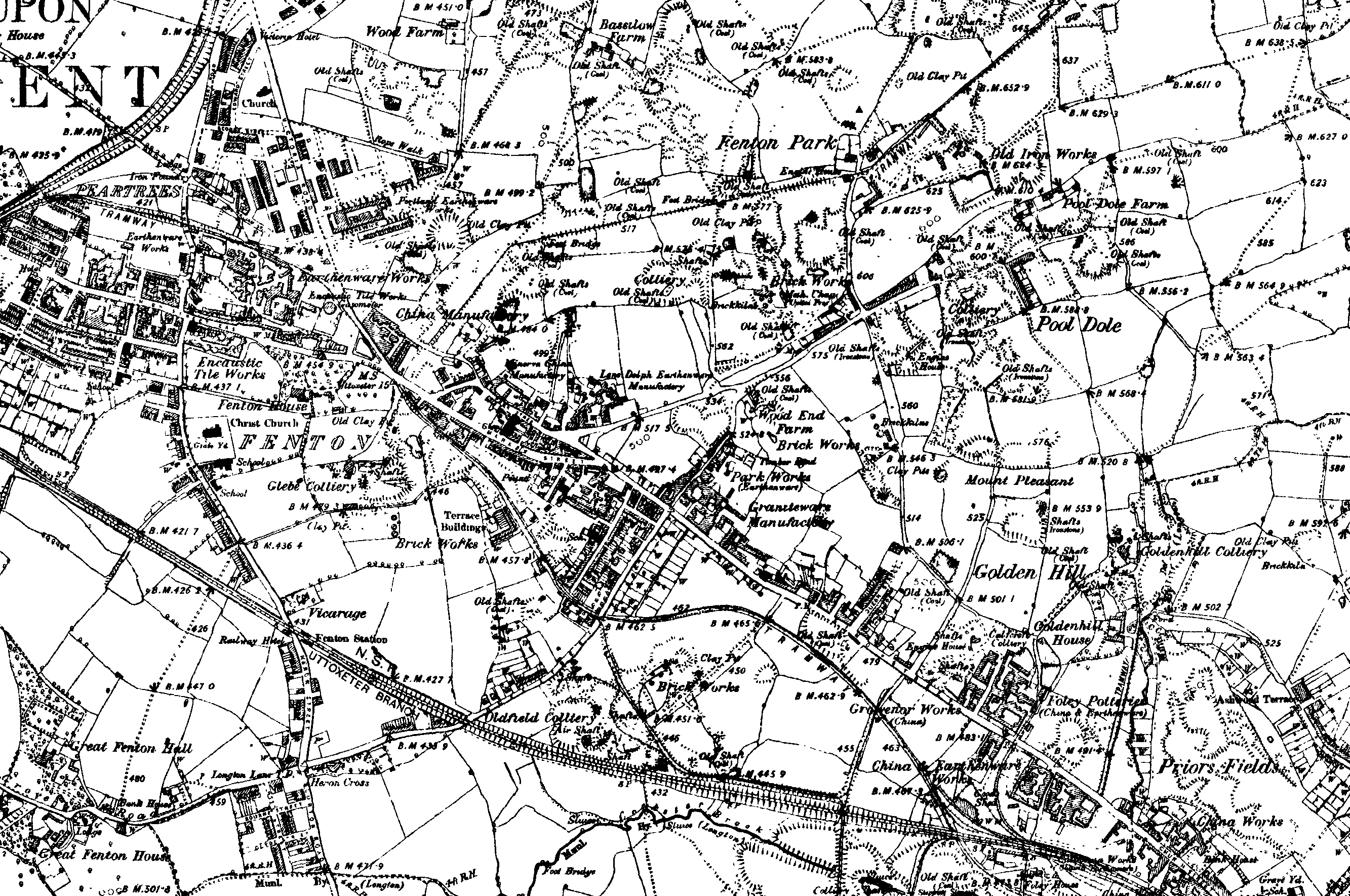
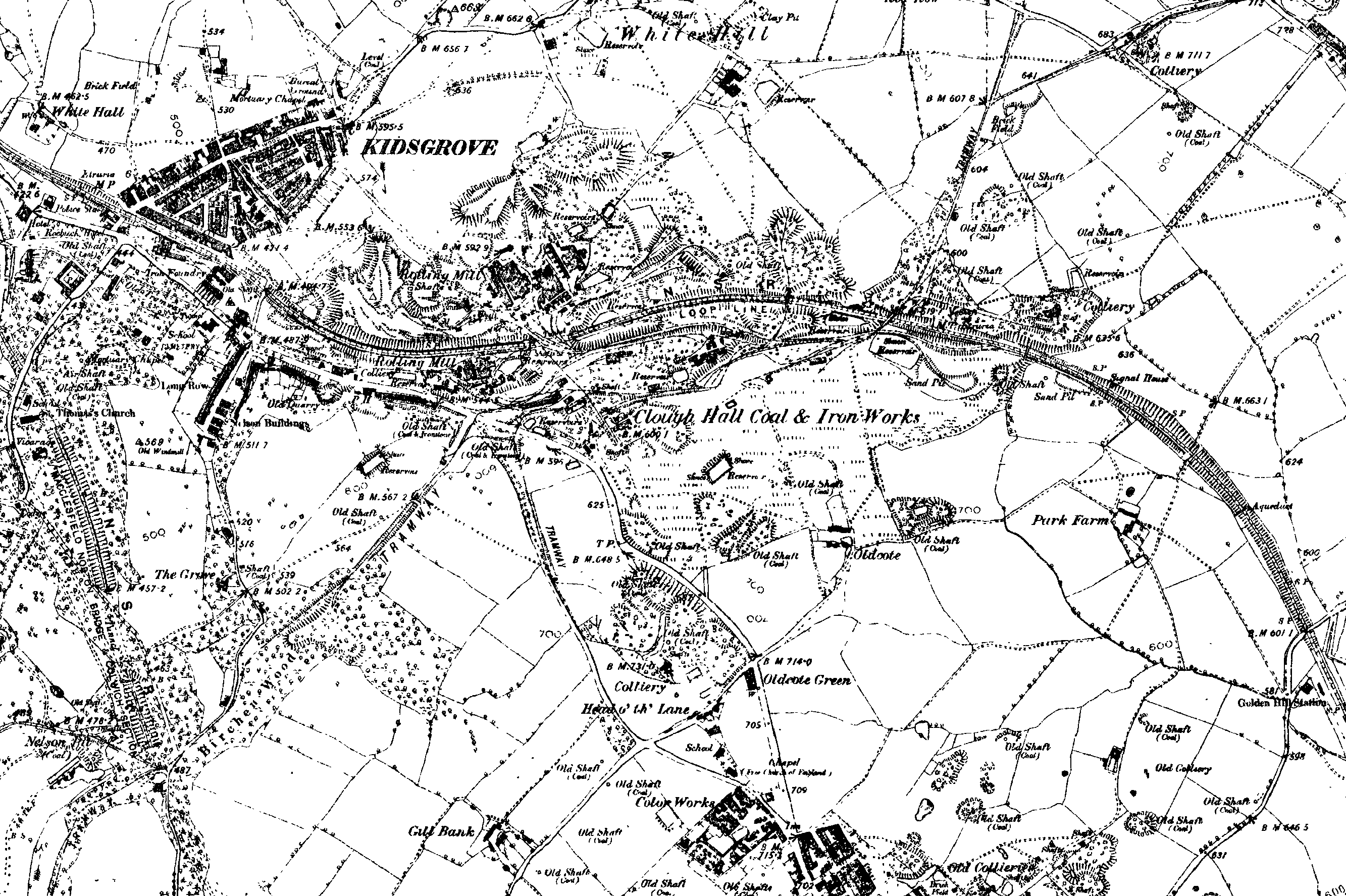
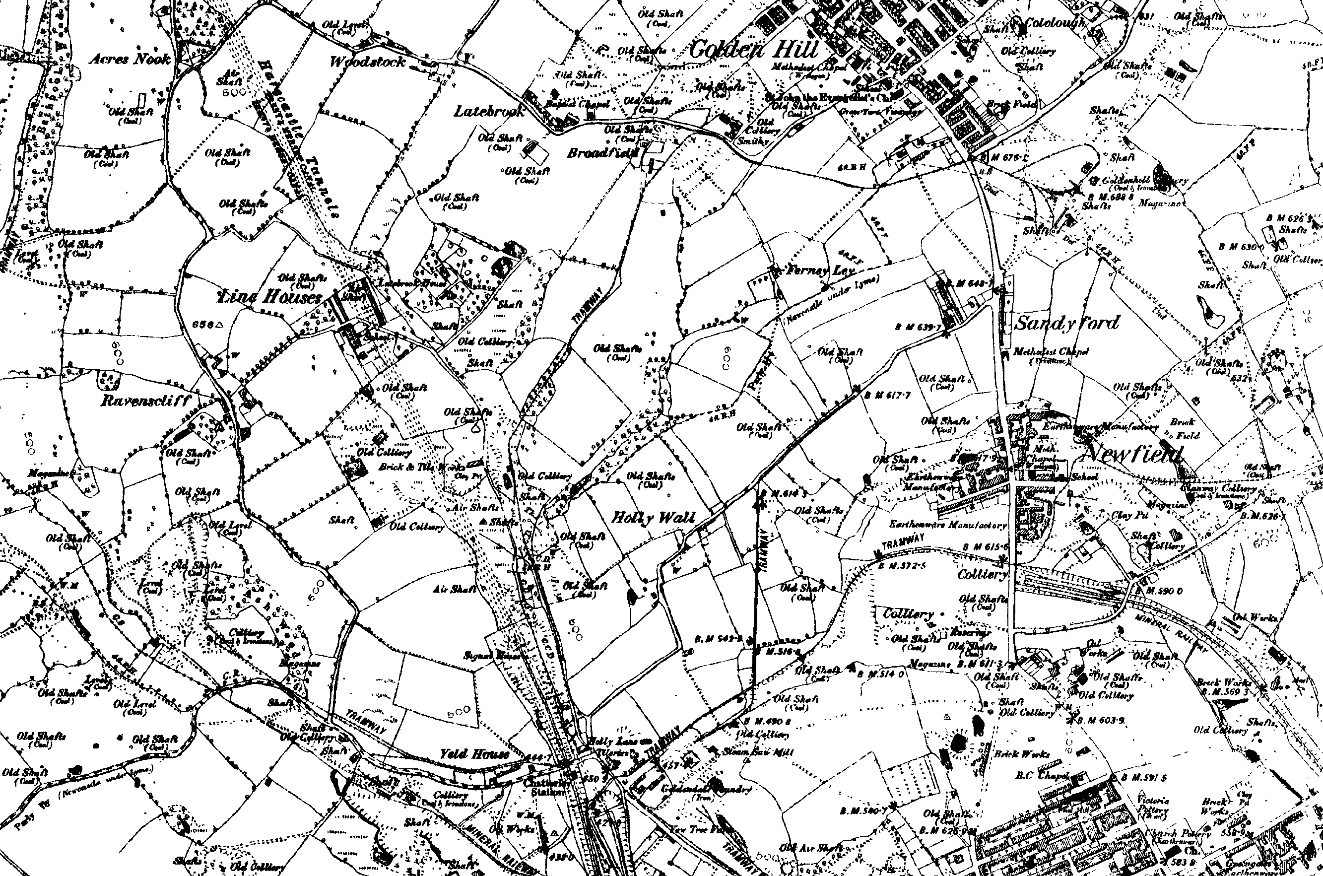
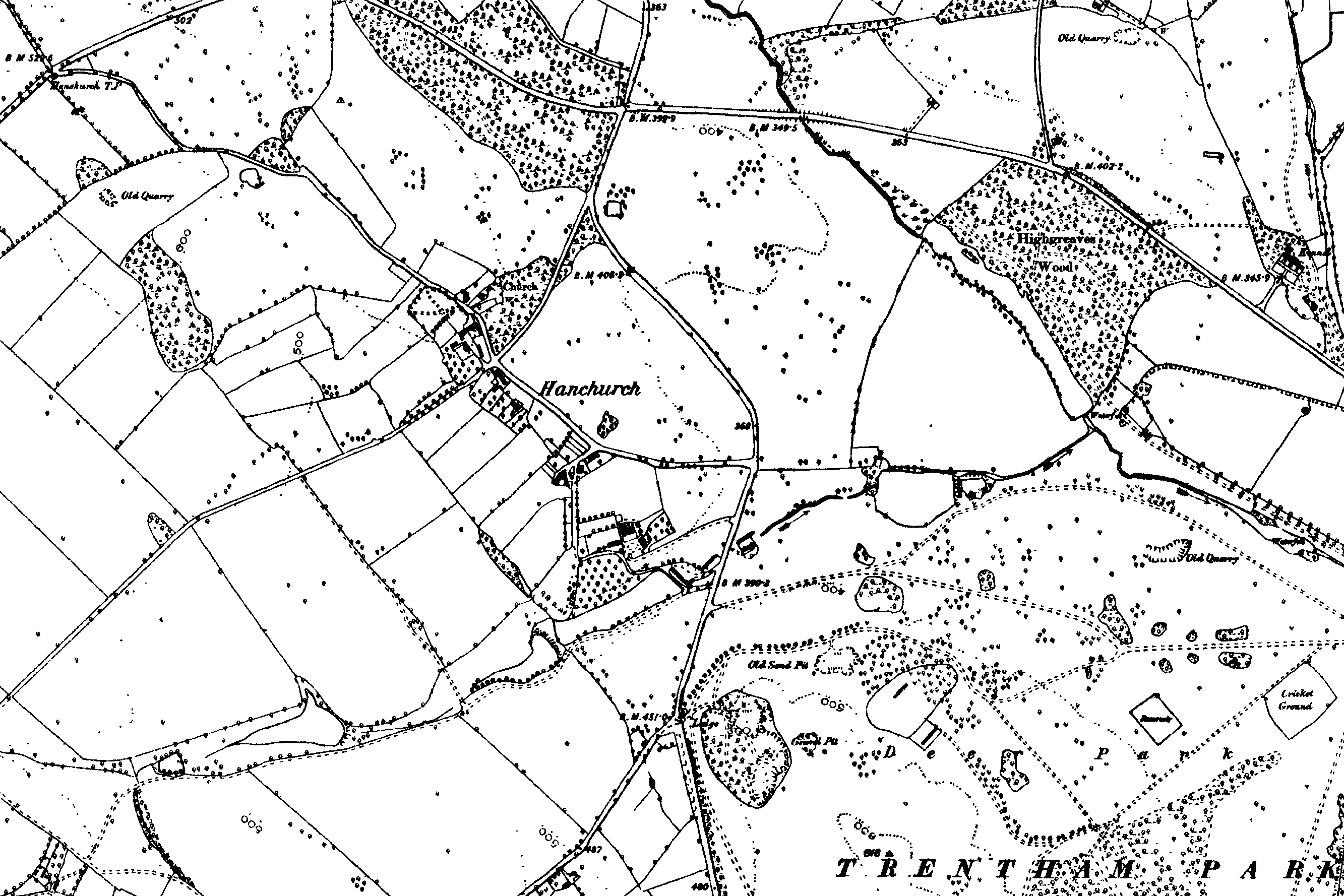
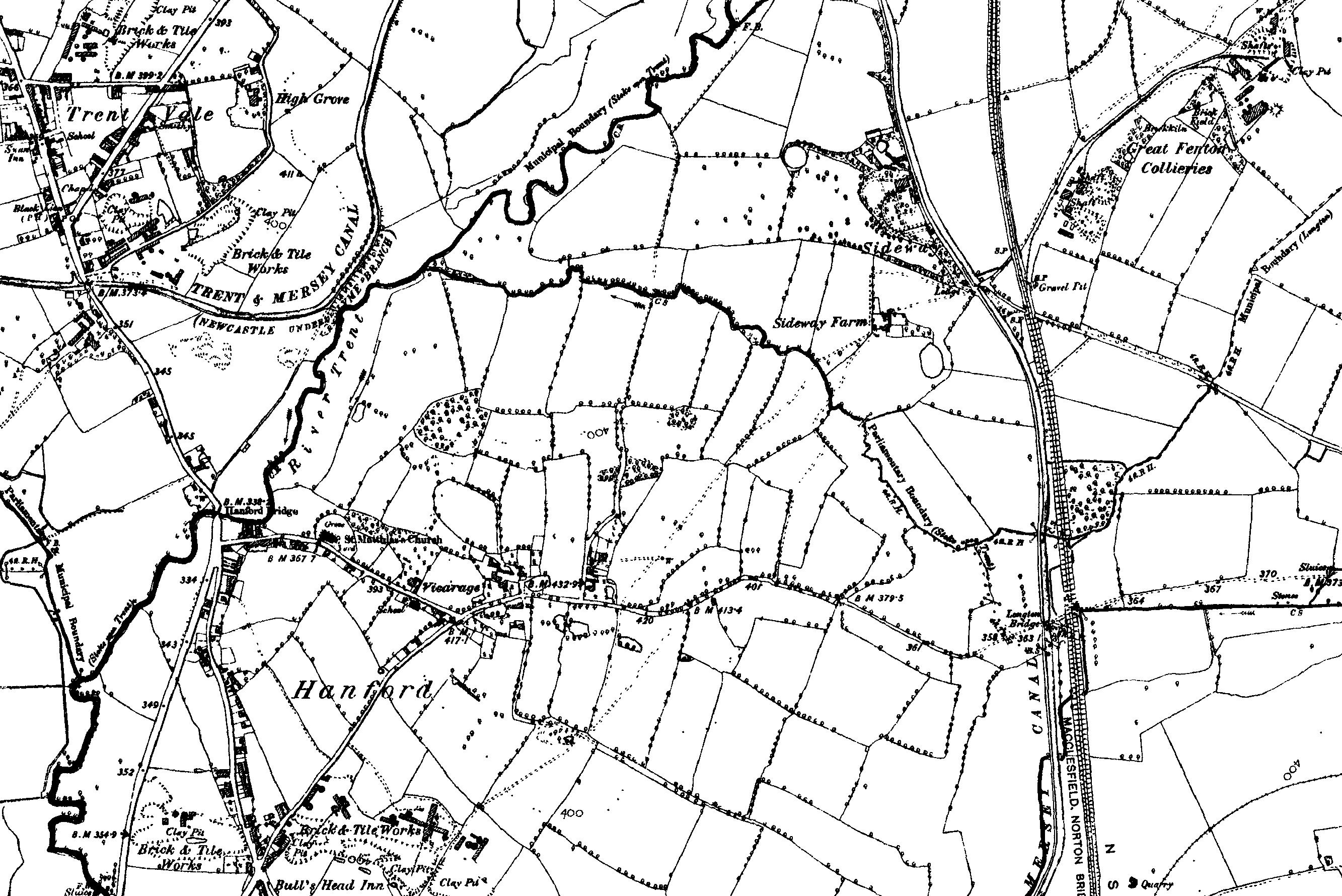
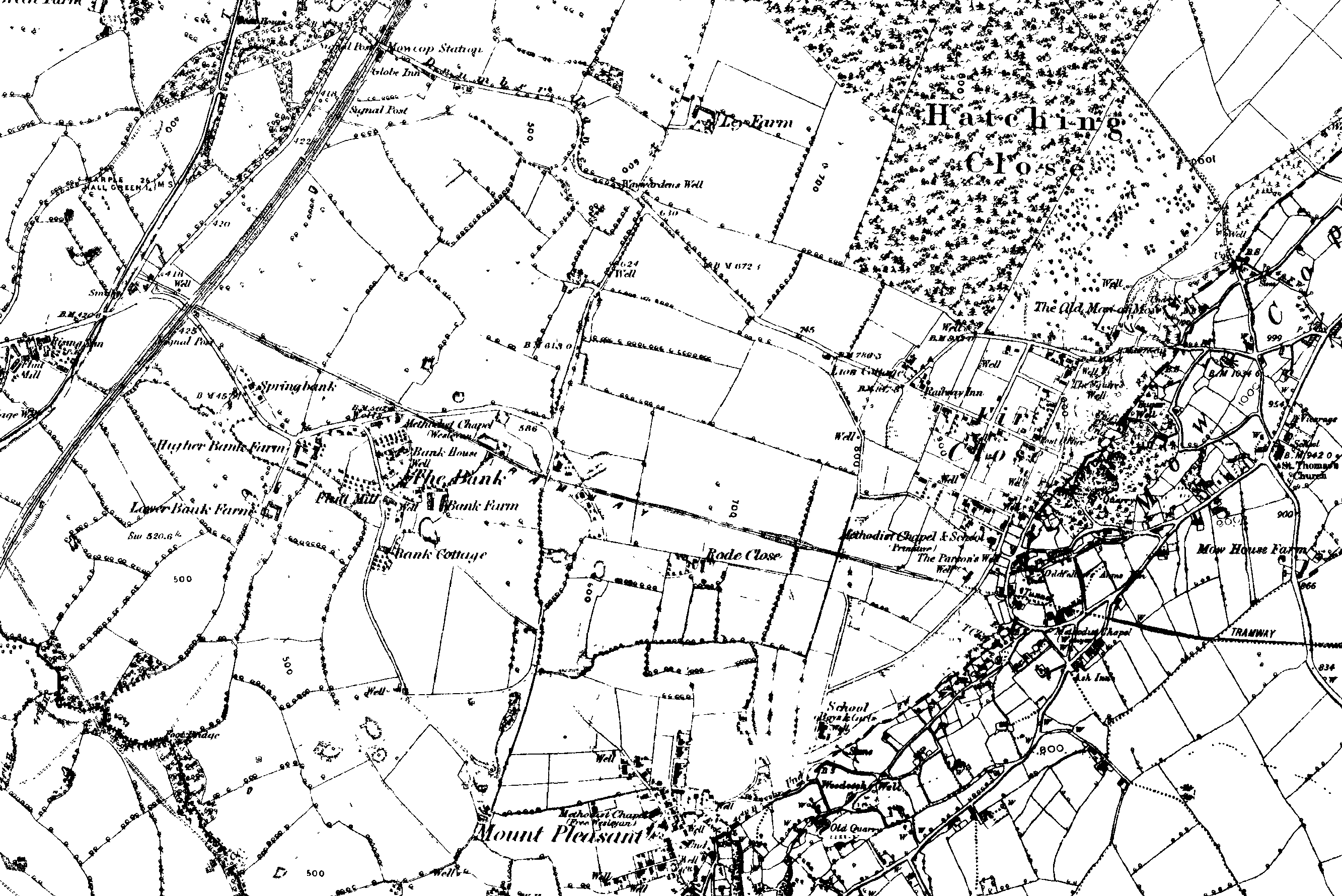
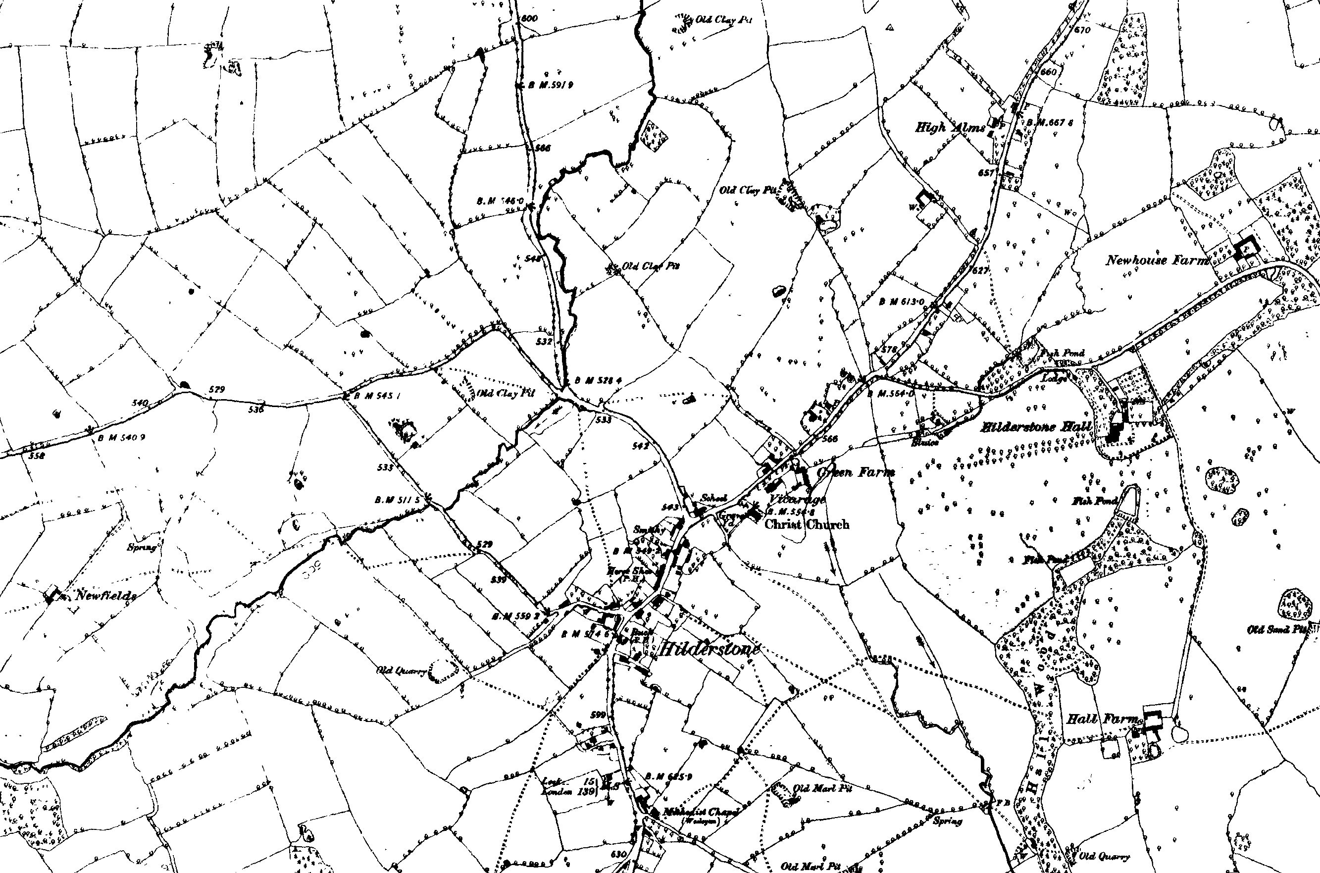
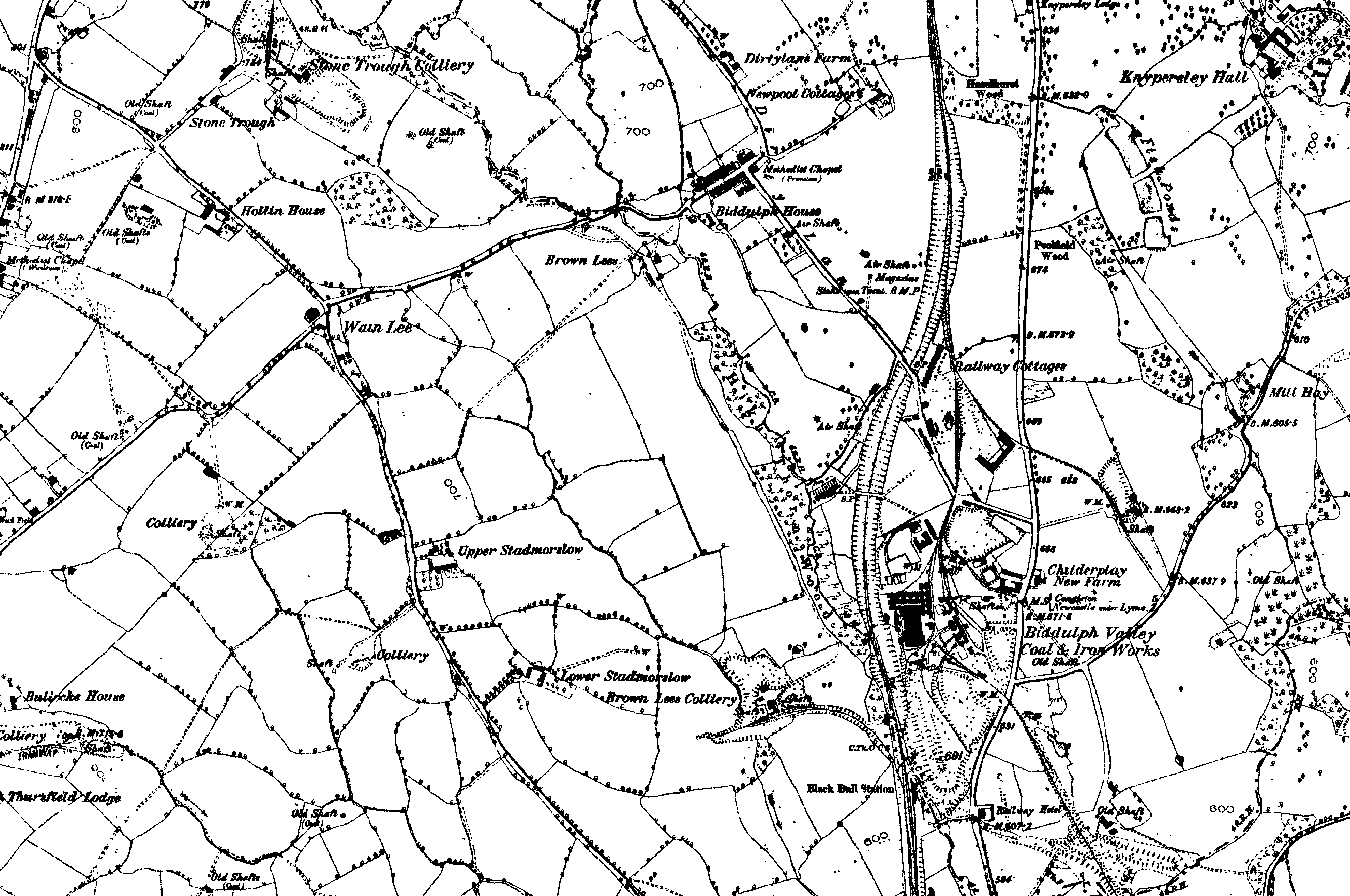
Maps of Stoke-on-Trent & North Staffordshire
![]()
Maps of Stoke-on-Trent &
North Staffordshire
![]()
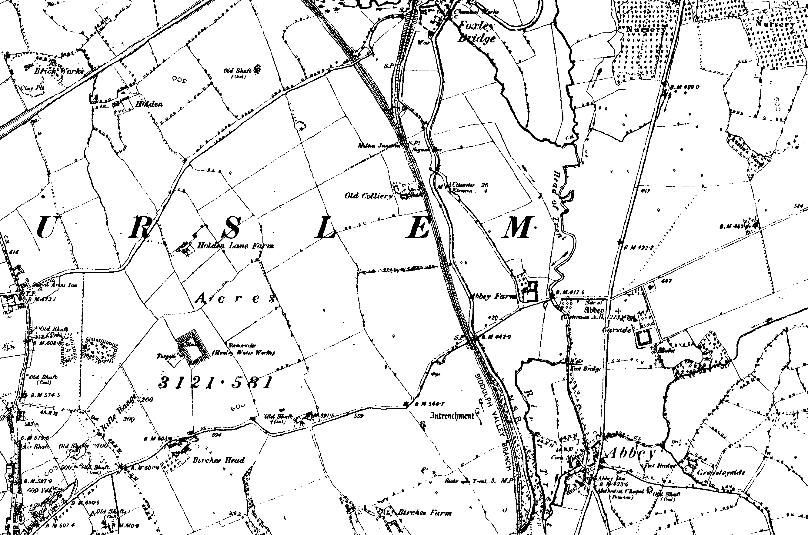
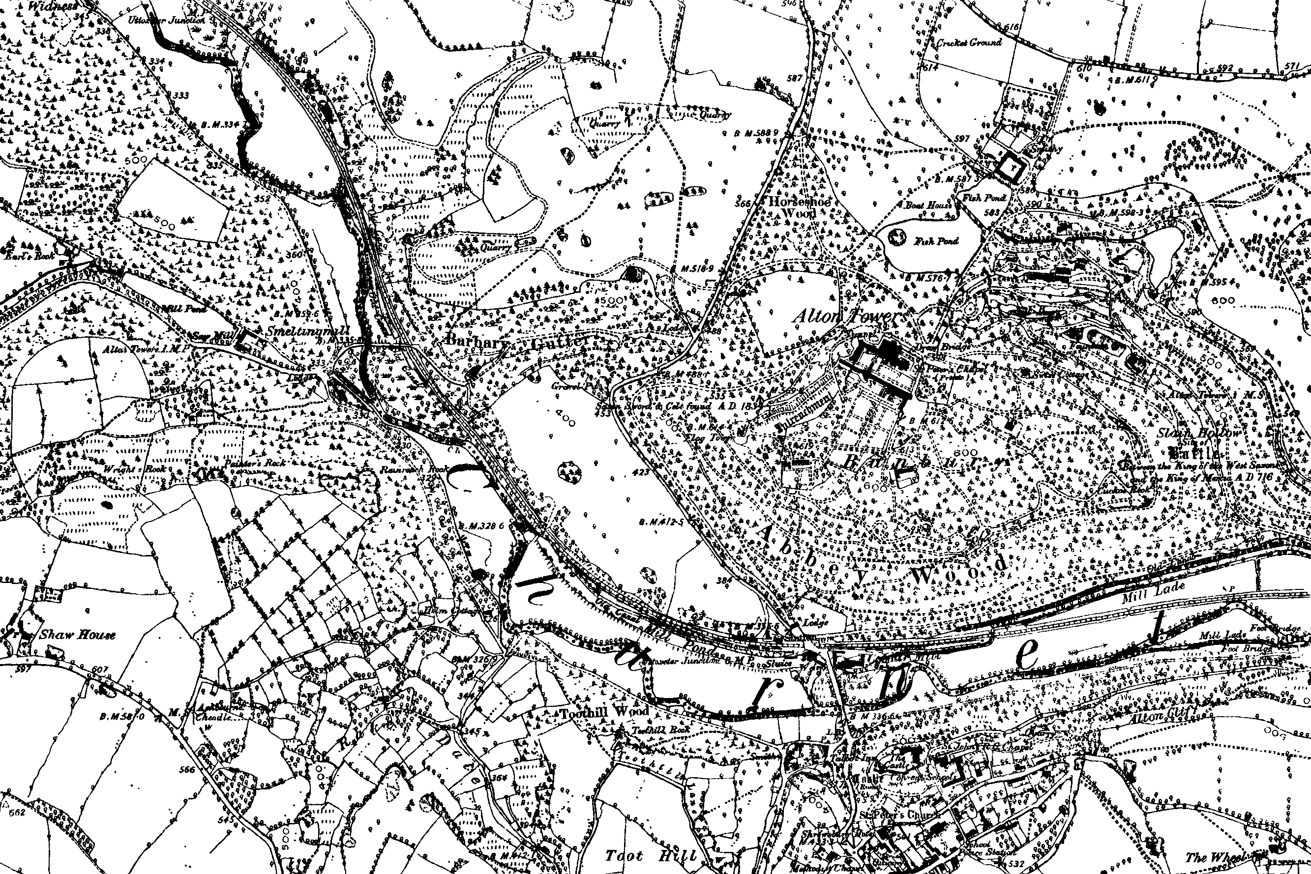
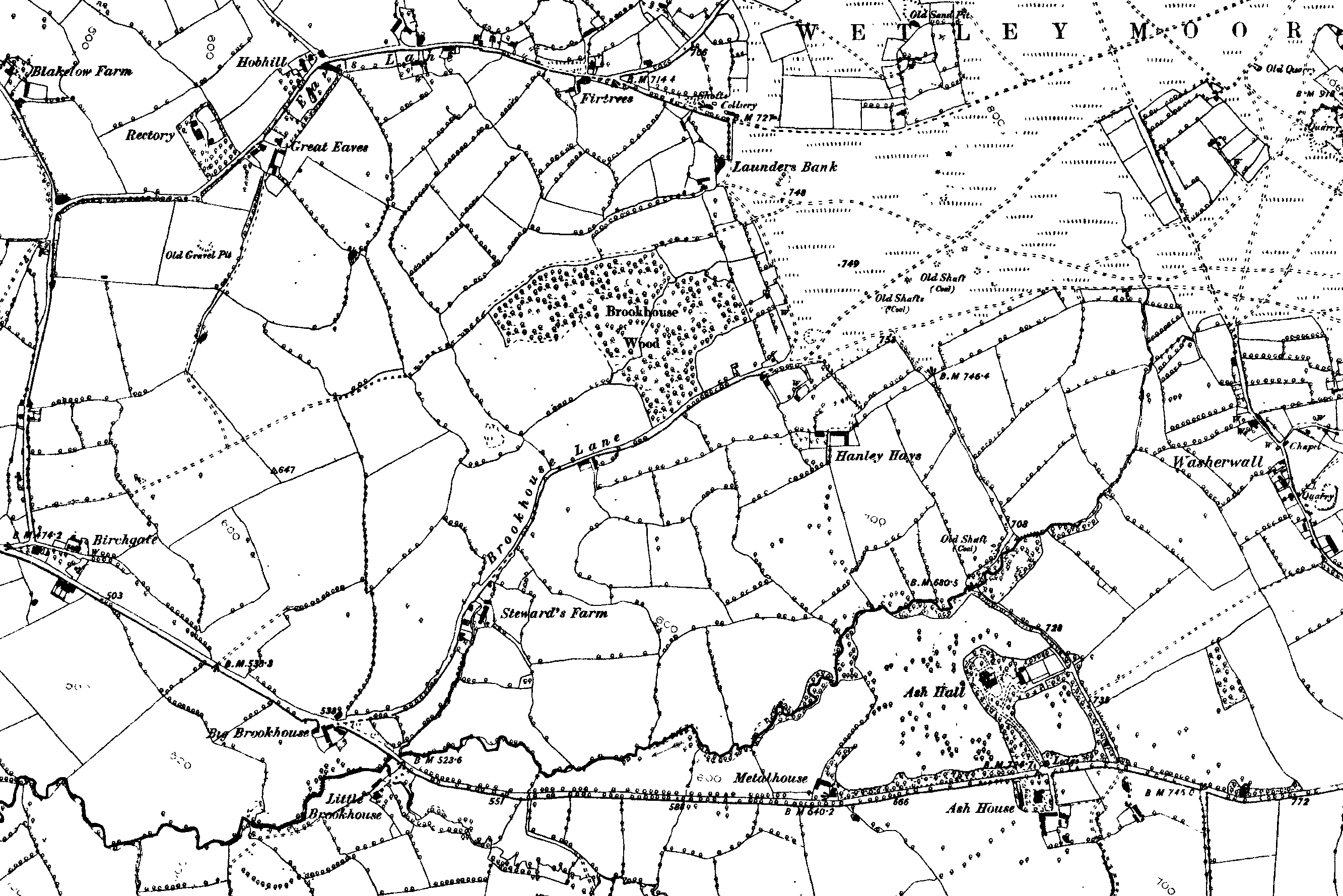
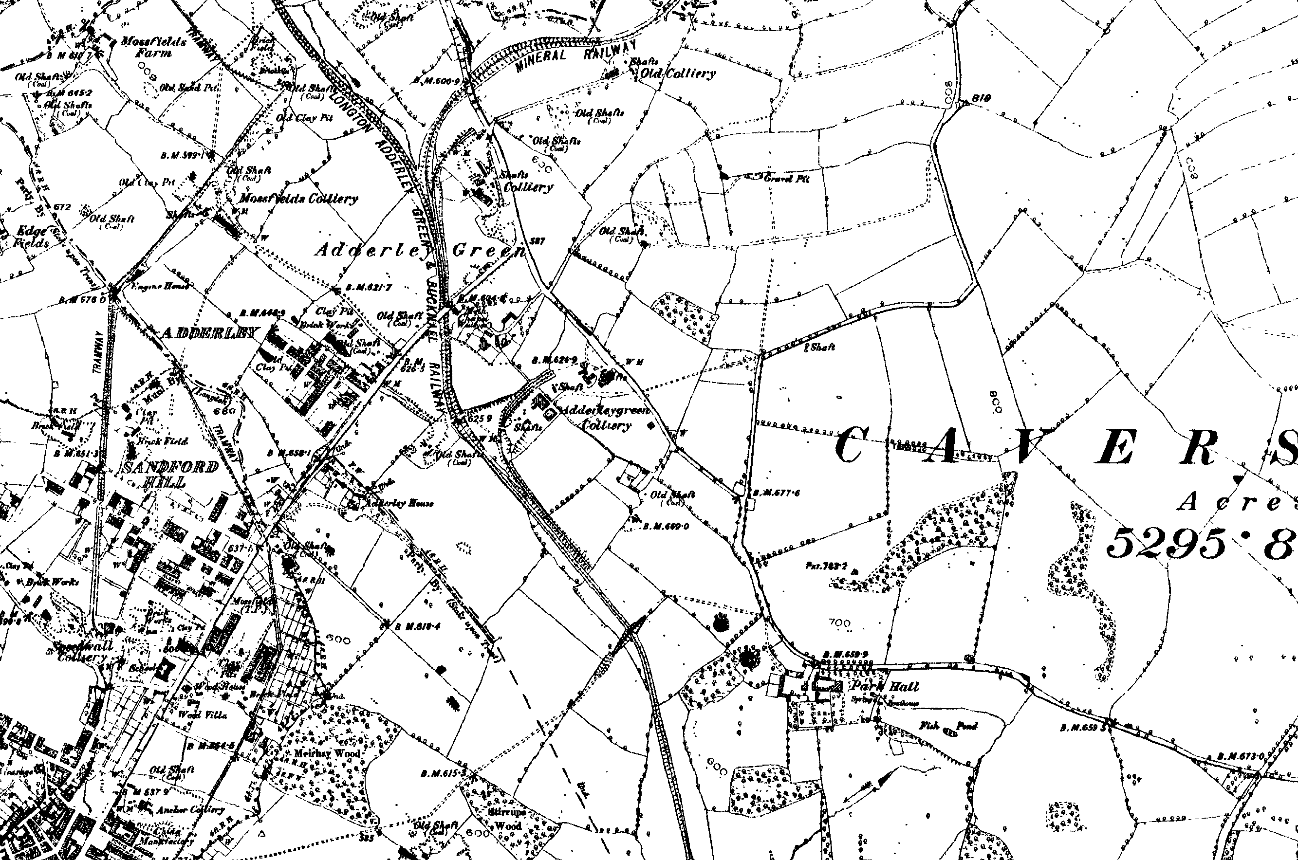
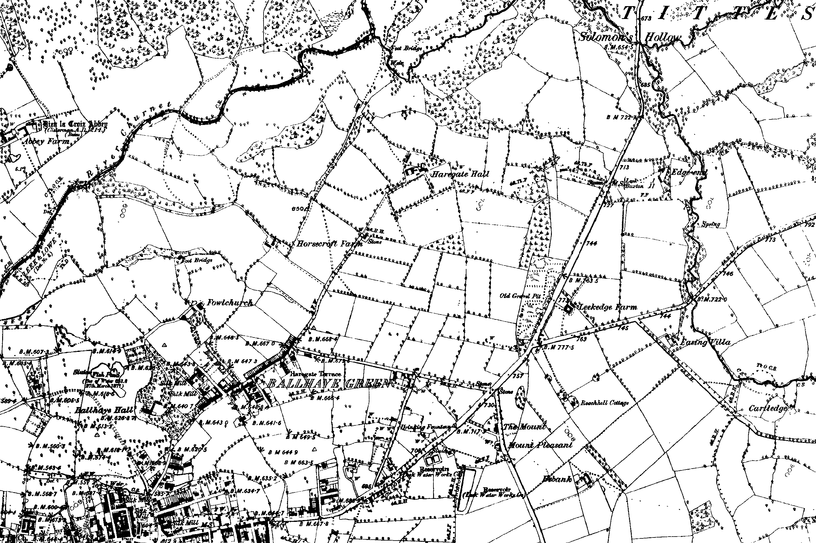
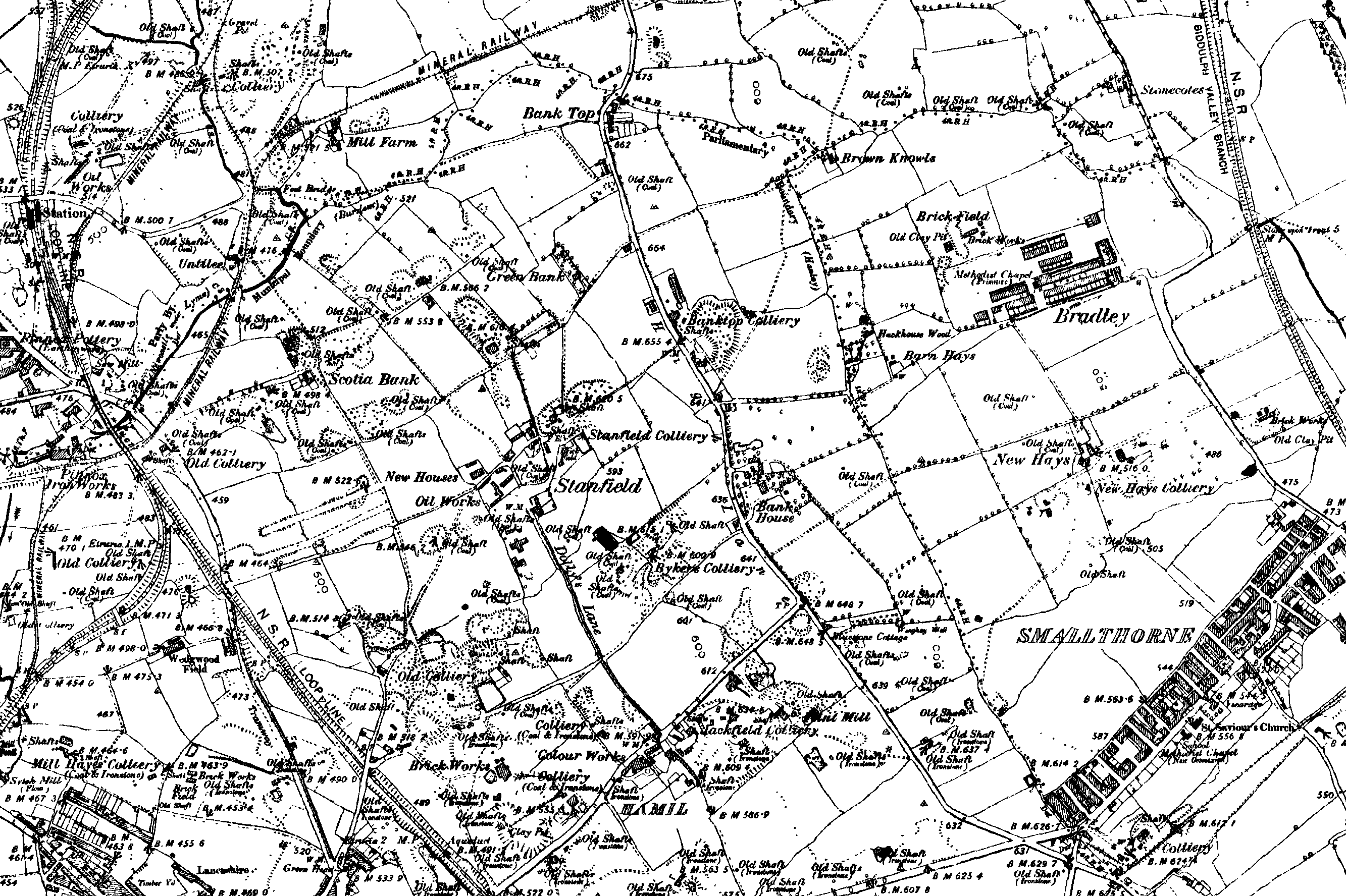
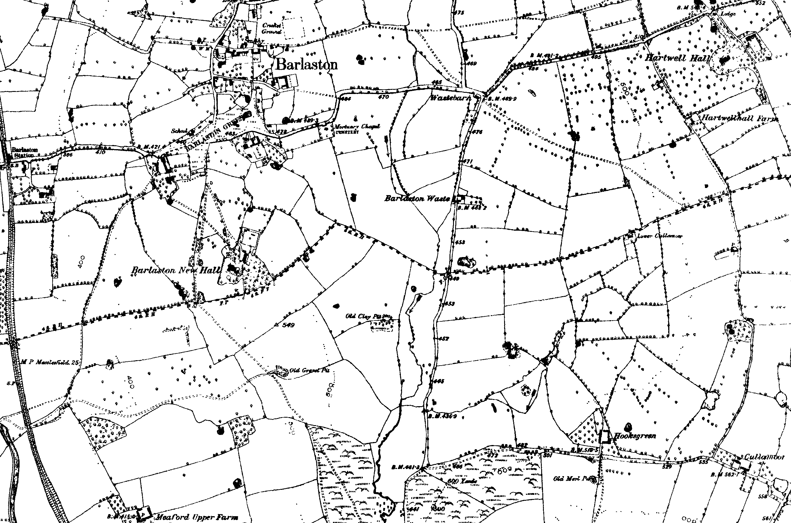
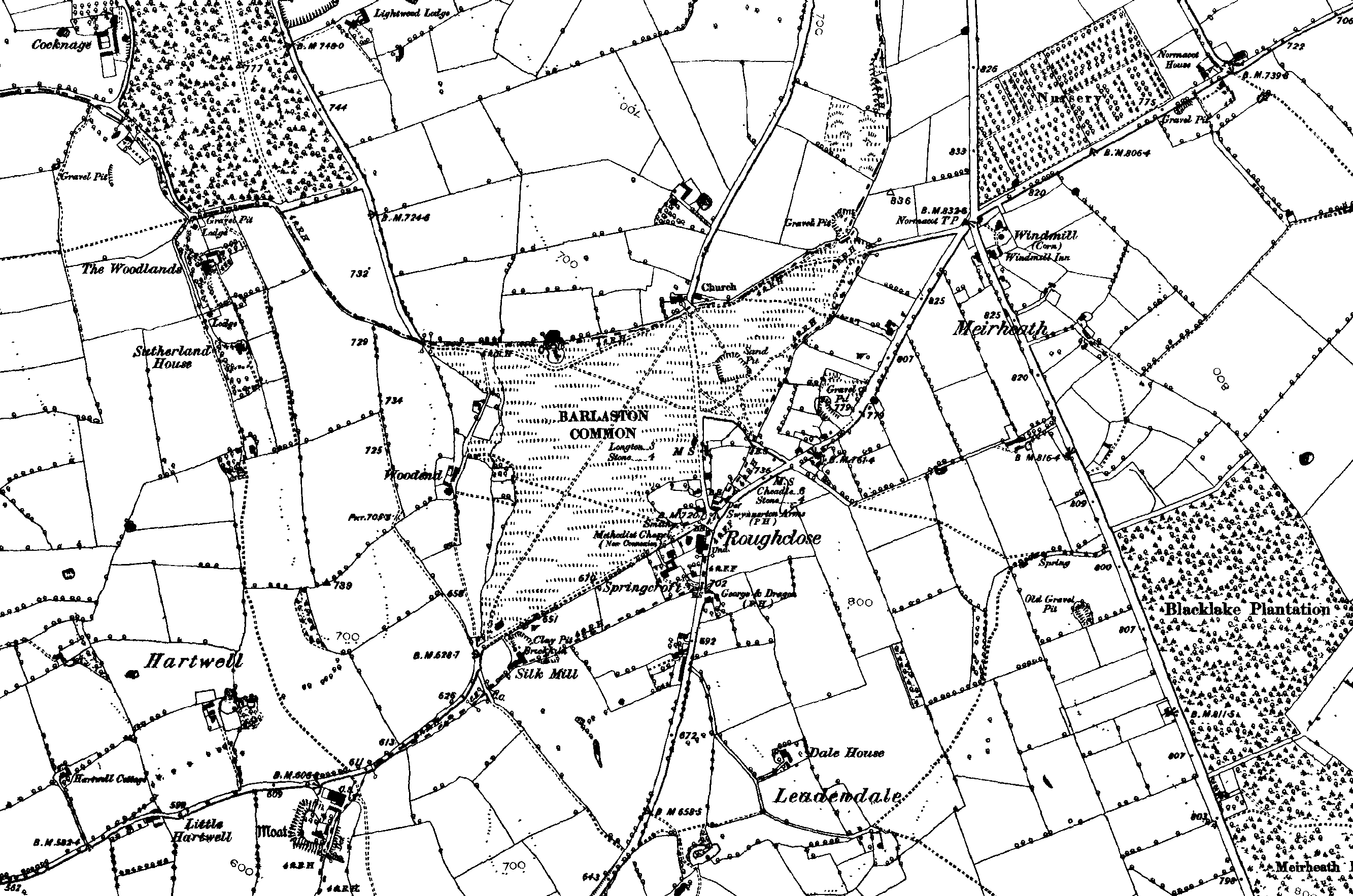
1890 OS County Series 1:10,560
These maps are around 125k and so will take a
minute or so to download. They are larger than the monitor size - so use the
scroll bar to pan around the map.
If you right click on the map you can save it to your hard disk or paste it into
something like Word (use landscape) and then print it out.
| main map index | 1890 maps A - L | 1890 maps M - Z |
![]()
![]()