Maps of Stoke-on-Trent & North Staffordshire
![]()
Maps of Stoke-on-Trent &
North Staffordshire
![]() | main
map index |
| main
map index |
Plan of the Estates of the Duke of Sutherland of Trentham Hall
Plan of the Estates of the Duke of
Sutherland of Trentham Hall
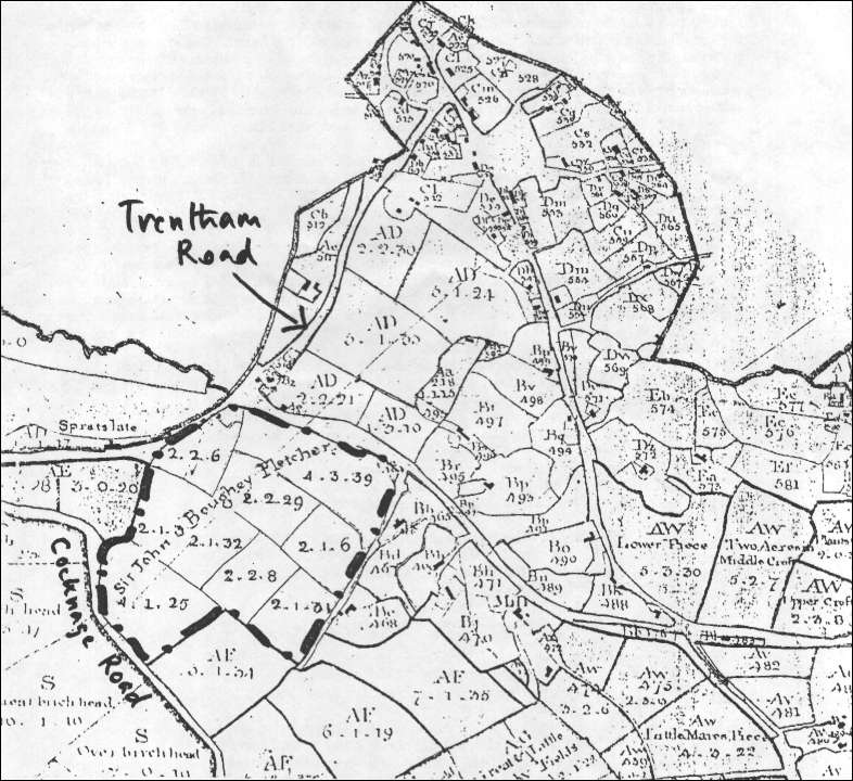
The map above, an extract from a Plan of the Estates of the Duke of Sutherland of Trentham Hall, shows the northern part of the parish of Trentham.
Virtually all the land in this parish was the property of the Duke.One of the few exceptions was Spratslade Farm which then belonged to Sir John Boughey Fletcher. This is shown on the map by a dotted line. The farm was bounded on the north by the present Belgrave Road (running east-west across the map), on the west by Trentham Road, on the south by Cocknage Road, and on the east by Red Bank Lane.
In the middle of the 19th century this estate was bought by the Longton Freehold Land Society and the district of Dresden was created.
- take a 'walk' around this area
![]()
![]() | main
map index |
| main
map index |