Maps of Stoke-on-Trent & North Staffordshire
![]()
Maps of Stoke-on-Trent &
North Staffordshire
![]() | main
map index |
| main
map index |
Extract from William Yates 1775 Map of Staffordshire - showing the Tunstall area
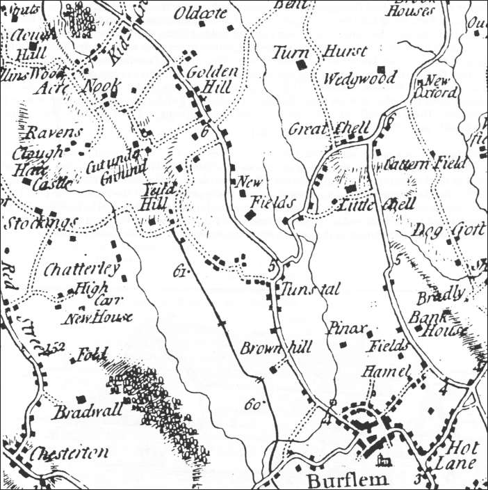
Extract from William Yates 1775 Map of
Staffordshire - showing the Tunstall area
The extract from William Yates’ Map of Staffordshire above shows the Tunstall and the surrounding area in 1775.
The main road through Tunstall from the Red Bull at Lawton to Burslem and Newcastle-under-Lyme was turnpiked in 1763. The road to Congleton, through Biddulph, was turnpicked in 1770.
The thick black line shown on the map west of Tunstall is the Trent and Mersey canal, which was built between 1766 and 1777.At this time Tunstall was little more than a village.
It was still described as such 25 years later in Allbut's directory of the Potteries, 1802:- "Tunstall, including its environs, is the pleasantest village in the pottery. It stands on high ground and commands pleasing prospects. The manufactories in it are respectable and do considerable business. There are a number of brick and tile works here; the clay being of a superior kind for such articles; so that with good management the tiles made from it look as well as moderate slate."
| See Thomas Hargreaves map of Tunstall 1832 |
![]()
![]() | main
map index |
| main
map index |
27 October 2006