Streets of Stoke-on-Trent | John Street |
John Street, Hanley,
Stoke-on-Trent
![]()
Streets of Stoke-on-Trent | John
Street |
![]()
![]()
| Index of all Hanley Streets |
![]() 1898 map showing John Street
1898 map showing John Street
400k - takes a few minutes to load.
John Street, Hanley, Stoke-on-Trent
|
John Street today The area is unrecognisable today, all the housing has been cleared away. During the building of the Potteries Way Ring Road Vine and Mollart Streets disappeared.
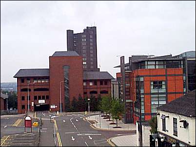
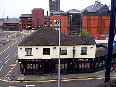
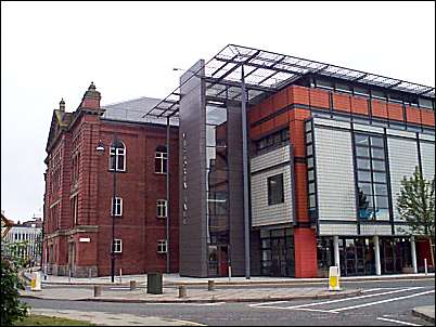
The 'John Street Car Park' was build in the middle of the original John Street, so now John Street encompasses part of the old South Street, which was the back alley to some of the John Street houses. The white building on the right is Lloyds public house, then the modern looking building is the extension (completed 1999) to the Victoria Hall. Behind the car park towers 'Unity House' which was the civic offices built on the Potteries Way.
Lichfield Street to the
front and John Street to the left.
Picture taken from outside the main entrance to John Street car park, the Victoria Hall can be seen to the left. The road to the left which fronts the Victoria Hall is Bagnall Street.
|
![]()
![]()
![]()
Did you live in this street or
area?
questions/comments/contributions?
email: Steve Birks