|
Fowlea Bank, Basford
The turnpike road:
In the Etruria valley runs
the Fowlea Brook, the turnpike road (now Etruria Road) to the left climbs
a ridge, rising 500ft to Basford.
Basford Bank as we know it
now was not built until 1820, prior to that the turnpike road ran along a
steep route "Fowlea Bank" which still exists today behind the houses
fronting Basford Bank.
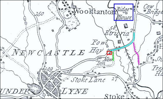
1775 Yates map showing
the road from Etruria to Basford
Basford lies on both the Stoke and the Wolstanton sides of Etruria
Road which at this point was known as Basford Hill or Basford Bank by the
1830's. As early as 1771 the road was known as Fowlea Bank - on the 1775
Yates map shown above the area is marked as "Fowl Hay".
The small red square marks the location of "The New Inn" - built in 1769
(now the site of the Queen's).
The road highlighted in light blue is "Fowlea Bank"; the purple line
indicates the route of "Brick Kiln Lane" and the light green line joining
at the New Inn is the trackway from Stoke Lane (now Stoke Old Road) to
Basford.
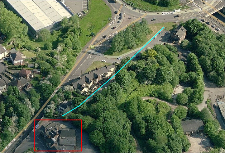
Basford Bank - MS Live
Search 2008
The red square is the
present Queen's public house
and the light blue line is the route of
"Fowlea Bank" the pre-1820 turnpike road.
|