|
Lord Street, Etruria
The development of Etruria:
Wedgwood was having discussions with the great canal engineer James
Brindley about a canal to link the Trent with the Mersey, the so-called
'Grand Trunk' Canal which would provide transport links from the Potteries
to Liverpool in the one direction and the Midlands in the other. In July
1766 — just 16 months after the preliminary dinner with Brindley —
Wedgwood cut the first sod and the following year he purchased the Ridge
House Estate, 350 acres of land in Shelton which would be ideally placed
for the canal. The new factory was called Etruria, after the pottery
recently discovered around Pompeii and then thought to be Etruscan, and
was ceremonially opened in 1769.
The prestige of the firm continued to grow, especially following a
major commission for Catherine the Great in 1773-4. By the time the canal
was finally complete in 1777 both 'useful' and 'ornamental' ware were
being produced at Etruria.
The classical simplicity of the factory buildings, facing the canal,
served as model for many other potteries in the area, and Wedgwood also
set an example by building houses for his workers. There may have been an
element of philanthropy here, but it was also a necessity if skilled men
were to be enticed to Etruria from Burslem. The terraced houses,
stretching along both sides of the main road, were mainly two-up,
two-down, with shared pumps and privies and communal bake-houses. The
community did not grow much beyond its original 120 or so houses, though
there was some late 19th century expansion along the new Etruscan Road and
off Cavour Street.
Severe mining subsidence resulted in the ground dropping as much as 30
feet in places — this discouraged further development as did the
dampness caused by the canal. Most of the original houses were
demolished in the 1950's and the factory itself did not long outlast them;
only a solitary round house remains.
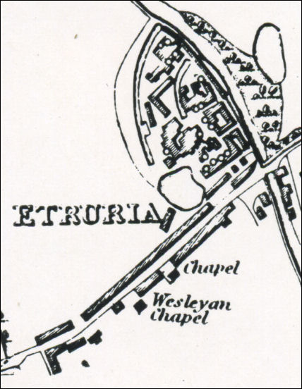
1832 Hargreaves map of Etruria
showing the houses spread along the line of Lord Street,
between the Trent & Mersey Canal and the Fowlea Brook.
Etruria Old Road - was
Lord Street (then Etruria Road)
this was the main road to
Newcastle, in 1953 it was renamed Etruria Road and then when the dual
carriageway was built was renamed Etruria Old Road and then became a
byway.
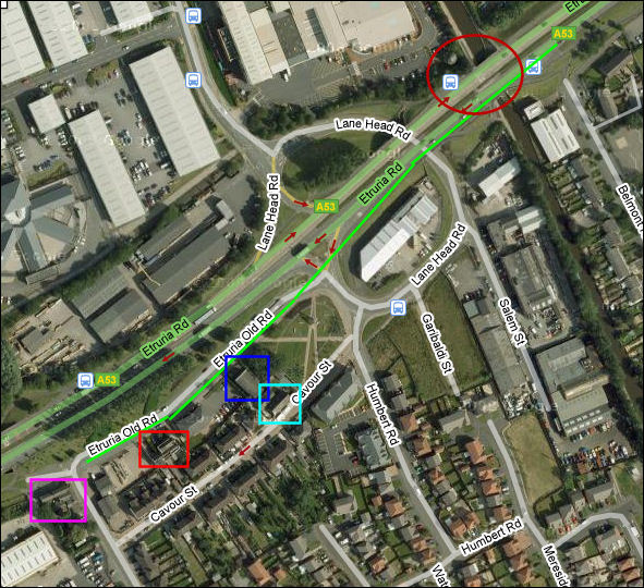
Dark red circle = bridge over the canal and
the 'round house'
dark blue square = Wesleyan Chapel
light blue square = Sunday school building
red square = Jessie Shirley's house
purple square = Rendezvous Pub
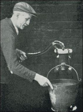
Mr Albert Sherratt,
100 Lord Street with the only remaining water pump,
one of many installed by Josiah Wedgwood at the rear
of the houses in the village. It was fed by a well in the cellar.
- photographed by E Warrillow (c.1952) -
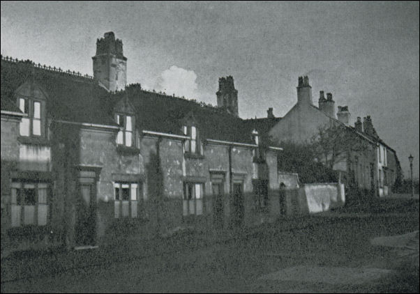
Old cottages at the
lower end of Lord Street near to what was Etruria Station.
photo: Warrillow collection 1947 -
|