Waterways of Stoke-on-Trent - Burslem
Branch Canal
![]()
![]()
![]()
![]()
![]()
next: map of Navigation Road
showing tramway
![]() black and
white aerial photo of the site
black and
white aerial photo of the site
![]() photo
showing proposed restoration
photo
showing proposed restoration
![]() plan
of the new 'Burslem Port'
plan
of the new 'Burslem Port'
|
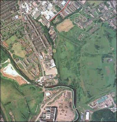
Aerial
photo of the area - 2000 The Trent and Mersey canal can be clearly seen at the bottom left of the photograph. The indication of the old route of the Burslem branch canal and the mineral railway (see map on right) can also be seen on the photo. At the top of the photo and map Navigation Road is marked in red. |
OS
map of 1890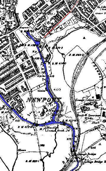 |
![]()
![]()
next: map of Navigation Road
showing tramway