|
|
| Stoke-on-Trent Districts: Normacot |
![]()
![]()
next: Sand and Gravel Quarries
previous: Normacot and the Iron Furnace
|
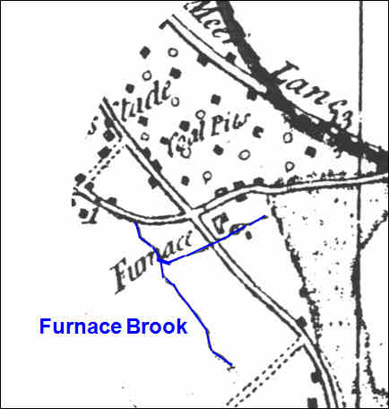
The need for water: As well as wood (later coal), limestone and iron ore, water was essential to supply the furnace and drive the mills - the water was obtained from the furnace brook which was marked (although not named) on the 1775 Yates map:
Today is is all but
impossible to locate the trickle of water which is Furnace Brook, it is
hard to imagine that it was powerful enough to supply the furnace needs
and drive the mill wheels.
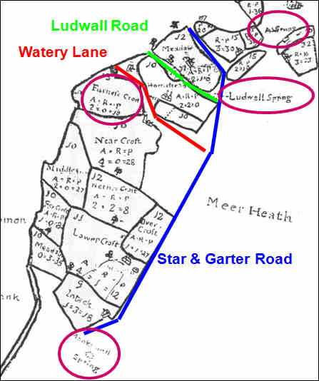
Also there is the nearby "Spring Road"
This section of the 1714 map shows the northern part of Lightwood Common and the fields are marked on it. The location of some of the current Normacot roads have been added. Of note are the references to water, top right to bottom left along what is now Star & Garter Road is "A Spring"; "Ludwall Spring" (at the end of what is now Ludwall Road); and "Monkswall Spring" Also of note is "Furnace Croft"
|
![]()
![]()
next: Sand and Gravel
Quarries
previous: Normacot and the Iron Furnace