![]()
|
|
|
|
|
Stoke-on-Trent - photo of the week
|
The Grange Branch of the North Staffordshire Railway
For additional information see: 'The North Staffordshire Railway in LMS Days' - Vol 2 by Basil Jeuda |
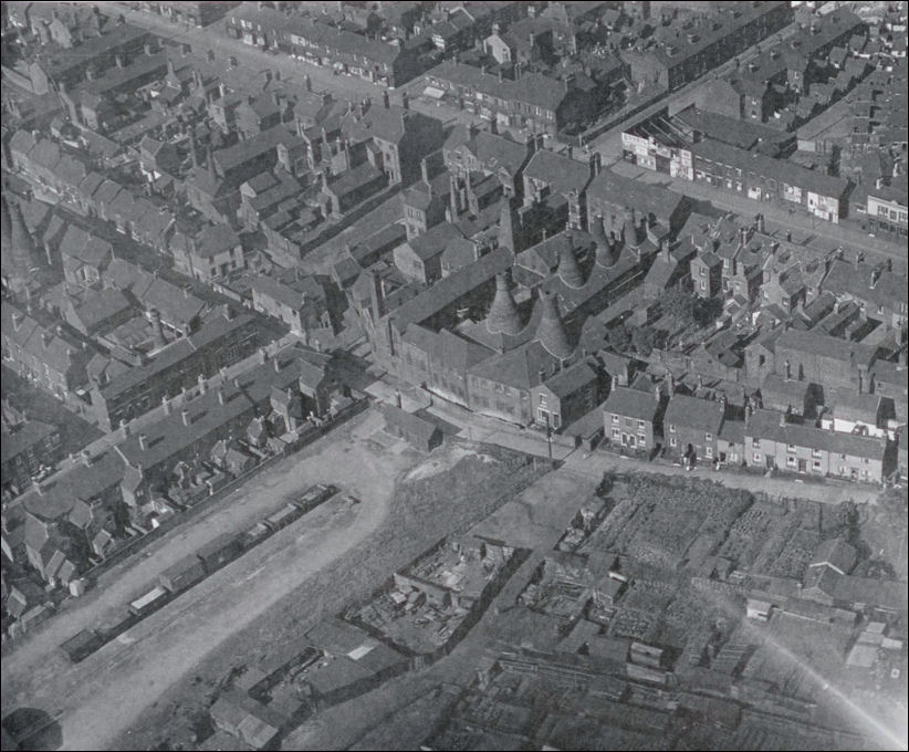
Grange Wharf, Burslem c.1930
the sidings of the Grange Branch railway are on the bottom left with eight
wagons on it
the road running left to right at the end of the branch line is Commercial
Street
and at the top right is Waterloo Road
photo - kind permission of Basil
Jeuda
Steve Grudgings Collection
![]()
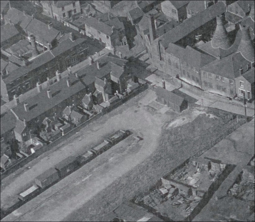
close up of the Grange Wharf -
a small goods office with weighing machine stands at the end of the
sidings
note the allotments to the bottom right of the photo
the pottery company to the top right was the encaustic tile works of the Weston
Pottery Co.
to the left is the works of E. Sydney Heath, colour manufacturers.
![]()

the location in 2012 - photo:
Bing maps
red lines = the sidings of the Grange
Branch railway
dark blue circle = the former Weston Pottery
green circle = the former works of E. Sydney Heath
light blue line = Commercial Street
yellow line = Leonora Street (originally Edward Street)
purple line = Waterloo Road
dark blue line = Glendale Street (originally Stoneley Street)
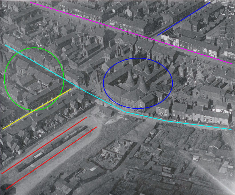
the same location on the 1930's
photo
red lines = the sidings of the Grange
Branch railway
dark blue circle = the former Weston Pottery
green circle = the former works of E. Sydney Heath
light blue line = Commercial Street
yellow line = Leonora Street (originally Edward Street)
purple line = Waterloo Road
dark blue line = Glendale Street (originally Stoneley Street)
![]()
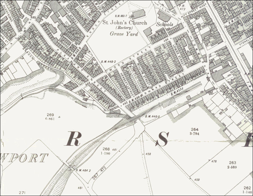
1898 map of the sidings of the
Grange Branch wharf
St. John's Church is to the top centre of the map, Waterloo Road to the top
right
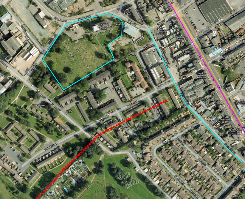
the same location on Google
maps
St. John's Church is to the top centre of the map, Waterloo Road (purple
line) to the top right
the light blue line is Commercial Street
the route of the Grange Branch railway is shown in red
![]()
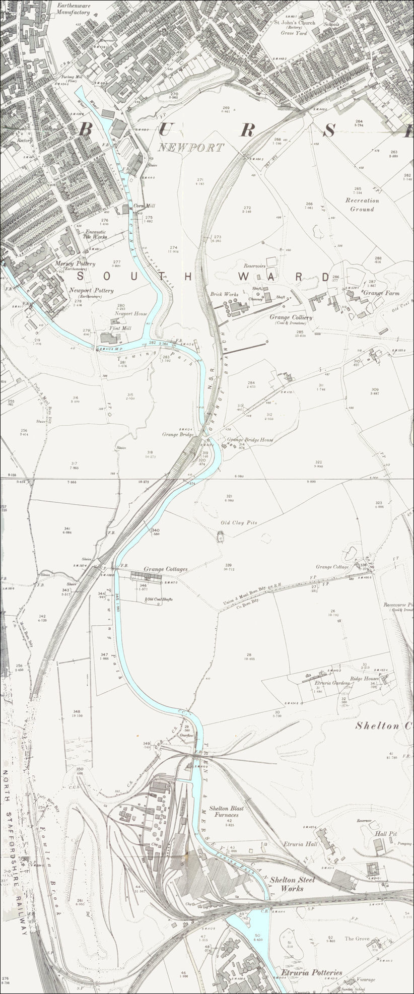
1898 map showing the route of
the Grange Branch railway line
the single line railway (also known as the Burslem Mineral Line)
started at Etruria
and ran for 1 mile 1,410 yards to Grange Wharf just south of the town centre of
Burslem
the Trent and Mersey Canal is marked in light blue - note the Burslem Branch to
the canal at the top left
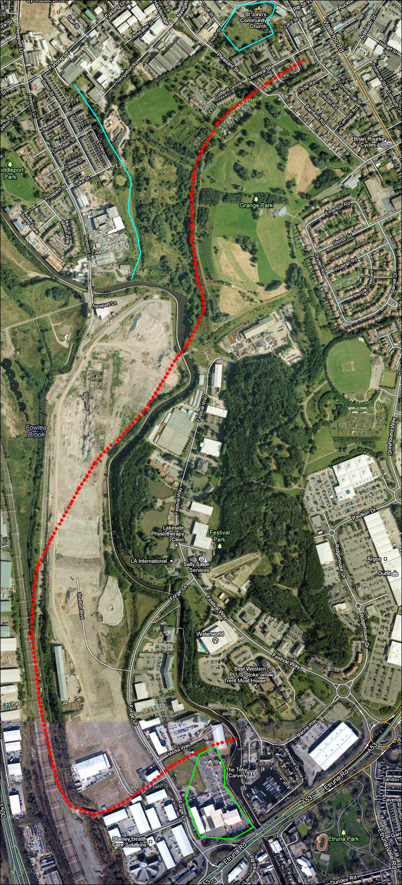
the route of the Grange Branch
railway line shown in red on this Google map
the location of the now closed Burslem Branch canal is shown in blue
St. John's Church is marked in light blue at the top of the map
and the location of the former Josiah Wedgwood's Etruria Potteries is shown in
light green at the bottom of the map
![]()
![]()
![]()
![]()
contents: 2013 photos
