Hulton Abbey to Ruston
Grange
the trackway to Ruston Grange
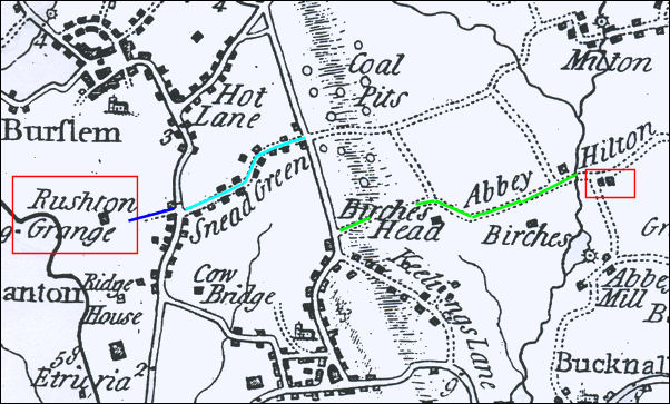
Yates 1775 map showing
Abbey Hilton and Ruston Grange
It is known that the trackway taken by
the monks on their journey from the Abbey to their farmlands at Ruston
went via Sneyd Street which can easily be seen on this map (light blue
line) at the bottom of Sneyd Street was a track which is now Grange Street
(dark blue line). It is supposed that what is now Birches Head Road (green
line) formed part of the route.
At the time of this 1775 map all these
routes are shown as dotted lines which denotes a track or walk way - in
the years 1219 to 1538 (the period of the Abbey) this route would be no
more than a footpath across the open fields.
  
next: Birches Head
Road
previous: Abbey Hulton
|