![]()
![]()
|
|
|
Pirehill and Totmonslow Hundreds: Early Administration of
Stoke-on-Trent
|
|
|
The Hundreds of Pirehill and Totmonslow
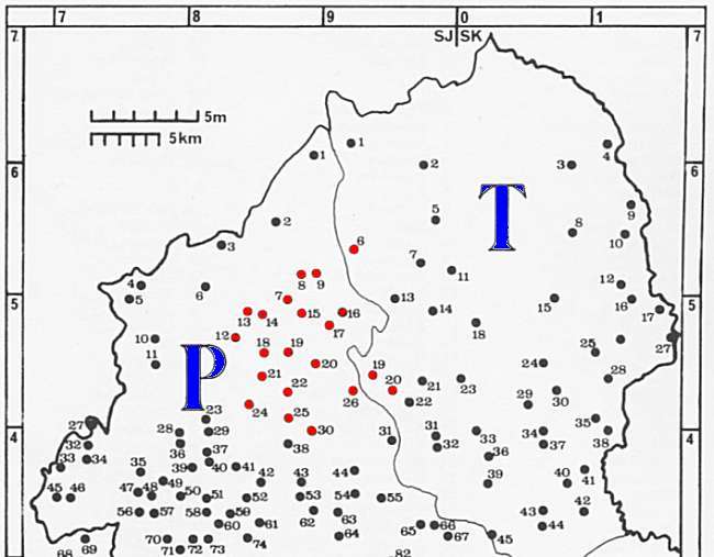
Long before Stoke-on-Trent existed as a city, the settlements that later formed the Potteries were divided between two ancient administrative districts � Pirehill Hundred and Totmonslow Hundred.
When the Domesday Survey was compiled in 1086, these settlements were recorded under their respective Hundreds rather than as part of any single district called Stoke-on-Trent. |
|
- those marked in red eventually became the Stoke-on-Trent area - |
|
|
|
The names of the Hundreds
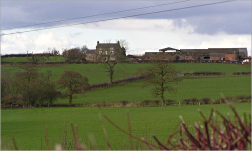 View from Pire Hill towards North Pirehill Farm |
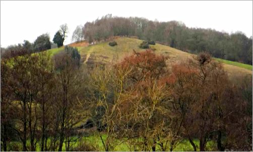 Oak Hill mound near Little Totmonslow Farm |
|
|
| Pire Hill photo: � Jack Barber / Geograph (Image 345140), CC BY-SA 2.0. Totmonslow photo: from "Ancient Totmonslow", Draycott in the Moors Independent News & Comment Website (2025). |
|
|
|
1851 description of the Hundreds of Pirehill and Totmonslow
|
Pirehill (Summary of a 1851 gazetteer entry): Pirehill was the largest of Staffordshire�s five Hundreds, covering much of the central and southern part of the county, including the area that would later become the Potteries. It was notable for both its fertile agricultural land and its important centres of industry, particularly earthenware and china manufacture in North Staffordshire, and the shoe trade at Stafford and Stone.
|
|
Totmonslow (Summary of a 1851 gazetteer entry): Totmonslow (or Totmanslow) formed the north-eastern Hundred of Staffordshire and covered much of the upland Moorlands, a landscape of hills, valleys, and moorland broadly similar to the neighbouring Peak District.
|
|
Gazetteer
entry for Pirehill - "Pirehill, one of the most populous and largest of the five Hundreds of Staffordshire, is as remarkable for the fertility of its soil, for the beauty and diversity of its scenery, and the number and beauty of its seats of nobility and gentry, as it is for the extent and importance of its manufactures of earthenware and china, in the long chain of towns and villages called the Potteries, and of shoes at Stafford and Stone. It is about 28 miles in length, and from 8 to 15 in breadth, and is bounded on the north-east by Totmonslow, on the east by Offlow, on the south by Cuttlestone Hundred, and on the west and north-west by Shropshire and Cheshire. This large Hundred is also traversed by the North Staffordshire and the Grand Junction (or Birmingham & Liverpool) Railways, which have several branches. It includes the boroughs of Stoke-upon-Trent and Newcastle-under-Lyme, and part of Stafford, and is divided into 43 parishes, which comprise about 150 townships, liberties and hamlets, and many chapelries or district parishes. Besides Stoke, Stafford and Newcastle, it has seven other market towns, Burslem, Tunstall, Hanley & Shelton, Longton, Stone, Eccleshall, and Abbot's Bromley. It is divided into North and South Divisions, and is all in the Northern Parliamentary Division of Staffordshire, in the Diocese of Lichfield, Archdeaconry of Stafford, and Deaneries of Newcastle and Stone. Its population has increased rapidly during the last half century, from 64,946 in 1801, to over 150,000 in 1851. The great bulk of this augmentation has occurred in the three parishes of Burslem, Stoke-upon-Trent, and Wolstanton, which include the Potteries." From History, Gazetteer and Directory of Staffordshire, William White (Sheffield: William White, 1851).
|
|
Gazetteer
entry for Totmonslow Hundred
- "Totmonslow, or Totmanslow, is the north-eastern Hundred of Staffordshire, and contains that mountainous region called the Moorlands, which adjoins and partakes of the general character of the Derbyshire Peak, abounding in lime, coal and stone. This bleak and alpine district exhibits many of the wildest and most stupendous features of nature, as well as some of her more chaste and fertile beauties, the latter of which are confined chiefly to the narrow and picturesque valleys of the rivers Dove, Manyfold, Hamps, Tean, Blythe, Dane, and Churnet, which have their principal sources in this Hundred, and here receive many small but rapid streams from the high, peaty moorlands and rocky mountains which rise in picturesque disorder, and shut in the fertile pastures of the glens and valleys. The Hundred is of irregular, oval figure, stretching from the three shires stone, above Flash, southwards to Uttoxeter, a distance of 25 miles, and averaging from 10 to 15 miles in breadth. The River Dove forms its eastern boundary for nearly 30 miles, and separates it from Derbyshire, and from about 10 miles at its northern extremity, it is divided from Cheshire by the River Dane. The southern and eastern parts of it are traversed by the Uttoxeter and Caldon Canals, and by the Churnet Valley and North Staffordshire Railways. It contains four market towns, Leek, Longnor, Cheadle, and Uttoxeter, and
about 70 townships, comprised in ten chapelries and thirty parishes. They
are divided into North and South Divisions, and Mr William Keats, of Leek,
is the High Constable of the former, and Mr J Kidney, of Uttoxeter, of the
latter. The whole Hundred is in the Northern Parliamentary Division of
Staffordshire, and in the Rural Deaneries of Alstonfield, Cheadle, Leek, and
Uttoxeter." From History, Gazetteer and Directory of Staffordshire, William White (Sheffield: William White, 1851).
|
carry on exploring » The Domesday Book | Trade Journals and Gazetteers
|
|