|
Queens Gardens -
a garden from a
marsh
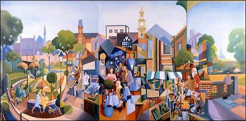
A Town on
Millennium Eve, Newcastle
An oil painting by
Tim Lloyd, commissioned for the Millennium by Newcastle-under-Lyme
Museum and Art Gallery. The painting contains images of people
celebrating Millennium's Eve in Newcastle and contains various
scenes, including the market, Queen's Gardens, and the Guildhall.
© Borough Museum and
Art Gallery, Newcastle under Lyme - 1999
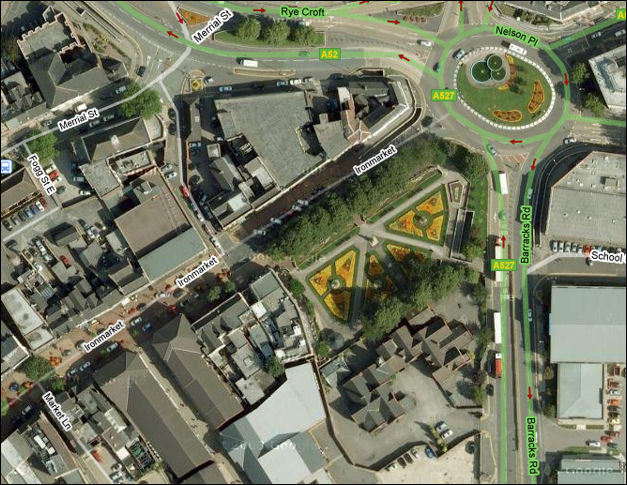
Queens Gardens -
Google maps 2008
Queens Gardens on the
corner of Ironmarket, Nelson Place and Barracks Road (was Bagnall
Street)
Queens Gardens - the origin of the area
|
A marshland & lake
The Ironmarket was in existence
by the middle of the 14th century - at the eastern end was
marshland and an area of water which was known as Colleswaynes
Lake.
The borough owned the waste land known as
The Marsh .......The Marsh, consisting in 1782 of 23 acres,
was situated at the east end of the town in the area now
occupied by Nelson Place, Queen Street, King Street, and
Brunswick Street. As early as 1698 the borough council had
attempted to have The Marsh inclosed but apparently without
success, and it was not until 1782 that an Inclosure
Act was obtained, whereby the land was inclosed.
In 1782 the first steps were
taken to reclaim The Marsh by enclosing its 23 acres of waste
land described as being in a "ruinous state". As a
result of the operations of the Marsh Trust the waterlogged
area at the eastern end of the Ironmarket was drained to
become the existing Nelson Place, from which new streets
radiated eastwards and southwards.
On the east were Queen Street, King Street, and Brunswick
Street, and on the south Bagnall Street, now Barracks Road, by
1818 all these streets were in existence.
Source:
'Newcastle-under-Lyme: Introduction',
A History of the County of Stafford: Volume 8 |
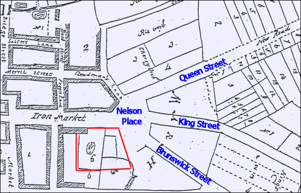
Ironmarket and the Marsh c.1785
At the eastern end of
the Ironmarket can be seen the area marked on the map as "Marsh" -
this became Nelson Place, the new roads shown radiating from the
marsh became Queen Street, King Street and Brunswick Street.
The area shown in red
is where the Queens Gardens came to be located. The location of
Colleswaynes Lake is shown.

|