Waterways of Stoke-on-Trent - Burslem
Branch Canal
![]()
![]()
![]()
| Burslem Branch
Canal Index |
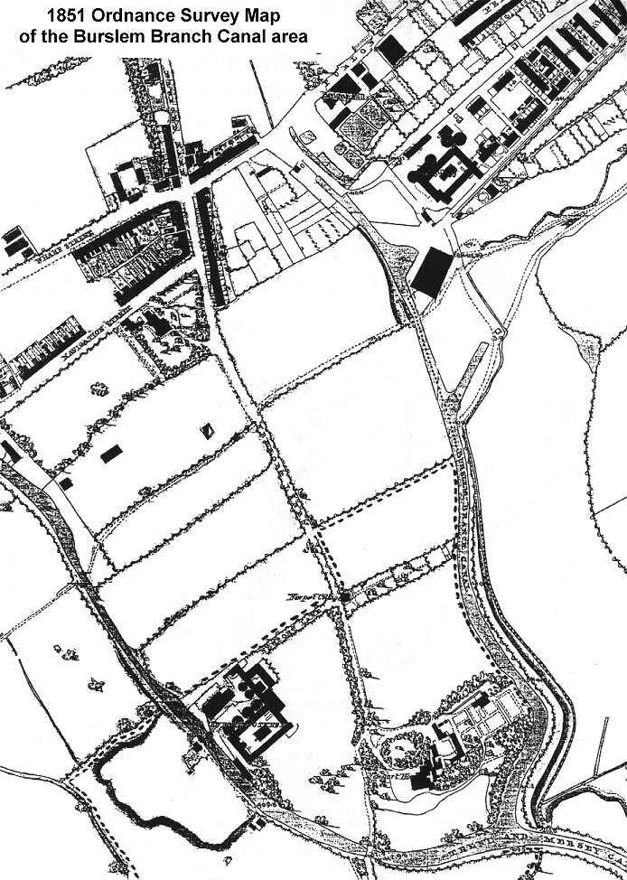
From: "1851 Ordnance Survey Map of the Burslem
Branch Canal area"
| Streets have
started to spring up at the end of the canal - on the left Wharf Street
and Navigation Street have some housing on them and the area on the
Burslem side, around Navigation Road, has started to be more developed.
|
![]()
![]()
![]()
previous: 1832 map of the canal area
next: 1878 OS map showing major development
![]()
![]()
![]()
previous: 1832 map of the canal area
next: 1878 OS map showing major development
| Burslem Branch Canal Index | aerial photo and map of the canal area |