|
|
| Stoke-on-Trent Districts: Normacot |
![]()
next: Normacot on the maps
|
Normacot, Longton, Stoke-on-Trent, Staffordshire.
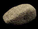
Normacot has been a site of habitation and activity for around 3 to 4,000 years..... Bronze age (1000-2000BC)
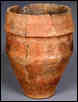
Roman Occupation (late first century) Normacot was on the
route of the Roman Road from Derby/Uttoxeter to Chester which was called
Rykeneld Street "This road proceeded
from Blyth Marsh, in a direct course towards Lane End… the Sutherland
Road in Lane End is a continuation of it; at the north end of which it
again unites with the turnpike road, and passing the church, goes on to
Lane Delph..."
Normacot was recorded in the 1087 Domesday Book as part of the "Land of Richard Forester" the only other settlements nearby recorded in the Domesday Book were Fenton, Weston, Caverswall and Stoke.
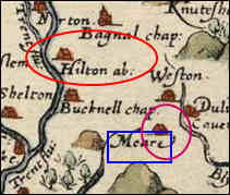
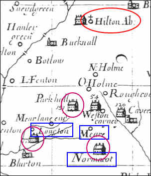
Hulton Abbey and Normacot (1219 - 1500's)
Henry de Audley - vill of Hulton, the vill of Rushton to the south of Burslem with a wood at Sneyd 'with the enclosed hay' at Carmount near Hulton, all his land at Bucknall and Normacot. Further land at Normacot was given by Simon de Verney
By 1242 there is mention of the abbey's sheepfold at Normacot.
They were running an iron smithy at Horton in 1528 and owned coal mines at Hulton and Hanley by the 16th century. Although in 1535, as in 1291, much of the abbey's income was derived from rents, there was extensive farming at Hulton, Normacot, Bradnop, and Cammeringham
Normacot Grange: By the 15th century Normacot Grange, including all the buildings and lands, was leased out. In 1540, following Henry VIII’s dissolution of the monasteries, the grange was sold to Sir John Gifford of Chillington, remaining in his family for several generations.
The property continued to operate as a farm and the grange farmhouse, with its reputedly medieval cellars, was only demolished in 1984.
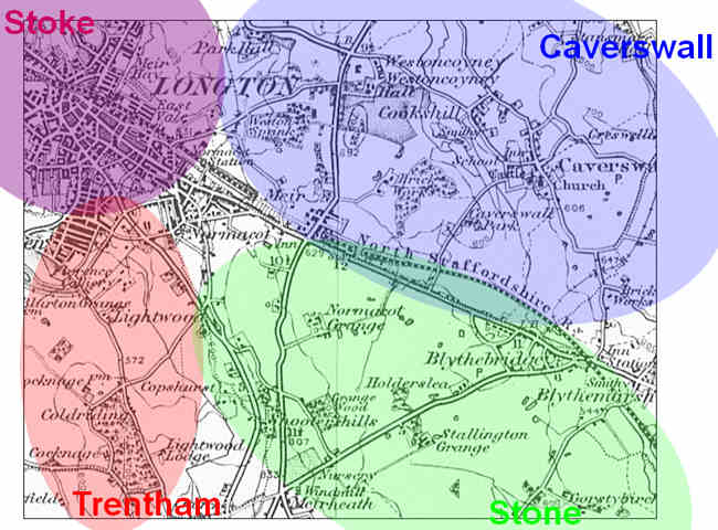
Normacot lay at the junction of four parishes: Caverswall parish which lay north of "Meer Lane" (now Uttoxeter Road); Stone parish to the east, which contained the liberty of Normacot; on the west Trentham parish which also included the township of Blurton and Stoke parish to the north-west which contained the town of Lane End. "Normacot, at the north end of the parish [of Stone], adjoins Blurton, and the large pottery town of Longton. It includes Mear Lane, Mear Heath, Mear Furnaces, and many neat houses, some of which are occupied by china and earthenware manufacturers. A new suburb, called Dresden, is being built here. " From: History, Gazetteer and Directory of Staffordshire, William White, Sheffield, 1851 "Normacot,
comprising the triangle of land between the Uttoxeter road, Upper
Normacot Road, and Meir Road, lying east of Longton, had been laid out
in building plots for the Duke of Sutherland by 1875 and much of it
built up by the late 1870's.
|
![]()
next: Normacot on the maps
questions / comments / contributions? email: Steve Birks
3 December 2007