![]()
|
|
|
|
|
Stoke-on-Trent - Potworks of the week
|
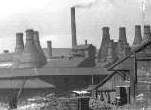
Bleak Hill Works, Cobridge
|
Later development of the area... The western part of the Cobridge area around the former Grange farm was in 1960 still largely waste, much of it was occupied by the workings of the disused Grange Colliery. There are two council housing estates in this district. One was laid out off Commercial Street south of St. John's Church in the years between the world wars. The other, south of it, dates from after 1945. Demolition of the cottages around the Bleak Hill Pottery between Waterloo Road and Elder Road was in progress in 1958 and cottages in Waterloo Road west of Christ Church had been pulled down before the end of 1959. Cobridge Park (9 acres), between Elder Road and the railway, was opened in 1911. Victoria History of the County of Stafford
|
'
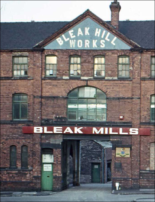
Bleak Hill Works - photo taken from Orgreave
Street
(Originally Bleak Street - renamed in the 1950's)
the
road in front of the works is Warburton Street
(named after the Warburton family who were prominent potters in the late
1700's)
to the right was
Gilchrist Place - now replaced by housing
(originaly Parker Street - see the 1898 map below)
![]()
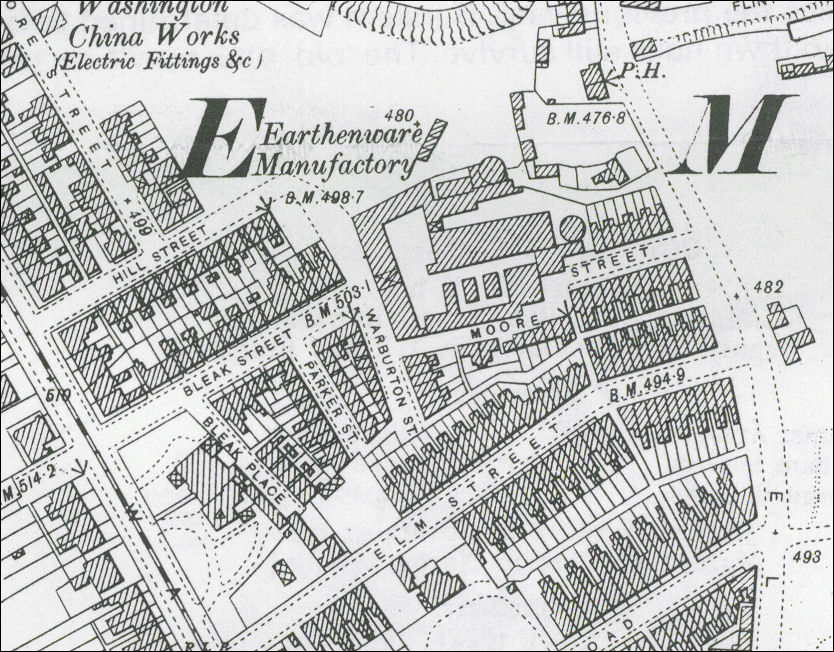
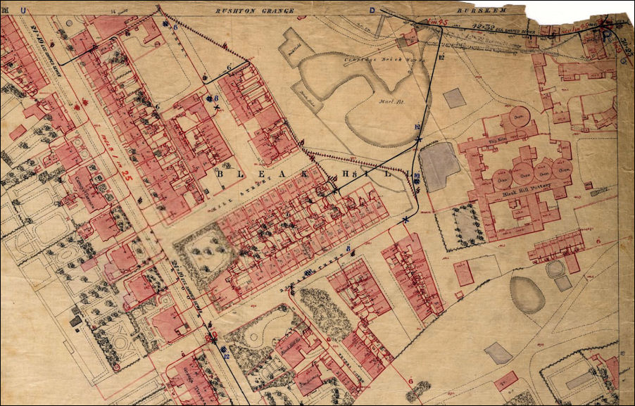
1898 map showing the Bleak
Hill Works at the end of Bleak Street
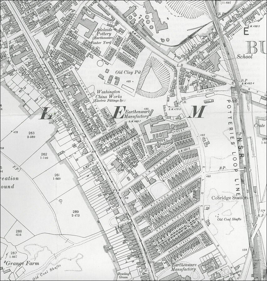
1898 map showing the area of
Cobridge around the Bleak Hill Works
Waterloo Road to the left and the
Potteries Loop Line to the right
![]()
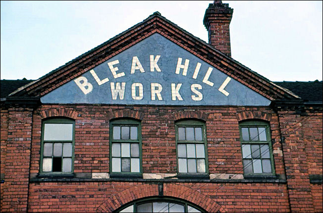
the tiled name on the
pediment of the Bleak Hill Works
at the time of the 1881 census Francis Emery employed 50 men and 40 women at the Bleak Hill Works
1881 census:
Dwelling: 222 Waterloo Rd
Census Place: Burslem, Staffordshire, England
|
Name |
Marr | Age | Sex |
|
Birthplace |
Occupation |
|
Francis J. EMERY |
W 49 M |
Head |
Burslem |
E Ware Manufacturer & Councillor Employing 50 Men 40 Females |
|
Francis EMERY |
U 20 M |
Son |
Burslem |
Drapers Assistant |
|
Mary EMERY |
U 22 F |
Daur |
Burslem |
|
|
Edmond J. EMERY |
U 13 M |
Son |
Burslem |
Scholar |
|
Agnes LEDWITH |
U 20 F |
Visitor |
Autherley |
Book Keeper |
|
Sarah JOHNSON |
U 24 F |
Serv |
Tunstall |
Servant Domestic |
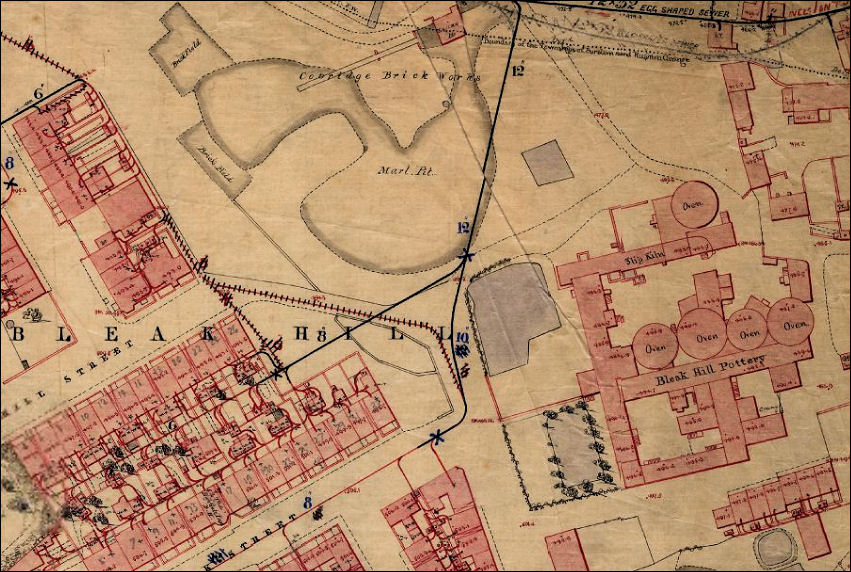
early 1851 map showing the Bleak
Hill Works
the area in front of the works
contains a small garden and a water pond
to the upper left is the Cobridge Brick Works
map © Staffordshire Past-Track
the 1851 map showing
the Bleak
Hill area
Waterloo Road, Hill Street and Bleak
Street are laid out on this map
on Waterloo Road Camoys Terrace and Grange Terrace can be identified
|
|
![]()
![]()
![]()
contents: 2009 photos
Related pages..
A photo walk around Cobridge - a Victorian Suburb