![]()
Home » Streets » Abbey Hulton Streets » Abbey Lane
|
|
Home » Streets » Abbey Hulton Streets » Abbey Lane |
|
|
|||||||
| Abbey Lane at a glance | |
| Origin of the name | Names such as 'Abbey' and 'Abbots' in this area reflect the connection to the Hulton Abbey of 1223-1538. |
| District | Abbey Hulton » |
| Historic Area |
Formerly part of the parish of Burslem, often known as the lordship of Hulton. Became part of the County Borough of Stoke-on-Trent in 1922 |
| Connections |
To the south joins the junction of Heath House Lane and Fellbrook Lane. To the north joins School Road and Abbey Road. |
| 1880 | Abbey Lane appears only as an unnamed track leading from the Hanley & Bucknall Colliery to a tramway connected with the Blackelow and Greasleyside Colliery - both these names would later be reflected in housing streets. |
| 1900 | The unnamed track had become Abbey Lane. The Hanley & Bucknall Colliery is still in existence but by 1924 was marked as 'disused' and the earlier Blackelow and Greasleyside Colliery had disappeared and been replaced by two buildings named White House and Lower Blakelow. |
| 1940 |
Housing had appeared at the lower end of Abbey Lane and new streets were beginning to spread across former colliery and farmland sites. At the northern end of Abbey Lane a school and several new residential streets are shown, including Whitehouse Road and Greasley Road, both reflecting earlier local names already visible on the older maps. Half way along Abbey Lane, to the east are allotment gardens. |
| 2026 |
On the east Tewkesbury Close, Marne Place have been built. Abbey Lane allotments still exists - housing has been built between the allotments and Abbey Lane. At the top and to the west Chapter Walk, Greyfriars Road, Cluny Place, Benedict Place and St. Bernard Place have been built - all names which reflect the monastic influences of the area. |
| Churches | Our Lady and St. Benedict Roman Catholic Church - originally built c. 1937/8; rebuilt 1962. |
| Schools | Our Lady and St. Benedict Catholic Academy. |
| Collieries |
Hanley & Bucknall Colliery was located between a track which became Abbey Land and open ground which was to be where Abbey Road was laid out. Jammies Fishing Pool is situated on the site of the colliery. |
| Other features | Hanley Town Football Club - Established in 1966, the club was originally formed as a pub side called "The Trumpet" (link verified May 2026). |
|
|
|
Maps showing Abbey Lane The following Ordnance Survey maps show a section of Abbey Hulton from 1880, 1900 and 1940 show the rapid development of Abbey Hulton from a largely rural and industrial landscape into a growing residential suburb of Stoke-on-Trent.
Corresponding locations on all maps have been marked using matching coloured markers. |
|
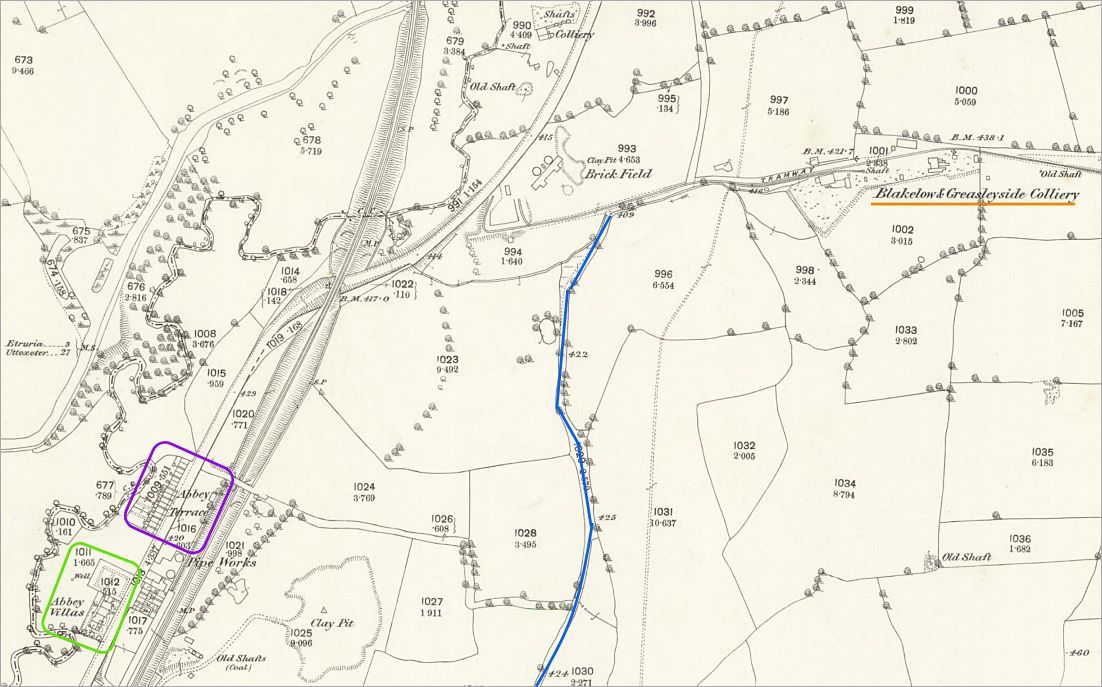
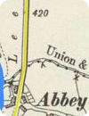
1880 OS map In 1880 Abbey Hulton was still largely rural with collieries, tramways, scattered housing and farmland dominating the landscape. Abbey Lane, shown in blue, appears only as an unnamed track leading from the Hanley & Bucknall Colliery to a tramway connected with the Blackelow and Greasleyside Colliery - both these names would later be reflected in housing streets. Leek Road already formed the main route through the area, accompanied by the Caldon Canal, River Trent and the Biddulph Valley Branch railway. Abbey Villas and Abbey Terrace can both be seen fronting Leek Road. |
|
|
|
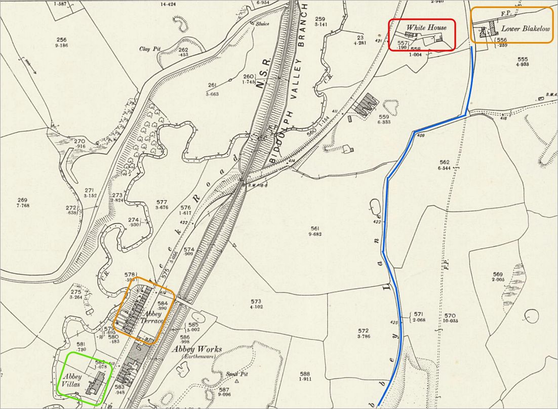
1900 OS map By 1900 the unnamed track had become Abbey Lane. The Hanley & Bucknall Colliery is still in existence but by 1924 was marked as 'disused' and the earlier Blackelow and Greasleyside Colliery had disappeared and been replaced by two buildings named White House and Lower Blakelow. The map still shows Abbey Hulton as largely open countryside, some industrial activity (Abbey Works - an earthenware pottery) and transport links continued to shape the area. Many later street names can already be traced in these earlier features and place names. |
|
|
|
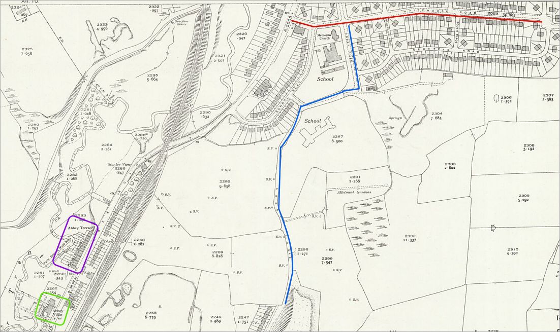
1940 OS map The 1940 map shows the beginning of the major interwar housing development which transformed Abbey Hulton during the 1920s and 1930s. Housing had appeared at the lower end of Abbey Lane and new streets were beginning to spread across former colliery and farmland sites. At the upper end of Abbey Lane a school and several new residential streets are shown, including Whitehouse Road and Greasley Road, both reflecting earlier local names already visible on the older maps. The Hanley & Bucknall Colliery had disappeared by this time and the district was rapidly becoming suburban in character. |
|
|
Photos of Abbey Lane
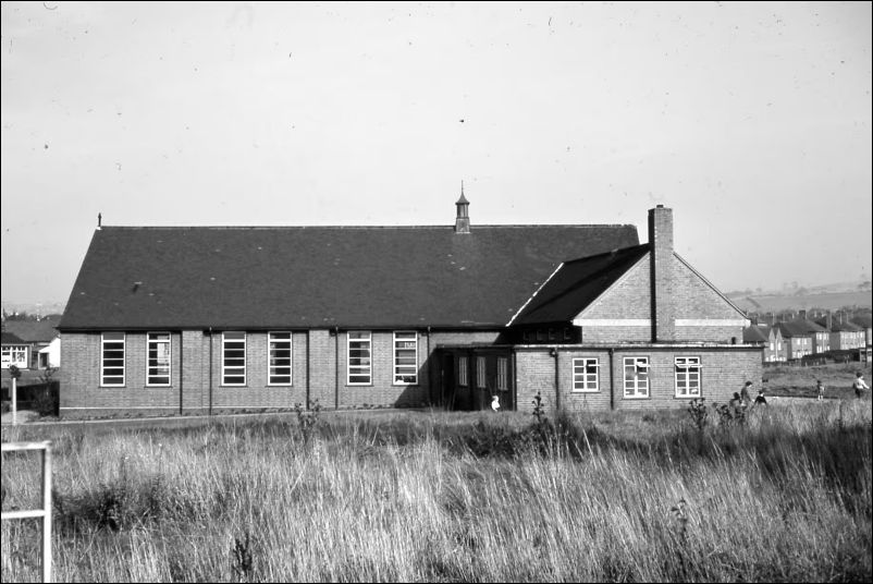
Abbey Lane, Roman Catholic School, the junior school block - c.
1963/4
| photographer Bert Bentley | Stoke Sentinel Archive | published May 2020 |
|
|
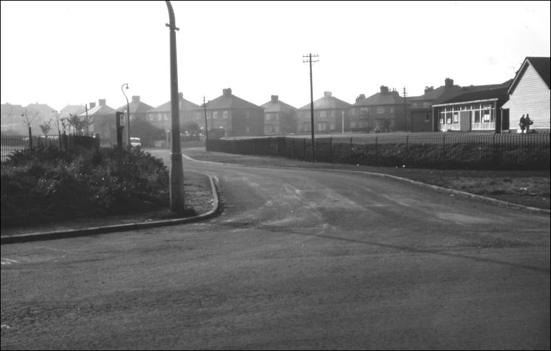
Abbey Lane, view west from Abbey Road, Abbey Hulton Infants School on right - c. 1963/4
| photographer Bert Bentley | Stoke Sentinel Archive | published May 2020 |
|
|
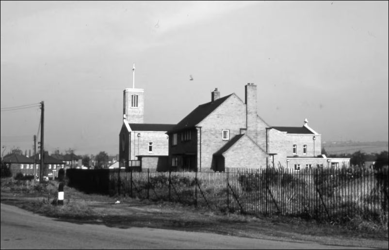
Abbey Lane, Abbey Hulton Roman Catholic Church and Presbytery. Church of Our Lady St Benedict.
- c. 1963/4
| photographer Bert Bentley | Stoke Sentinel Archive | published May 2020 |
|
||||||||||||||||
|
|
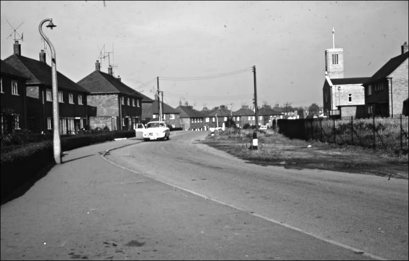
Abbey Lane, view north east
from Chapter Walk - Church of Our Lady St Benedict on right - c. 1963/4
| photographer Bert Bentley | Stoke Sentinel Archive | published May 2020 |
|
|
|
Keep exploring... |
|
 |
 |
| Abbey Hulton Streets | District
of Abbey Hulton |
|
|
|
|